Park overview
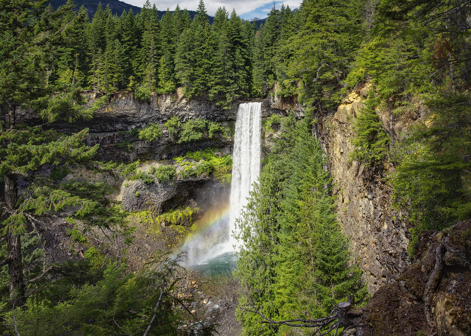
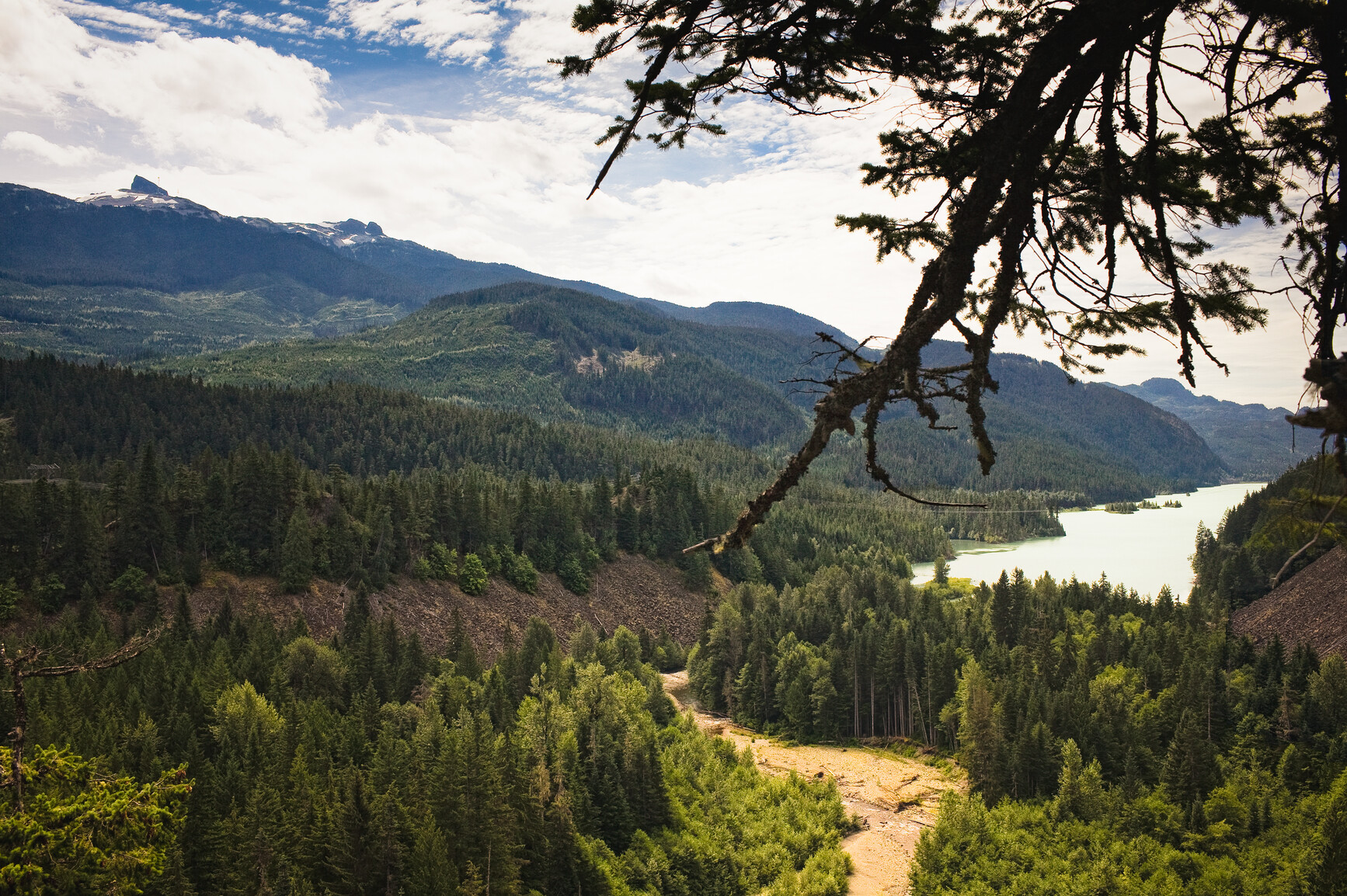
Brandywine Falls is a spectacular 70 metre waterfall for which this park was named after. This park also offers visitors the chance to see some marvelous views of Daisy Lake and the surrounding mountains.
Brandywine Falls Park provides opportunities for hiking, picnicking, mountain biking and viewing of the waterfall. The park was tripled in size in 2010 to include unique habitat for red-legged frogs (a provincial “blue listed” species at risk). A number of existing recreational trails were included in the expansion as well.
Advisories
Dates of operation
The park gate is open May 1, 2024 to October 31, 2024
- Winter season note
- During the off-season, no parking is available and the park is only accessible by foot access or pick-up/drop-off.
Safety info
- Bring your own drinking water as there is no potable water available in the park.
- Campfires are not permitted in the park.
- There is no access to the lower falls area. The canyon is extremely unsafe and has very significant public safety concerns due to unstable slopes and falling rock. Public visitors should not be travelling off of designated and approved trails and viewpoints. Please help us protect the sensitive ecosystem and stay out of the canyon. Park Trail Map [PDF]
Special notes
- During the off-season, the park gate is closed and users can only access the park by foot.
- Keep the highway clear at all times for safety, and winter maintenance.
- Vehicles parked illegally may be towed at owners expense.
Facilities
Accessibility information is available for this park.
This park has a day-use and picnic area with six picnic tables and pit toilets.
Pit toilets are located in the day-use area.
Activities
For your own safety and the preservation of the park, obey posted signs and keep to designated trails. Shortcutting trails destroys plant life and soil structure.
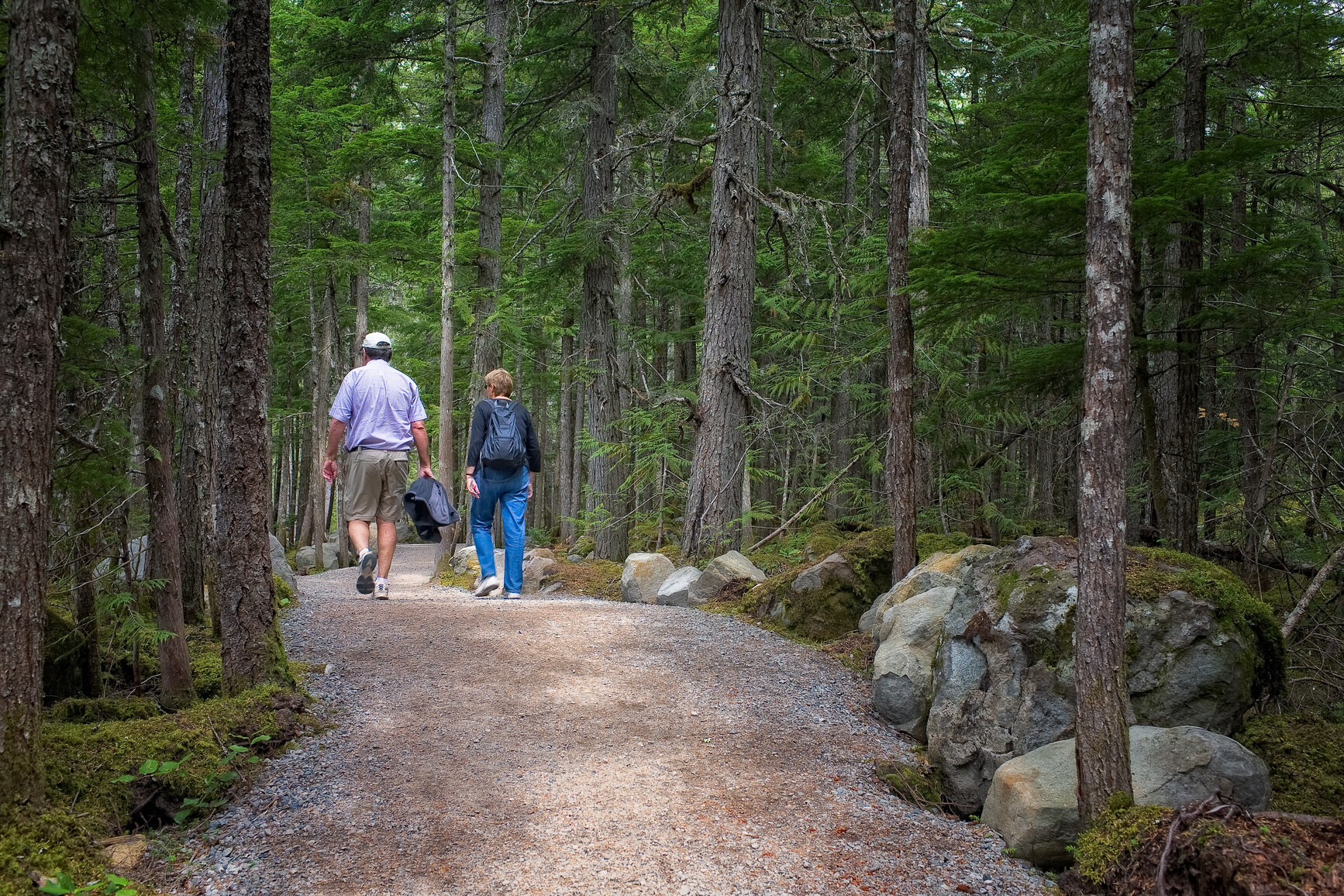
Brandywine Falls Trail
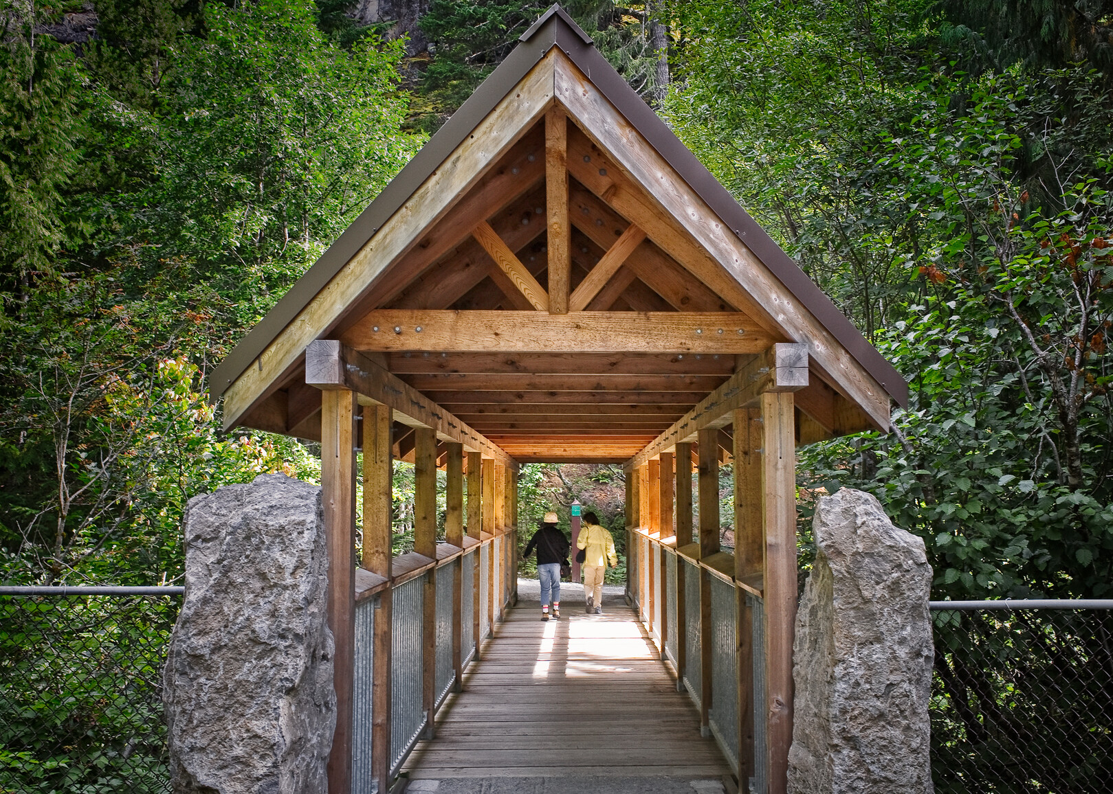
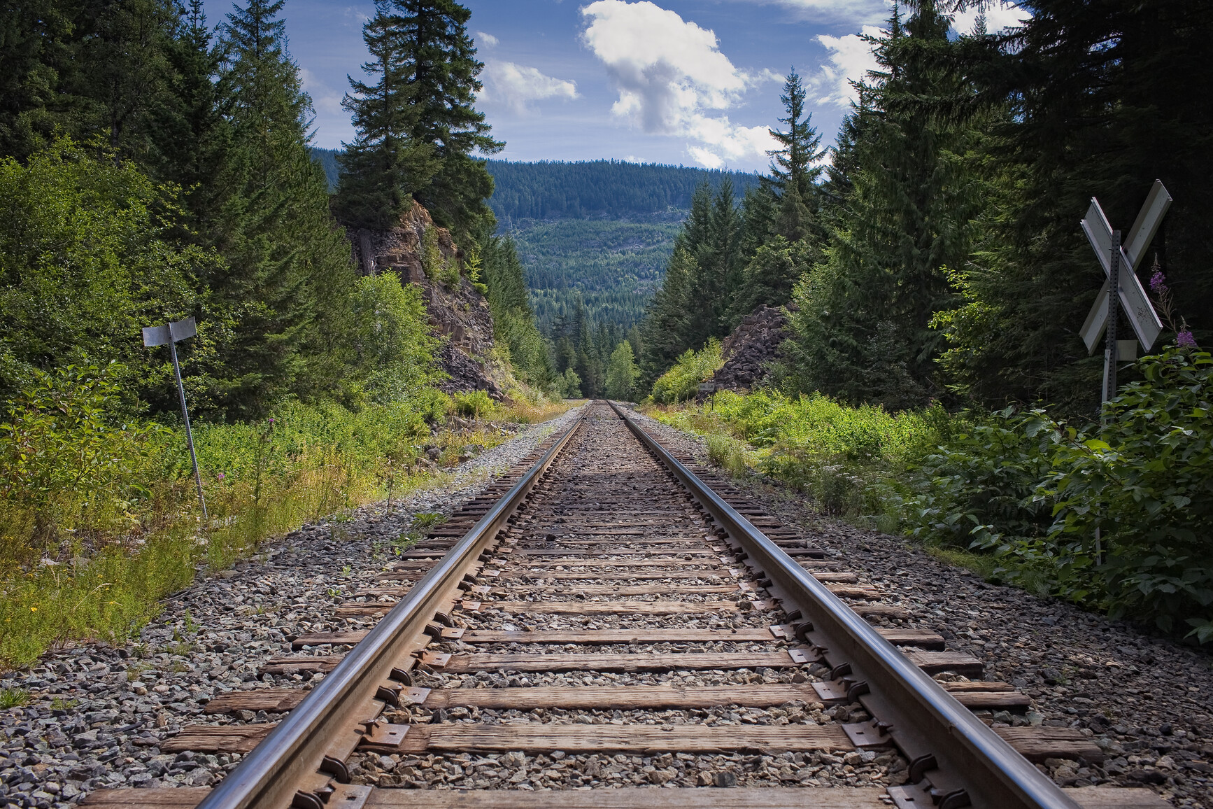
Enjoy a 10 to 20 minute (one way) walk across the covered footbridge and through the forest to a new viewing platform overlooking Brandywine Falls. Continue along a new, short walking path to a second viewpoint of the falls and another of the surrounding area of Daisy Lake and the Black Tusk. Stay behind fences and away from the river’s edge. Use caution when crossing the Canadian National Rail line. Trails in the park are not maintained during the winter.
Swim Lake Trail
This is a short branch off the the main Brandywine Falls Trail that starts just before the railway crossing. It’s a bit rough, with one short steep climb, leading to a small lake. The hardier person may wish to try swimming but there is no beach or dock or lifeguards. Keep your eye out for the rare, red-tailed frog that inhabits the marshes and ponds of the park.
Sea to Sky Trail and Lava Lake Trail
As described in the Cycling section, this trail is also suitable for hiking. Keep your eyes and ears alert for approaching cyclists.
Brandywine Falls (a spectacular 70 metre waterfall) is best seen from the new viewing platform, completed in the spring of 2006 and perched high on the edge of a volcanic escarpment. Those who love heights will enjoy this one! Marvellous views of Daisy Lake and the surrounding mountains are also seen from the platform and from the other viewpoints described above.
Pets and domestic animals must be on a leash at all times and are not allowed in beach areas or park buildings. You are responsible for their behaviour and must dispose of their excrement. Backcountry areas are not suitable for dogs or other pets due to the potential for problems with bears and other wildlife.
Bicycles must keep to roadways. Bicycle helmets are mandatory in British Columbia.
Sea to Sky Trail
The newly completed 1.5 km section of the planned 180 km long Sea to Sky Trail leads in a north-east direction from the main Brandywine Falls Trail (after crossing the train tracks) to the Whistler Bungee bridge over the Cheakamus River. A packed gravel surfaced trail, mostly gentle grades (a few steep pitches and tight corners for mountain bikes) and suitable for families.
Lava Lake Trail
After crossing the covered footbridge over Brandywine Creek from the parking lot, this 2.7 km trail starts left up a short but steep hill then wanders on gentle ground thru pine forest (rare for the coastal environment) and small lake areas to the north end of the park.
Please note that bicycles with electric assist motors (e-bikes) are not allowed on the trails within Brandywine Falls Park. E-bikes are restricted to park roads and areas where motorized use is permitted. The only exception to this policy will be for authorized and identified trail maintenance bikes conducting work on behalf of BC Parks.
This park is located 47 km North of Squamish, off Highway 99.
Park and activity maps
Learn more about this park
Park details
- Date established: January 18, 1973
- Size: 420 hectares
Park contact
Nature and culture
History
The word brandy is actually the shortened word for brandywine. No one is completely sure about how the falls got their name, but one possible explanation is that two surveyors (Jack Nelson and Bob Mollison) for the Howe Sound and Northern Railway made a wager for a bottle of brandy about who could estimate more accurately the height of the falls. When the height was actually measured with a chain it was Mollison who won the bottle of brandy and Nelson then named the falls Brandywine.
Conservation
Here you will find basalt columns and lava flows covered by small ponds and a forest.
Reconciliation with Indigenous Peoples
BC Parks honours Indigenous Peoples’ connection to the land and respects the importance of their diverse teachings, traditions, and practices within these territories. This park webpage may not adequately represent the full history of this park and the connection of Indigenous Peoples to this land. We are working in partnership with Indigenous Peoples to update our websites so that they better reflect the history and cultures of these special places.