Park overview
Cape Scott Park is a truly magnificent area of rugged coastal wilderness that is located at the northwestern tip of Vancouver Island, 563 kilometres from Victoria.
Established in 1973 and named after the site of a lighthouse that has guided mariners since 1960, Cape Scott is characterized by more than 115 kilometres of scenic ocean frontage, including about 30 kilometres of spectacular remote beaches.
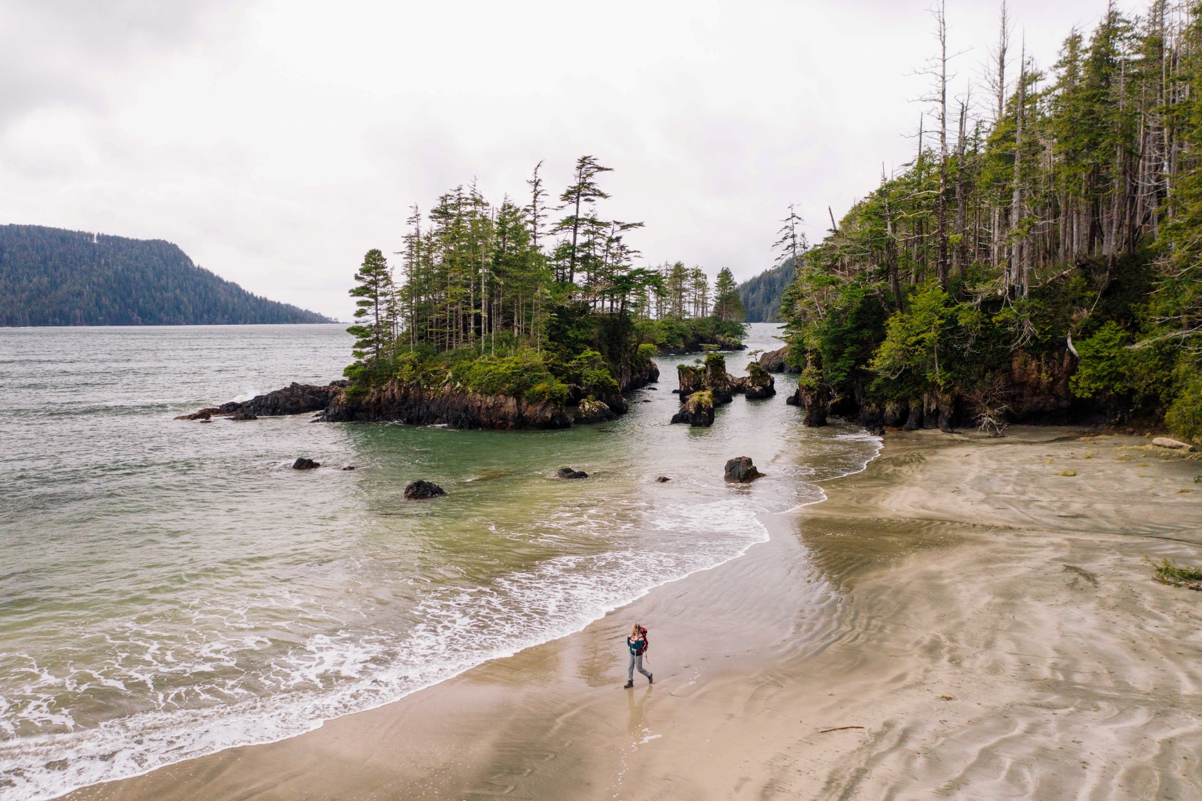
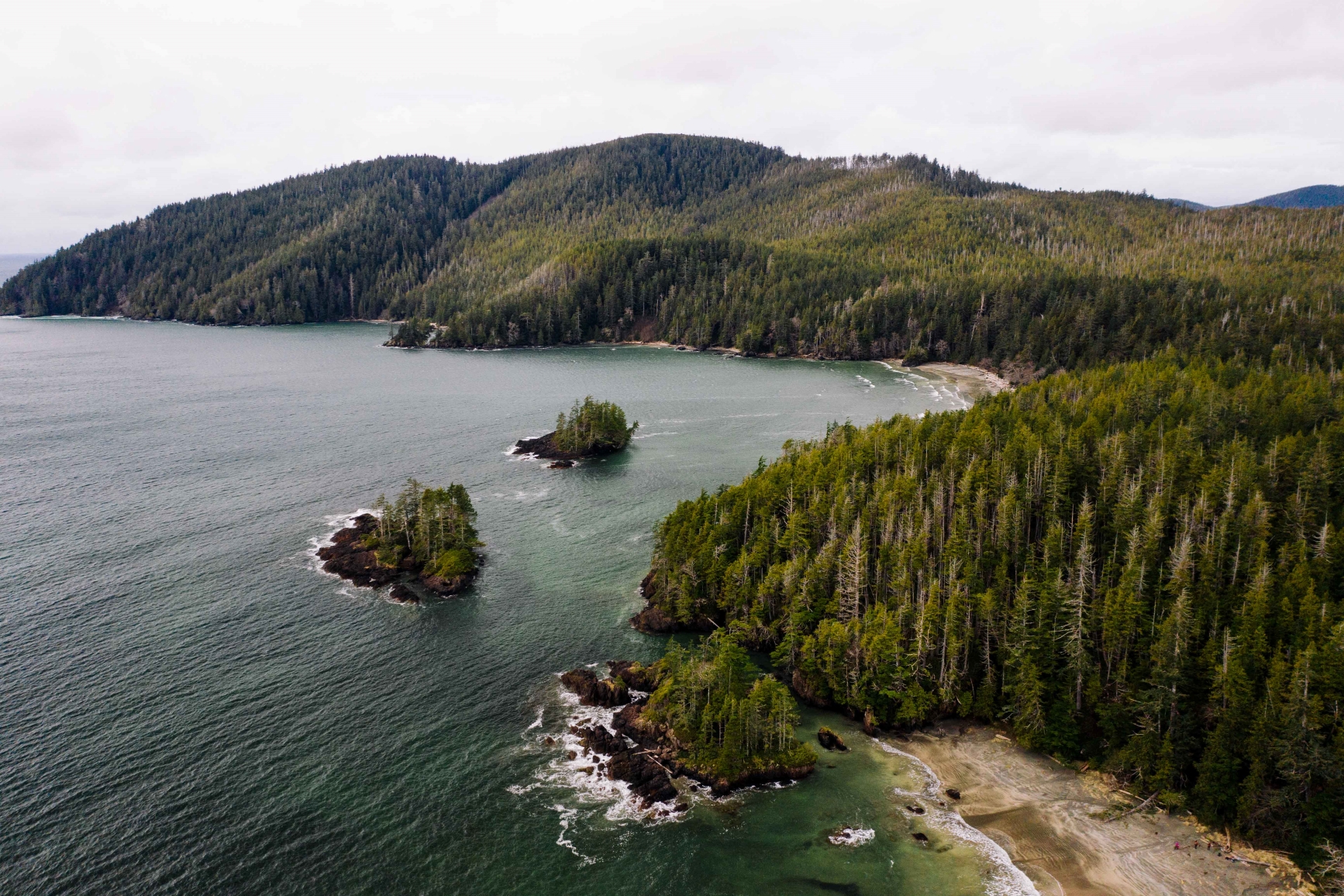
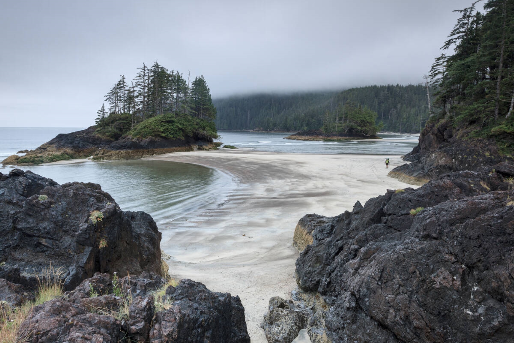
The park stretches from Shushartie Bay in the east, then westward around Cape Scott and south to San Josef Bay. Rocky promontories, salt marshes and jagged headlands punctuate the fine-textured, white-sand beaches. The most impressive of these beaches, Nels Bight, stretches more than 2,400 metres long and 210 metres wide at low tide, and is one of the park’s most popular camping destinations. Other significant beaches include San Josef Bay, Guise Bay, Experiment Bight, Lowrie Bay and Nissen Bight.
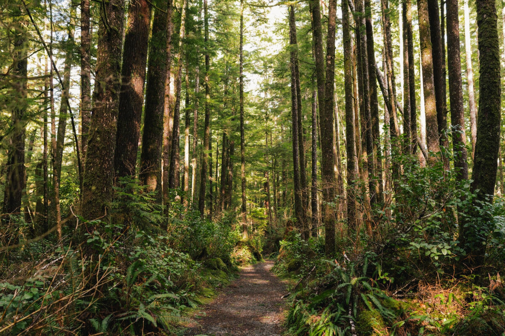
Visitors can choose between a day hike or a backpacking excursion to explore the sandy beaches, rainforests, and lowland bogs and muskeg of this wilderness park.
Special Features
Cape Scott Park is home to sea stacks, which visitors can access at low tide. The eastern portion of the park contains a number of estuaries that are accessible only by boat. Cape Scott is also fortunate to have some excellent examples of old-growth forest, including Sitka Spruce in excess of 3 metres in diameter, and Western Red Cedar of similar sizes. Examples of these trees can be found throughout the park, including on the easy hike to San Josef Beach. About 20 minutes north of the Eric Lake campsite is a Sitka Spruce that measures more than 7 metres in circumference. This is a popular spot for hikers to stop and absorb their surroundings, as well as take photographs.
Cape Scott Lighthouse
The lighthouse and the cape are outside the park boundary and are private property belonging to the Department of National Defence. The old trail and foghorn were built during World War Two by DND staff to give access to the beach etc. but as the old structures, boardwalk and suspension bridges deteriorated, they became dangerous and were removed by the federal government. BC Parks is not responsible for this trail and not allowed to trespass on this private property.
Tourist Facilities and Information
Even though Cape Scott is a wilderness park, a variety of tourist facilities are located nearby in Port Hardy, Port McNeill, Holberg and Port Alice. Accommodation in these communities is limited, so reservations are recommended. Consult the Accommodation and Campground Directory published by Tourism British Columbia for names, addresses and other pertinent information. Some links that may be helpful:
Advisories
Dates of operation
The park is open year-round
- Facility type
- Backcountry camping
- Number of campsites
- Backcountry sites: 11
- Main operating season
- 2024: year-round
- Winter season
- Not known
- Booking required
- 2024: May 1 to September 30
- Service note
- Fees are only collected from May 1 to September 30, when backcountry services are provided.
Safety info
Access
Logging trucks are present on the gravel access road from Port Hardy to the Cape Scott trail head. Drive with caution and lights on at all times. Always yield to logging trucks and be mindful of pull outs. It is best to pull to the side of the road and let trucks pass.
The following links are the park use permit holders with permission to transport visitors to and from the park:
Wildlife Safety
Visitors should be prepared to encounter bears and wolves throughout Cape Scott.
Read the bear safety guidelines and the wolf safety guidelines.
- Ensure your vehicle is locked and windows are closed. Food and other attractants must be secured in the trunk of the vehicle. Bears have broken into vehicles parked in the Cape Scott Park.
- During low tide, bears frequent the shoreline turning over rocks in search of food on the North Coast Trail, Nahwitti River area. Camp only within the developed campsite area, avoid camping along in close proximity to shoreline areas.
Hiking and Camping
- School hiking groups registration
- Detailed hiking and trail information
- All campers and hikers should be prepared for extremely cold and wet conditions year-round.
- The boardwalk is extremely slippery when wet. Please avoid hiking beside the boardwalk and off the established trail as this increases sediment flow and will damage the sensitive riparian habitat.
- Water sources are very limited. Carry an adequate supply of drinking water or be prepared to boil or treat water.
- Please pack out what you pack in and use Leave No Trace while visiting the park.
Camping
There are 11 designated camp pads located at Eric Lake, available on a first come, first served basis. There is no longer a campsite at Donaldson Farm.
Random wilderness camping is also allowed in this park.
Reservations and fees
Cape Scott Park is open year-round (check website for updates on trail conditions in case areas are closed for safety reasons). Fees are only collected from May 1 to September 30 when backcountry services are provided.
Backcountry camping fee
- $10 per adult (16+) per night
- $5 per youth (6–15) per night
You can get a camping permit before leaving home on the backcountry permit registration service. Although the system does not reserve a campsite, the system provides visitors the convenience of prepaying for their trip and not having to carry cash. We encourage all visitors to register online so we can reduce the need to collect fees in the field.
Self-registration vaults are located at the San Josef River boat launch and trailhead.
Random wilderness camping is allowed in this park.
- No facilities other than food caches (at Guise Bay, Nels Bight, San Josef, Nissen Bight, and Eric Lake) and pit toilets are provided.
- Please camp on the beach whenever possible.
- If you erect a temporary shelter, please dismantle it entirely when you and return the site to its natural state before you leave so that others may enjoy the surroundings as you have.
- Please practice Leave No Trace camping ethics.
Facilities
The trail to San Josef Bay has been re-surfaced with crushed material, and an existing section of boardwalk has been extended. The trail is now accessible for high clearance “BOB” style strollers and assisted wheel chairs as it is a rough gravel backcountry trail with some slopes that are steeper then the optimal grades for special needs access.
BC Parks’ boat launch is accessed via San Josef Heritage Park, but it is a BC Parks facility. It is for canoes and kayaks and small car-toppers only. The San Josef River is tidal at this spot so don’t plan on using the launch at low tide or you may be hauling over gravel bars.
While fires are allowed, we encourage visitors to conserve the environment by minimizing the use of fire and using stoves instead. Two communal fire rings are provided at Eric Lake and three at Nels Bight. Campers are requested to not bury their beach campfires. Several visitors have been burned where fires have been buried. Please practice Leave No Trace camping ethics.
Campfire bans may be in place. Before lighting a fire, check for bans or restrictions on BC Wildfire Service and on local or Indigenous government websites.
There are 10 pit toilets available throughout the park. There are no flush toilets at this park.
Activities
For your own safety and preservation of the park obey posted signs and keep to designated trails. Shortcutting, switchbacking, skirting mud holes, and trampling across meadows and boggy ground destroy the plant life and soil structure, thus increasing erosion and deterioration of the trails.
There are no designated swimming areas at Cape Scott Park, however the beaches at Nels Bight and San Josef Bay are popular destinations for swimmers. Please be aware of sometimes intense surf conditions and possible riptides.
There are no lifeguards on duty in BC Parks.
Canoeing is becoming increasingly popular, particularly in San Josef Bay, where there is a BC Parks boat launch.
Kayaking is becoming increasingly popular, particularly in San Josef Bay, where there is a BC Parks boat launch. More experienced kayakers can make the trip from Port Hardy and around the Cape, finishing in Winter Harbour or Coal Harbour. San Josef Bay has also become a popular spot for surf kayaking, particularly in the spring and fall when waves are larger.
Fishing is permitted as per provincial and federal fishing regulations. All anglers should check the current regulations issued by Fisheries and Oceans Canada prior to fishing.
Anyone fishing in British Columbia must have an appropriate licence. To learn more, see the fishing and hunting guide.
The scenery in this park is incredible no matter where you are. The view from the top of Mount St. Patrick offers spectacular panoramic views of San Josef Bay and down into Sea Otter Cove and the unspoiled wilderness of Cape Scott Park.
Dogs are permitted in San Josef Bay only. Dogs are prohibited in all other areas of Cape Scott including all sites on the North Coast trail.
Warning: a wolf advisory in in effect.
Portions of the park are open to hunting for specific species. Please refer to the current annual hunting and trapping regulations synopsis for closures and regulations. All hunters must have valid licences and tags.
This park is open year-round. The camping rules noted above apply, however there is no winter camping fee.
National Topographic Series maps, scale 1:50,000, Index No. 102, Sheets i/9 and i/16 cover the Cape Scott area. These maps are available from most map retailers in British Columbia.
Cape Scott is a hike-in park, located at the northwestern tip of Vancouver Island. The only parking lot within the park, located near the southeast corner, provides easy access to the Cape Scott and San Josef Bay Trailhead. The lot, which is located 64 kilometres west of Port Hardy, can be reached by driving on a combination of public highways and private, active logging roads.
Port Hardy is the northern terminus of Highway 19, which connects with Vancouver Island communities south to Victoria, it is also the southern terminus of the British Columbia Ferries service to Prince Rupert. Port Hardy is also served by regularly scheduled air and bus lines. The community of Winter Harbour is another settlement southwest of the park that offers tourist amenities, RV campsites, fuel and a general store.
- For additional information on transportation options to the park, visit the North Coast trail shuttle’s webpage.
Park and activity maps
- Park map [PDF] (updated June 2008)
- Brochure [PDF]
- Brochure map [PDF]
Learn more about this park
Park details
- Date established: May 18, 1973
- Size: 22,300 hectares (17,328 ha upland and 4,972 ha foreshore)
Park contact
For North Coast Trail information only, please contact:
43K Wilderness Solutions
1-844-43K-WILD
parkinfo@43k.ca
www.43k.ca
Nature and culture
Reconciliation with Indigenous Peoples
BC Parks honours Indigenous Peoples’ connection to the land and respects the importance of their diverse teachings, traditions, and practices within these territories. This park webpage may not adequately represent the full history of this park and the connection of Indigenous Peoples to this land. We are working in partnership with Indigenous Peoples to update our websites so that they better reflect the history and cultures of these special places.