Park overview
The towering north shore mountains which form a backdrop to the bustling city of Vancouver have beckoned outdoor recreationists for many years. Until the opening of the Lions Gate Bridge in 1939, a fleet of ferries transported hikers and skiers across Burrard Inlet on the first leg of their journey to Hollyburn Ridge, which is now part of Cypress Park.
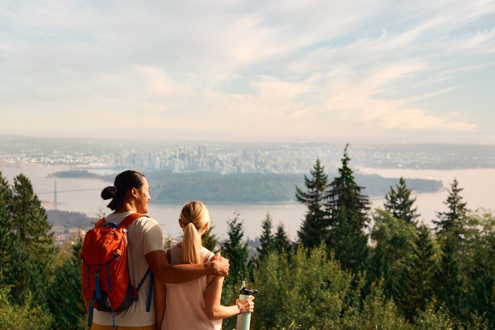
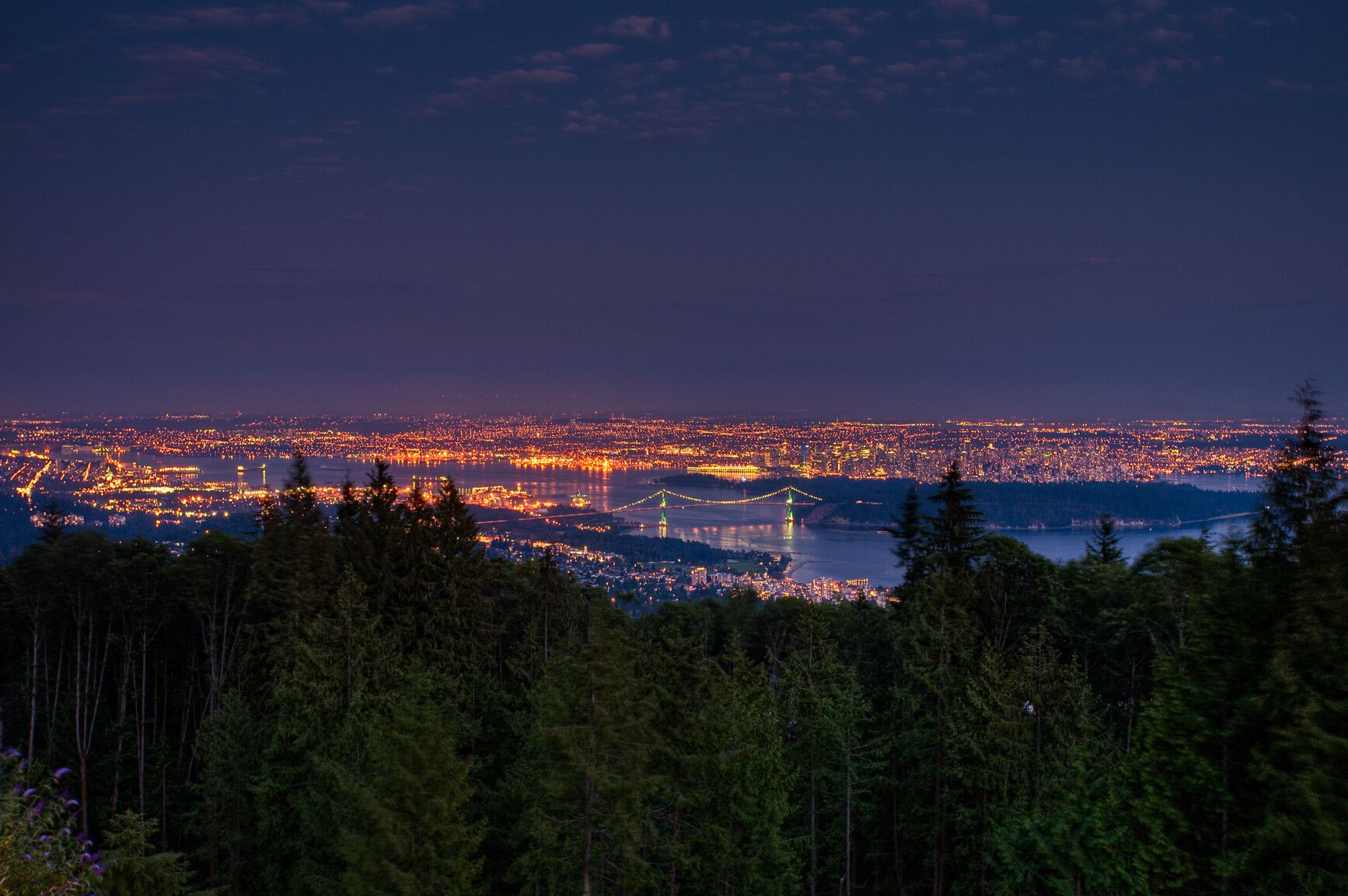
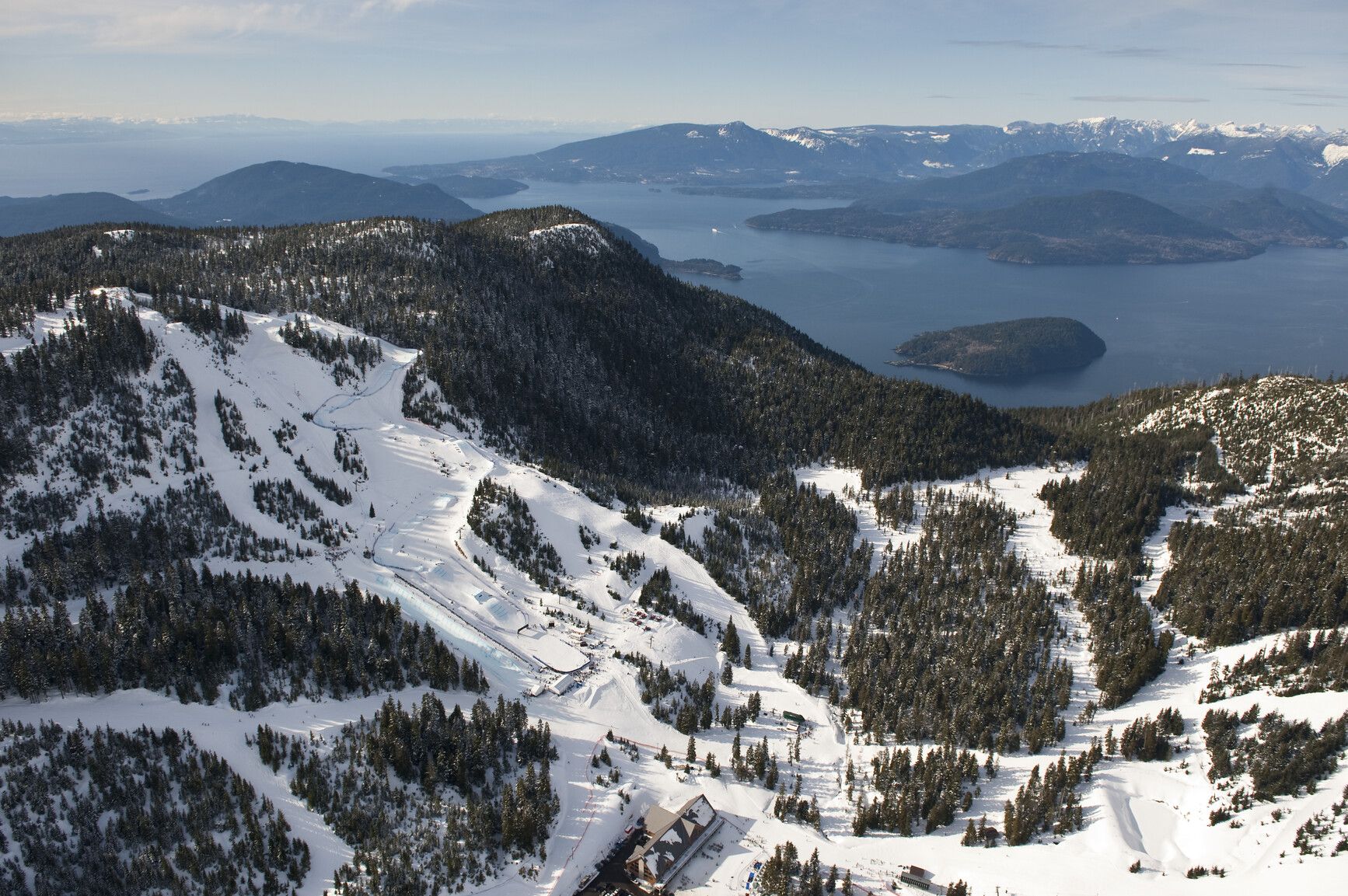
Bounded on the west by Howe Sound, on the north and east by the ridge tops of Mount Strachan and Hollyburn Mountain and to the south by West Vancouver, Cypress sits like a ship’s crow's nest high above Vancouver.
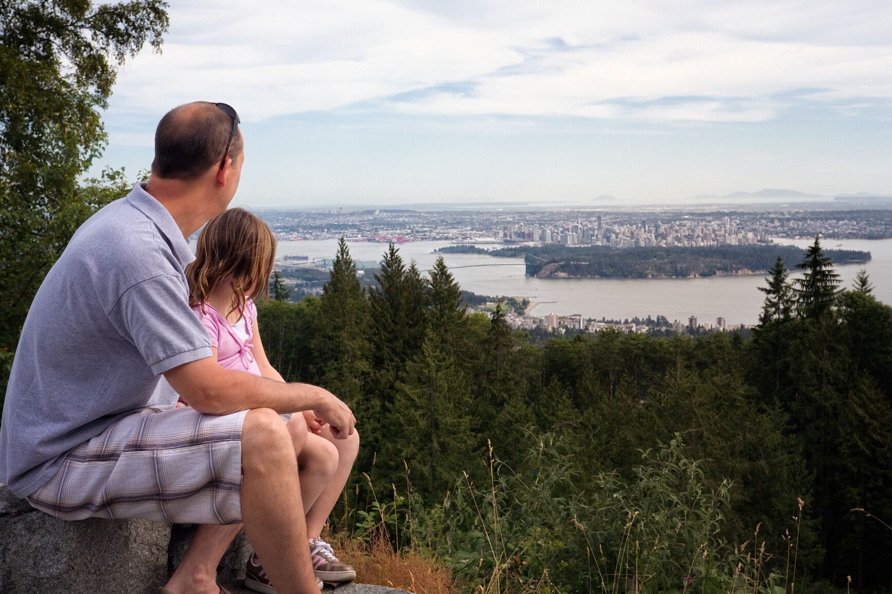
On a clear day the views are spectacular! To the south is the sprawling metropolitan area of Vancouver, while to the southeast is snow-clad Mount Baker in the Cascade Mountain chain. To the west and southwest lie the Gulf Islands and Vancouver Island with Georgia Strait in the foreground.
The diversity of natural features, old-growth trees, and outdoor recreation opportunities both summer and winter, is due partly to the climate of coastal British Columbia. The mean annual temperature of around 10° C (50° F) results in many warm days for hikers and sightseers.
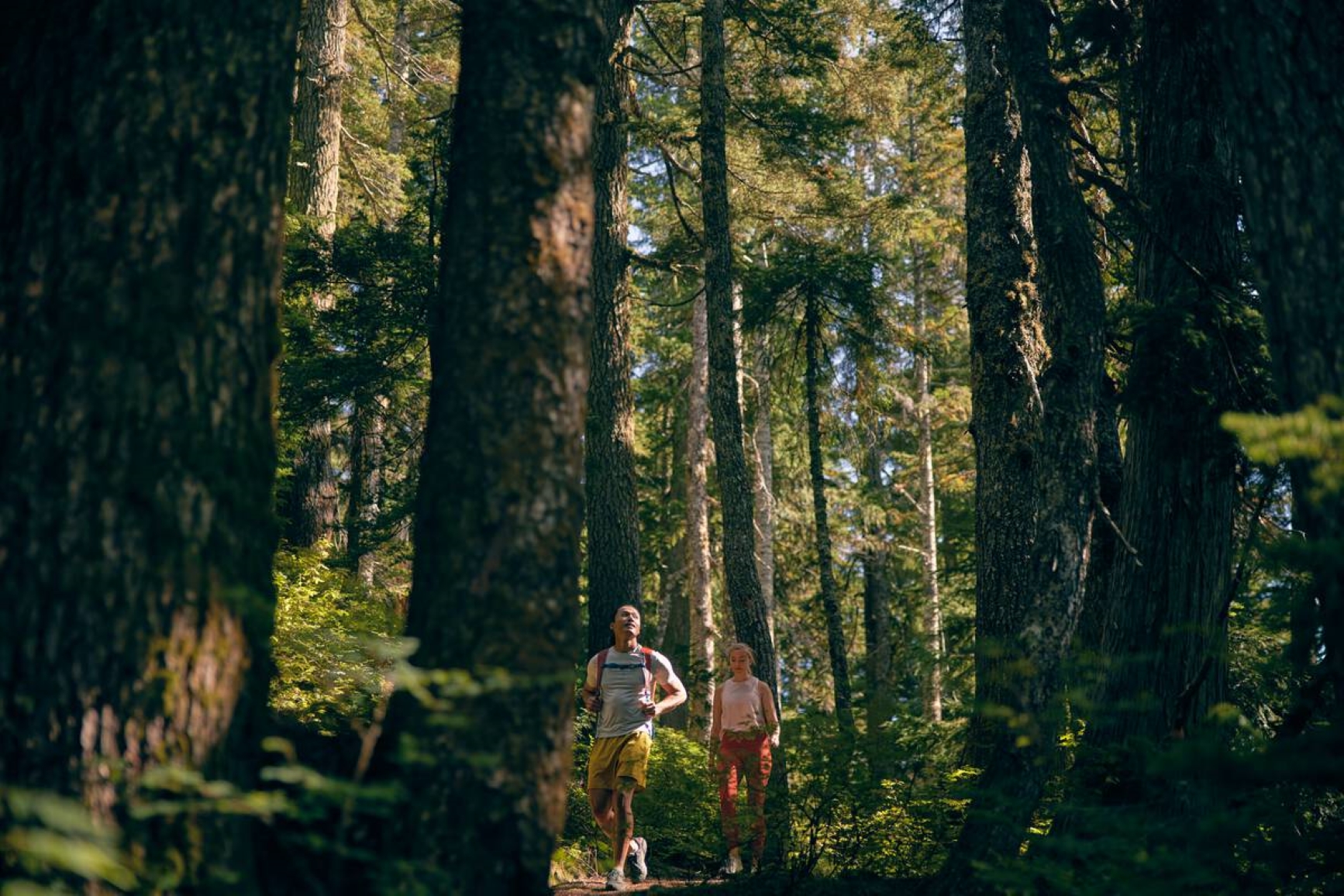
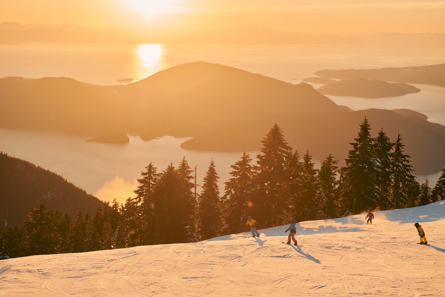
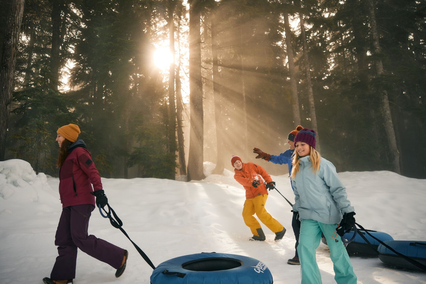
No matter what the season or the weather, Cypress Park is an enjoyable place to be. Hiking, sightseeing, photography, wilderness camping, skiing, snowboarding, cross country skiing, snow tubing, and snowshoeing and other snow-related activities are just some of the activities the park offers.
Cypress Park, through the commercial ski area under permit within the park, Cypress Mountain, was the official freestyle skiing and snowboard venue for the Vancouver 2010 Winter Olympics.
Established date: October 9, 1975
Park size: 3,012 hectares, including the Howe Sound Crest Trail
Advisories
Safety info
During winter months, backcountry users must follow the designated backcountry access corridors when accessing backcountry areas through Cypress Resort’s ski area boundary. This is to ensure Cypress Resort’s safe operation of maintenance activities on ski runs and in base areas, and the safety of other resort users.
Further details on backcountry access corridors can be found on the winter trail and backcountry corridor map.
Backcountry safety
- Open fires are not permitted in the backcountry.
- The mountainous backcountry of this park can be extremely rugged and unforgiving. Park visitors accessing the backcountry should be experienced and properly equipped. Anyone planning to travel in the backcountry (whether overnight or for just a few hours) should inform a friend or family member of their intended route and anticipated return time. A good trip planning form can be found on the AdventureSmart website.
- Mountain weather conditions often change suddenly and dramatically. Be prepared, take warm clothing and/or rain gear, and navigational equipment, and know how to use them.
- If mist and fog should close in and you become lost or disoriented, stay where you are until the weather clears or you are found. Never leave the trail!
- Un-bridged creek crossings exist on several trails within Cypress Park. They may be difficult or impassible due to high water during and after heavy rainfall. Use caution if you encounter fast-flowing water. If in doubt, do not attempt to cross!
- Current avalanche conditions can be found at avalanche.ca.
Special notes
- Peak-time parking: On peak days during the winter months, the upper parking lots of Cypress Park are often full. These parking lots service the customers of Cypress Mountain Resort who pay a fee to ski, snowboard, snowshoe, and snowtube, as well as the general public that comes to play in the park. Please do your part to ensure there is sufficient parking for everyone. Be sure to carpool, or consider taking the Cypress Coach Lines bus.
- Overnight parking: Please park only in the designated area, Lot 3B, for overnight trips. Failure to comply could result in a needless search and rescue operation and your vehicle being towed.
This park is serviced by Parkbus
Did you know Parkbus is an environmentally friendly, affordable transportation service from downtown Vancouver to select BC Parks? Find out more about Parkbus, including their routes, schedules, and contact details.
Camping
Wilderness camping is allowed at higher elevations beyond the Alpine and Nordic ski areas and along the Howe Sound Crest Trail, but no facilities are provided.
There are three preferred sites along the Howe Sound Crest trail.
- Magnesia Meadows (14.5km from Cypress Mountain Resort)
- Brunswick Lake (19km from Cypress Mountain Resort)
- Deeks Lake (22km from Cypress Mountain Resort)
Backcountry winter camping (1km beyond Alpine and Nordic ski areas) is also allowed.
Responsible recreation and safety
- No facilities are provided.
- Campfires are not permitted.
- Tent pads or sites are not provided. Campers are encouraged to camp in cleared areas to limit environmental impacts.
- The backcountry of Cypress Park can be rugged and weather is often severe. Campers should be experienced in the backcountry and prepared for all weather conditions.
- Backcountry travellers are encouraged to use extreme caution in avalanche terrain.
Facilities
Accessibility information is available for this park.
This park has two day-use picnic areas. Each day-use area has two pit toilets and picnic tables with barbeque attachments. Bring your own briquettes. There are no fire rings and fires are not permitted.
- The Quarry picnic area has a large grassy area with 11 picnic tables.
- Highview has a small grassy area and six picnic tables. It is mainly used as a lookout over Vancouver, Fraser Valley, and the south end of Vancouver Island.
Activities
Check the trail conditions report before heading out.
For your own safety and the preservation of the park, obey posted signs and keep to designated trails. Shortcutting trails destroys plant life and soil structure.
The videos below help hikers make informed decisions and stay safe along Eagle Bluffs Trail and Howe Sound Crest Trail.
Pets and other domestic animals must be on a leash at all times and are not allowed in beach areas or park buildings. You are responsible for their behaviour and must dispose of their excrement. Backcountry areas are not suitable for dogs or other pets due to wildlife issues and the potential for problems with bears.
Dogs and other pets are not permitted on the Yew Lake Interpretive Trail.
Bikes are not permitted on any trails within the park. Bicycles must keep to roadways. Bicycle helmets are mandatory in British Columbia.
Please note that bicycles with electric assist motors (e-bikes) are also not allowed on the trails within Cypress Park. E-bikes are restricted to park roads and areas where motorized use is permitted. The only exception to this policy will be for authorized and identified trail maintenance bikes conducting work on behalf of BC Parks.
Cypress Mountain ski resort
Cypress Mountain Resort is located within the park. They offer downhill skiing and snowboarding, cross-country skiing, a snow tubing park with a tube tow, and 11 km of marked self-guided interpretive snowshoeing trails in the Nordic ski area.
Tobogganing is only permitted in the designated area.
The Alpine Ski Area features six chairlifts and two high-speed quad chairs, two quad chairs, and two double chairs. There is also a magic carpet for Skooters (Kids Camp) that services 53 ski runs for all levels of ability.
Grouse Mountain and Mount Seymour offer skiing opportunities nearby.
Backcountry trails
BC Parks maintains three backcountry winter trails for snowshoeing and backcountry skiing: the Bowen Look-out, the Black Mountain Plateau, and the Hollyburn Peak trails.
Peak-time parking
During the peak winter months, parking capacity can be exceeded at the upper parking lots of Cypress Park. These parking lots service the customers of Cypress Mountain Resort who pay a fee to ski, snowboard, snowshoe, and snowtube, as well as the general public that comes to play in the park. Please do your part to ensure there is sufficient parking for everyone. Be sure to carpool, or consider taking the Cypress Coach Lines bus.
The access road to Cypress Park is from the Upper Levels Highway (routes 1 and 99) in West Vancouver and enters the park at an elevation of 300 metres. From the city of Vancouver, access is by crossing the Lions Gate Bridge to the Upper Levels Highway via Taylor Way in West Vancouver. The closest communities are West and North Vancouver.
Learn more about this park
Park details
- Date established: October 9, 1975
- Size: 3,012 hectares
Park contact
For hiking trails and backcountry information, contact BC Parks
- parkinfo@gov.bc.ca
- 1-800-698-9025 (toll free from Canada or the US)
- 1-519-858-6161 (internationally)
For ski resort questions, contact Cypress Mountain Resort guest services
Nature and culture
History
In 1939, the official opening of the Lions Gate Bridge linking Vancouver and West Vancouver by His Majesty King George VI and Queen Elizabeth II, signaled the end of the West Vancouver Ferry era and heralded the start of a population expansion in the city. As the population of the area increased there was an increasing necessity for more areas for skiing and hiking, which resulted in the creation of Cypress Park.
Conservation
The park has many natural highlights, including several sparkling mountain lakes, such as Blue Gentian, First, Yew, Cabin, and West Lakes, that are nestled below the peaks of Mount Strachan (1,454 m), Black Mountain (1,217 m), and Hollyburn Mountain (1,325 m).
Where the access road enters the park, at an elevation of 300 m, you pass first through a coastal Douglas fir forest. This is a fire-scarred area with even-age stands of mixed Douglas fir and western hemlock. Logging activities prior to the establishment of the park have opened much of the forest floor to the luxuriant growth of vine maple and cedar.
Between 800 m and 940 m elevation, the forest gradually changes and, as the ridge tops are approached at 1,300 m above sea level, mountain hemlock, amabalis fir, and yellow cypress, for which the park is named, predominate. The lush understory consists largely of shade-tolerant ferns, huckleberries, red and white heather, and false azaleas.
Invasive plants occur in the park and are being managed by BC Parks and partners. For more information, please see the Cypress Provincial Park Invasive Plant Management Strategy [PDF] .
Wildlife
A variety of large and small mammals inhabit the park. Coyotes and deer are often seen close to the access road. Black bears, squirrels, hares, and weasels may be encountered in the backcountry. Adding colour and sound to the park are a variety of birds like ravens, gray jays, chickadees, warblers, woodpeckers, grouse, hawks, and owls.
Reconciliation with Indigenous Peoples
BC Parks honours Indigenous Peoples’ connection to the land and respects the importance of their diverse teachings, traditions, and practices within these territories. This park webpage may not adequately represent the full history of this park and the connection of Indigenous Peoples to this land. We are working in partnership with Indigenous Peoples to update our websites so that they better reflect the history and cultures of these special places.