Park overview
Gladstone Park is most well known for the vehicle-accessible Texas Creek campground.
The park also has significant wilderness value. It provides a diversity of habitats in the Selkirk Foothills eco section of the province that is found nowhere else. These include Kokanee spawning areas, winter range for deer and elk, and of particular importance, low elevation habitats and old growth cedar and hemlock forests.
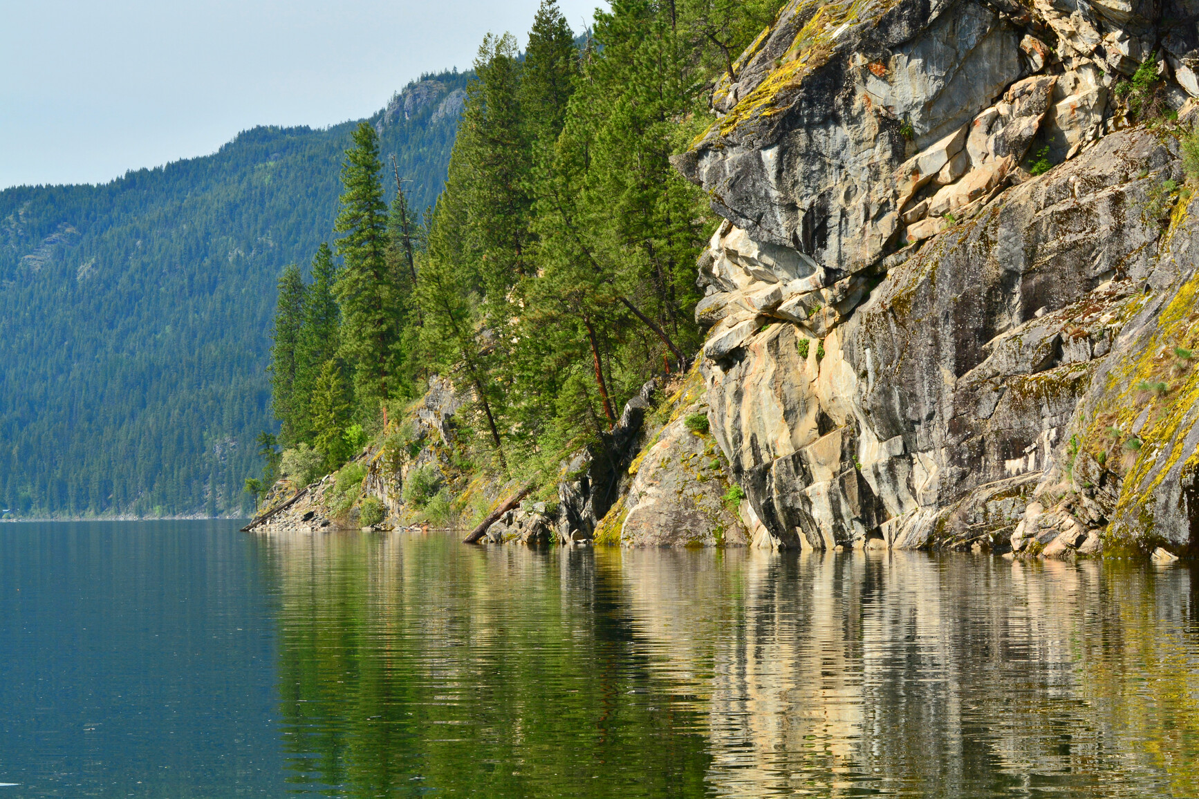
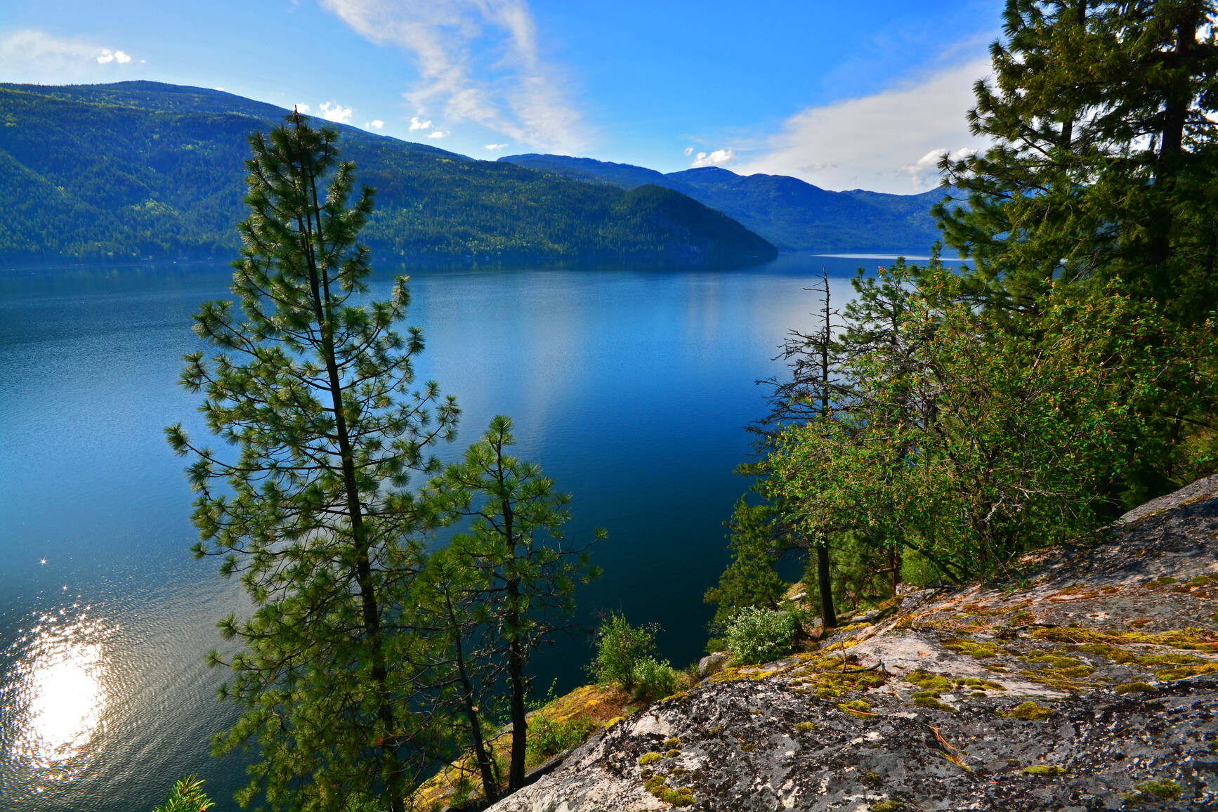
There are several short trails that lead from the campground to the lake. Christina Lake has a reputation as one of the warmest and clearest lakes in Canada. There are several pocket beaches that provide great opportunities for privacy and quiet moments. The Monashee Mountains surround the lake and it is a perfect backdrop for a variety of water-oriented recreational activities.
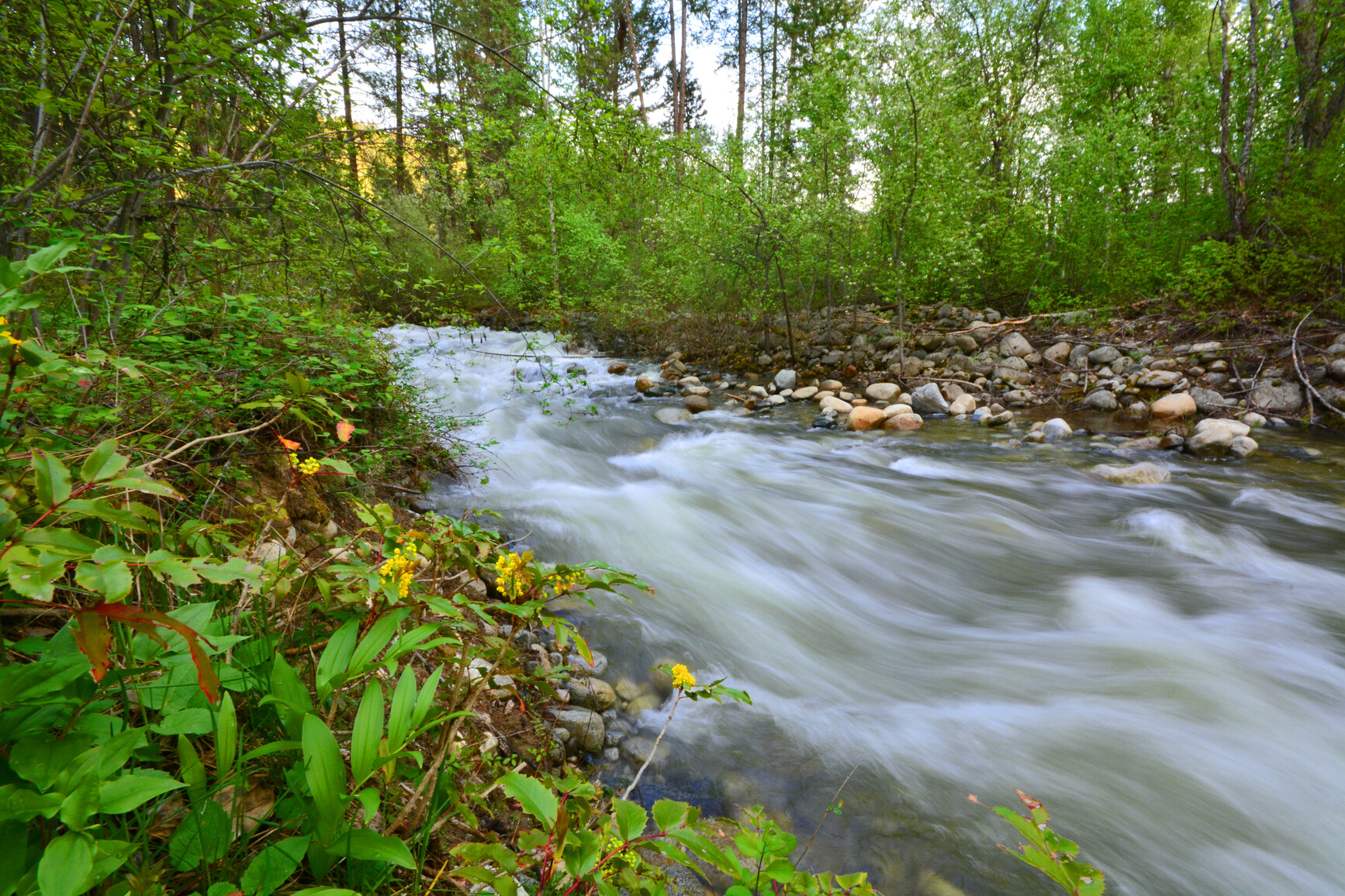
Fishing for Kokanee, rainbow trout and small-mouth bass is popular. The protection of spawning areas in the park such as Sandner Creek is extremely important.
Advisories
Dates of operation
The park is open May 2, 2024 to September 30, 2024
- Facility type
- Frontcountry camping
- Number of campsites
- Reservable frontcountry sites: 63
- Vehicle-accessible sites: 63
- Main operating season
- 2024: May 2 to September 30
- Winter season
- Not known
- Booking required
- 2024: May 16 to September 13
- Winter season note
- The gate is locked during the off-season, but you can access the park by foot.
- Facility type
- Frontcountry camping
- Main operating season
- 2024: May 2 to September 30
- Winter season
- Not known
- Booking required
- 2024: May 2 to September 29
Safety info
- Swimmer’s Itch: Symptoms will be an irritating rash and persistent itch. Calamine lotion is an effective treatment.
- Poison Ivy: A low plant with three glossy, bright green leaves and white berries. Wear shoes when hiking, especially in underbrush. Calamine lotion is an effective treatment.
- Trail maintenance has been reduced on all trails in Gladstone Park. Although these trails remain open, users may encounter fallen trees or trail wash-outs. Extra caution is advised.
Special notes
- All trails are closed to motor vehicles including ATVs.
- Texas Creek Campground is fully reservable.
- There is no long-term trailer storage permitted at the Texas Creek boat launch. Any trailers left in the parking lot for more than 14 days per calendar year are subject to removal and fines.
- Xenia Lake Campground access: Xenia Lake Campground, can be reached by road via the Miller Creek Forest Service Road, located at km 23 on the North Fork Road, north of Grand Forks. The forest service road reaches the provincial park boundary at km 8.3. Make a right turn on a rough road for another 1km east and you will arrive at the campground on the lake. This last kilometre is very rough and in poor condition. There are three campsites on the lake. Please keep the sites clean and carry out all garbage.
Camping
- Total number of campsites
- Total reservable frontcountry sites: 63
- Total vehicle-accessible sites: 63
Campsite reservations are accepted and the reservations must be made the BC Parks reservations system. When reservations are not available all campsites function as first come, first served.
Groupsite camping and day-use picnicking are not available in this park.
Texas Creek campground offers 62 vehicle-accessible campsites, including seven double sites. Campsite reservations are available in this park. The gate is locked during the off season. To check-in, refer to the reservation board at the campground entrance for a pre-assigned site number.
Most of the sites are large and shaded by a forest of Douglas fir mixed with some cedar, larch and Ponderosa pine. The double sites are medium to small in size. The forest has a thick understory of shrubs, including ocean spray, that offer privacy for the sites. Roads within the campground are gravel, with perimeter road being double lane and the others a little narrower.
| Vehicle-accessible camping fee | $27 per party per night |
| BC seniors’ rate (day after Labour Day to June 14 only) | $13.50 per senior party per night |
For information on the BC seniors’ rate, see the camping fees page
This park has unique camping opportunities on the west side of Christina Lake that are accessible by boat. Many are former Forest Service Recreation sites. Facilities are limited.
Marine-accessible camping fee: $13 per party or vessel, per night
The Ole Johnson site is situated on Bald Point on the west side of Christina Lake. Access to this small bay of coarse sand is by boat, 7.5 km from the boat launch at Texas Creek. There are 10 walk-in sites with fire rings, two picnic tables and two benches. The forested uplands rise steeply off the beach and are broken up by rocky outcrops. There is evidence of historical use in the form of two old cabin sites belonging to miner Ole Johnson for whom the site is named. There are excellent swimming, fishing and hiking opportunities.
Peter Lake has been used as a backcountry camp by past users. There is room for three tents beside the lake. There are no other facilities. There is no beach and swimming opportunities are limited. The lake contains rainbow trout and brook trout. There are opportunities for hiking up the ridge south of the lake for views into the Sandner Creek drainage.
Xenia Lake has an old Forest Service Recreation site. There are two pit toilets and five picnic tables.
Troy Creek is located at the extreme northwest corner of Christina Lake 10 km from the Texas Creek boat launch or 11.3 km hiking along the Deer Point and Troy Creek Trail. This small bay has a rocky shoreline backed by a mixed forest with some exceptional Western red cedar and Douglas fir. An old cabin provides evidence of past use of the site. There are great views across the lake and to the north as well as good fishing. There is one pit toilet and five picnic tables. A trail leads up to Xenia Lake.
Parson Creek is located on the west side of Christina Lake opposite Deer Point 6km from the Texas Creek boat launch accessible only by boat. The majority of the shoreline is rocky and the upland is heavily forested with few shrubs. The small beach is coarse gravel. There is one pit toilet and two picnic tables.
Treadmill Creek is located on the west side of Christina Lake 5km from the Texas Creek boat launch. This large beach of coarse sand is sheltered from prevailing south winds making it a great spot for swimming and fishing. It offers an excellent view of Sandner and Troy Creek at the head of the lake. The land slopes away from the beach in a series of terraces. There are two pit toilets and four picnic tables.
Axel Johnson is located on the west side of Christina Lake 3 km from the Texas Creek boat launch. This isolated bay has a long sandy beach making it a good spot for swimming and waterskiing. There are views across the lake of rock slides. There are two pit toilets and four picnic tables.
Starchuck Beach is located on the west side of Christina Lake almost opposite of Texas Creek. This large sandy beach area is the southern most site on the west side. It is a popular area for swimming and fishing. There are two pit toilets and four picnic tables.
Trapper Creek can be accessed by either boat or from the Deer Point Trail. It is a small, semi-open site with swimming and fishing opportunities. There is one pit toilet and two picnic tables.
Facilities
Accessibility information is available for this park.
Cold water taps are located throughout the Texas Creek campground. Taps are shut off during the off-season.
There is a paved boat launch available at Texas Creek. It is open year-round though ice will limit use. It is located on Litchy Road between pieces of private property, 500 m before the campground. There is a wide paved road with a single lane turn-around running off one side. The road slopes down to a double wide concrete ramp with two docks made of interlocking plastic blocks.
There is a payphone and an information shelter beside the dock. Parking is across East Lake Road in two large gravel parking lots. There is one pit toilet by the parking lots.
Please note: There is no long term trailer storage permitted at the Texas Creek boat launch. Any trailers left in the parking lot for more than 14 days per calendar year are subject to removal and fines.
Campfires are allowed and campfire rings are provided at each campsite. We encourage visitors to conserve wood and protect the environment by minimizing the use of fire and using campstoves instead.
Firewood can be purchased in the park or you may bring your own wood. Fees for firewood are set locally and may vary from park to park.
To preserve vegetation and ground cover, please don’t gather firewood from the area around your campsite or elsewhere in the park (this is a ticketable offence under the Park Act). Dead wood is an important habitat element for many plants and animals and adds organic matter to the soil.
Campfire bans may be in place. Before lighting a fire, check for bans or restrictions on BC Wildfire Service and on local or Indigenous government websites.
Visitors can use Christina Lake day-use area, located 10 km from the park.
This park offers nine flush toilets and five pit toilets.
Activities
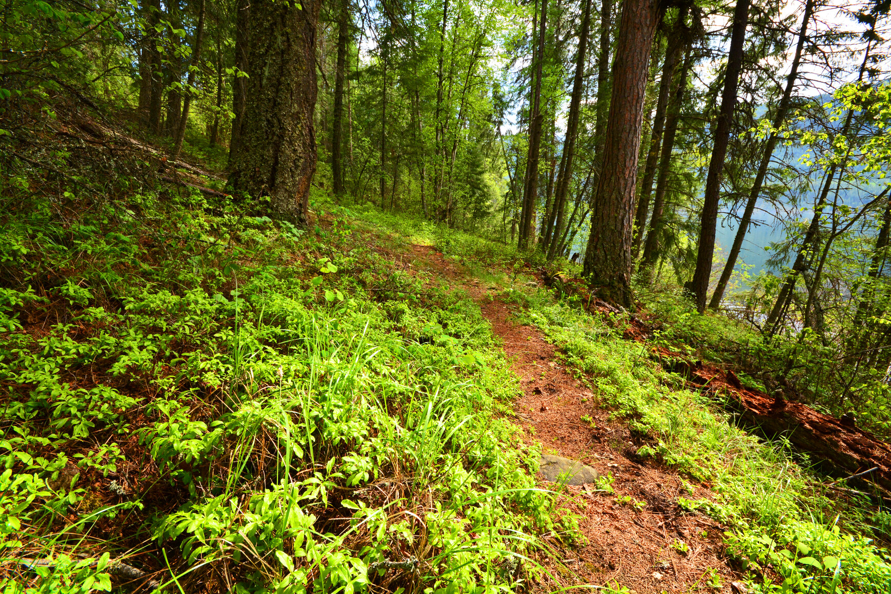
There are more than 48 km of trails in the park. Trails in the backcountry areas of the park are unmarked and unmaintained. They may not meet BC Parks standards. Most are suitable for hiking and horseback riding. All trails are closed to motor vehicles including ATVs.
For your own safety and the preservation of the park, obey posted signs and keep to designated trails. Shortcutting trails destroys plant life and soil structure.
| Deer Point Trail to Troy Creek | 11.3 km | Easy with some steep sections |
The trail starts out steep to traverse semi-open forest high above Christina Lake but levels off, rolling gently up and down along the shoreline to Deer Point. Huge cedar trees and a sandy beach await at the north end of the lake. At 8 km, take the Troy Creek Trail to get to the head of the lake or descent to Deer Point camping area on the lake.
| Xenia Lake Trail | 4 km | Difficult (steep descent) |
The Forest Service maintained a recreation site at the lake at one time making this a good weekend trip. The trail comes out at the north end of Christina Lake and joins up with Troy Creek Trail for a longer loop. A 4WD vehicle is required to access Xenia Lake. From Xenia Lake, the trail goes east and descends to Christina Lake.
| Sandner Creek Trail | 9 km |
A historic trail extends along Sandner Creek up past the Benninger property.
| Mt. Faith Trail | 18.4 km | Difficult |
This moderately steep, difficult route extends from the Lynch Creek trailhead, up Morrell Creek to Mt. Faith.
| Mt. Gladstone Trail | 6 km | Difficult |
This steep trail ascends Mt. Gladstone from the abandoned CPR railway north of Paulson.
| Peter Lake Trail |
This trail is currently inaccessible.
Visitors will find a safe swimming area in the warm waters of Christina Lake.
The campground is situated well above the lake but several pocket beaches are accessible. The beaches of coarse sand are separated by shrubs and some cottonwood trees that provide shade.
A roughly 100 m long, two metre wide gravel trail with a gentle slope leaves the campground between sites 2 and 3. This is the easiest trail to the beach. A variety of other narrow dirt trails cut straight down the bank in a series of stairs and switchbacks. On the main trail just above the beach are a rescue station, garbage can and two pit toilets.
There are no lifeguards on duty in BC Parks.
Fishing for Kokanee, rainbow trout and smallmouth bass is popular. There is no fishing north of a line between Bald Point and Knob Point between April 1 and May 31. Ice fishing is possible on Christina Lake depending on winter conditions.
Anyone fishing in British Columbia must have an appropriate licence. To learn more, see the fishing and hunting guide.
Pets and domestic animals must be on a leash at all times and are not allowed in beach areas or park buildings. You are responsible for their behaviour and must dispose of their excrement. Backcountry areas are not suitable for dogs or other pets due to the potential for problems with bears and other wildlife.
Bicycles must keep to roadways. Bicycle helmets are mandatory in British Columbia.
For details on e-biking within Gladstone Park, see the e-biking section below.
Please note that bicycles with electric assist motors (e-bikes) are permitted on signed or designated trails within Gladstone Park, provided they meet the definitions and criteria for e-bike use as outlined in the BC Parks cycling guidelines.
Hunting is allowed in the park. Please check the BC Hunting & Trapping Regulations Synopsis for more information. The Mount Faith area draws people internationally for guided hunting provided by a licenced guide outfitter.
Gladstone Park is located approximately 20 km northeast of Grand Forks on Hwy 3 at the north end of Christina Lake in the Monashee Mountains. The most common accesses to the park are via the Texas Creek campground and by boat from Christina Lake.
The campground is 5 km east of Christina Lake on Hwy 3; turn onto East Lake Drive and follow 4 km to the 63 site campground at the end of the road.
There is rough 4WD access to Xenia Lake, 22 km up the North Fork Rd from Grand Forks to Miller Creek Rd. Turn right and go about 4 km. Look for a small road on the left marked with a white deactivated road sign that leads to the lake.
There is also access to the Mt. Gladstone trailhead from Hwy 3 and the abandoned CPR railway at Paulson, the Mt. Faith trailhead from the Burrell Forest Service Road, and Peter Lake from Dog Creek Road.
Park and activity maps
Learn more about this park
Park details
- Date established: July 12, 1995
- Size: 39,387 hectares
Park contact
This park proudly operated by:
Quality Recreation Ltd.
250 584-9025
info@explorebcparks.ca
(For Texas Creek Campground and marine areas)
Nature and culture
History
Gladstone Park was identified for protection in the West Kootenay-Boundary Land-Use Plan. It includes the former Ole Johnson and Texas Creek parks.
Cultural heritage
The park contains nationally significant cultural values which include three shoreline pictograph sites and other evidence of First Nations habitation. There are historic home sites, a semi-permanent village, historic trails used by the First Nations, and a resource utilization site where fish may have been caught, stored and processed. The Dewdney Trail passed through the park as did an old section of CPR which was important history related to Doukhobor ethnicity and settlement. There is also a historic cabin on Benniger Creek and an old gold mine.
Conservation
The park contains the elevational gradient from lakeshore to alpine, capturing a diversity of habitats in the Selkirk Foothills ecosection which are captured nowhere else. It also protects low elevation dry interior cedar-hemlock forest communities with some old growth, important winter ranges for deer and elk, and high-value spawning areas for kokanee. With the exception of the privately owned D.L. 1188, the park protects the entire drainage of Sandner Creek which provides critical spawning habitat for kokanee and rainbow trout. Seventy percent of the stream-spawning kokanee from Christina Lake use Sandner Creek.
Wildlife
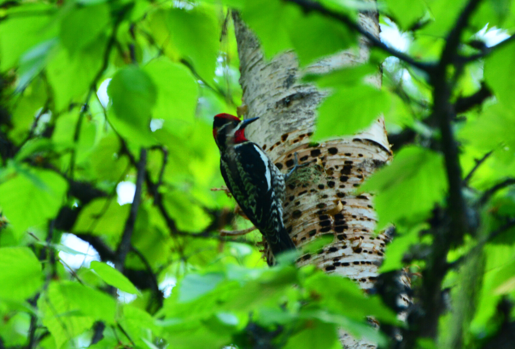
The park protects blue-listed California bighorn sheep and grizzly bear and the red-listed Northern leopard frog.
Reconciliation with Indigenous Peoples
BC Parks honours Indigenous Peoples’ connection to the land and respects the importance of their diverse teachings, traditions, and practices within these territories. This park webpage may not adequately represent the full history of this park and the connection of Indigenous Peoples to this land. We are working in partnership with Indigenous Peoples to update our websites so that they better reflect the history and cultures of these special places.