Park overview
This park designation is part of the Lower Mainland Nature Legacy initiative. Pinecone Burke is going through the master planning process. Current park operations are at a minimum. As a result, mapping and information about the opportunities is limited. It is the hope of BC Parks to further develop information pertaining to this park over the coming years.
Advisories
Dates of operation
The park is open year-round
- Facility type
- Marine-accessible camping
- Number of campsites
- Boat-accessible sites: 2
- Main operating season
- 2024: year-round
- Winter season
- No services
- Service note
There is one pit toilet on location. No dock, picnic tables, bear caches or fire rings as fires are prohibited.
Marine access only.
- Booking note
- Campsite is open year-round.
- Facility type
- Marine-accessible camping
- Number of campsites
- Boat-accessible sites: 15
- Main operating season
- 2024: year-round
- Winter season
- No services
- Service note
There are two pit toilets on location. There are also bear caches, food cages for food storage, and picnic tables. No fire rings are available as fires are prohibited.
Paddle-in, marine access only.
- Booking note
- Campsite is open year-round.
Safety info
- The old Widgeon Falls Trail is currently not recommended, due to many slippery foot-bridges and wooden stairs that are in poor condition. Visitors travelling to the falls are encouraged to utilize the old roadway instead.
- Bring your own drinking water, as potable water is not available in the park.
- Creek water is available at all day-use and camping areas. Always boil, filter, and otherwise treat your water before consuming.
Special notes
- Campfires are not permitted in the park at any time.
- Use the food cache provided at Widgeon Creek campsite to prevent conflicts between bears and humans.
- Use the existing tent pads at the Widgeon Creek campsite when camping to minimize your impacts on the area. Do not camp on vegetated areas.
- The Widgeon Creek campsite is a user-maintained area. There are no trash cans provided. Pack out everything you pack in. Leave nothing behind.
- Dogs must remain on leash at all times while in the park. Always clean up and properly dispose of your dog’s waste.
Camping
- Total number of campsites
- Total boat-accessible sites: 17
There are group campsites at this park. Reservations are not accepted for these group sites. All sites are on a first come, first served basis. There are no camping fees charged at this time.
Wilderness marine-accessible camping is allowed year-round. Please use the food cache provided at Widgeon Creek Campsite to prevent conflicts between bears and people. Campfires are not permitted in the park. Users must be prepared for winter conditions during the off-season.
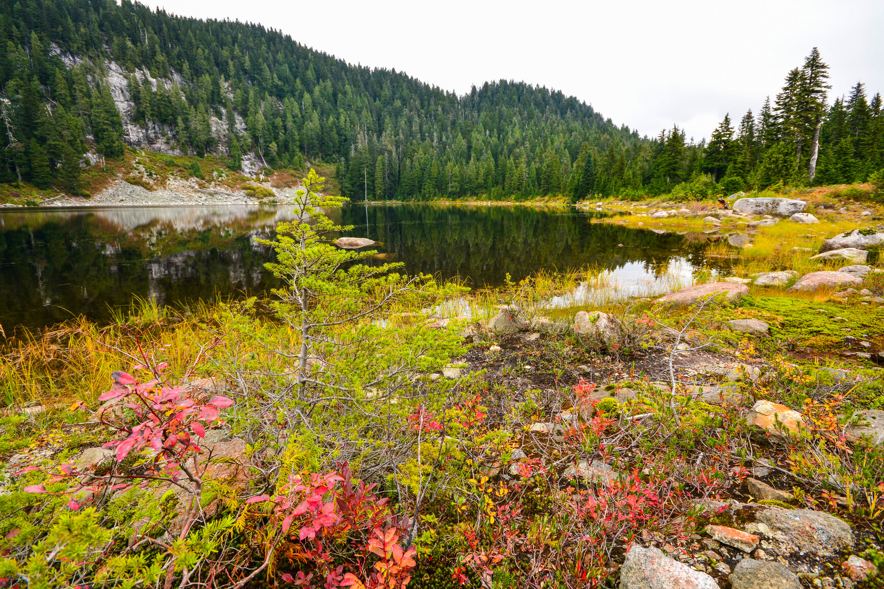
There are two main areas for marine-accessible camping.
Widgeon Creek
Not shown on the park map.
Widgeon Slough and Widgeon Valley are accessible by canoe. Canoes or kayaks can be launched from Grant Narrows at the south end of Pitt Lake, and paddled through Widgeon Slough. Paddling time is approximately two hours to reach the Widgeon Creek camp site. There are about 10 designated sites. Overflow camping is available on the grassy areas around the camping area. There is a pit toilet but no garbage facilities. Users are required to pack out all garbage.
Pitt Lake
There are four marine-accessible camping areas up the shoreline of Pitt Lake. BC Parks is currently in the planning process for these areas, and has yet to fully implement an operations strategy. The sites are maintained.
Camping facilities are provided at Dark Creek on the west shore of Pitt Lake, Osprey Creek (north and south), and Raven creek camping areas are located on the east side of Pitt Lake. Please see the Golden Ears Park map [PDF] which shows the camping locations on Pitt Lake.
Wilderness camping is allowed year-round, but no facilities are provided. Campfires are not permitted within the park. Users must be prepared for winter conditions during the off-season.
The main camping area for wilderness camping is Burke Mountain (shown on the park map). Several of the Burke Mountain trails climb up the ridge onto the Burke Mountain plateau where there are several lakes. Please avoid causing damage to the ecosystem.
Winter wilderness camping is allowed. The backcountry of the park is open to year-round. Please use the food cache provided at Widgeon Creek campsite to prevent conflicts between humans and bears. Campfires are not permitted in the park. Users must be prepared for winter conditions during the off-season.
Facilities
This park has a day-use and picnic area. Widgeon Creek is used as a destination day-use area for paddlers.
Defrauder Falls, on the west shore of Pitt Lake, is a day-use area. No facilities are provided. The site is boat access only.
There are pit toilets available at the Widgeon Creek camping area.
Activities
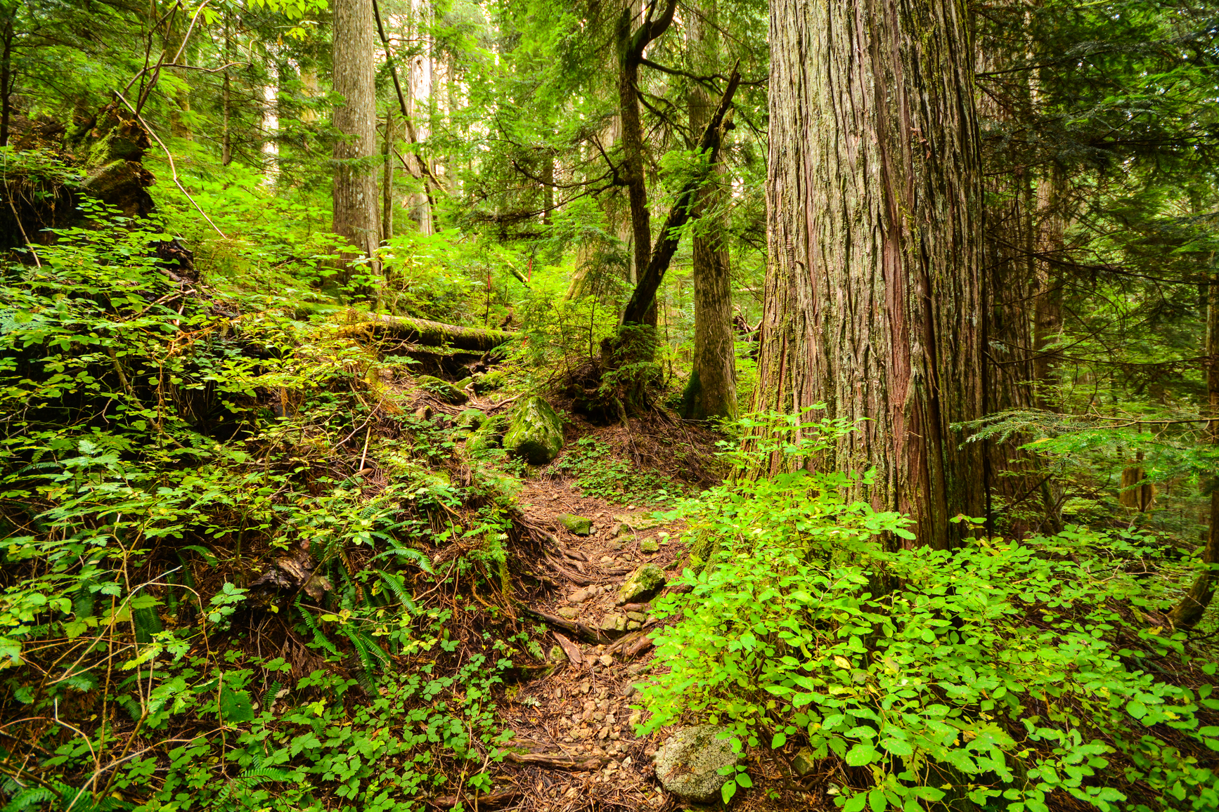
Use caution when travelling over creek crossings. Bridges and boardwalks are in poor condition. For your own safety and the preservation of the park, obey posted signs and keep to designated trails. Shortcutting trails destroys plant life and soil structure.
There are no lifeguards on duty in BC Parks.
- Widgeon Creek is used as a destination day-use area for paddlers. See Marine-accessible camping for more information.
- Defrauder Falls on the west shore of Pitt Lake is a day-use area. No facilities are provided. The site is boat-access, only.
There are kayaking opportunities available.
Pitt Lake is well known for excellent cutthroat trout fishing. Several species of salmon pass through the lake in the fall enroute to the Pitt River.
Anyone fishing in British Columbia must have an appropriate licence. To learn more, see the fishing and hunting guide.
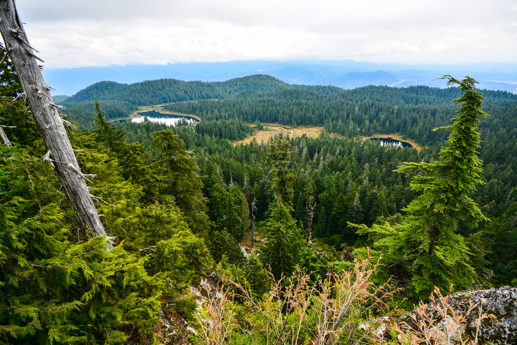
Widgeon Slough provides unique waterfowl habitat. Depending on the time of year, migratory birds can be viewed in large numbers. Blue Herons are a common site along the bank of the slough and lake. In addition, the higher elevation trails on Burke Mountain offer unique views of the lower mainland and the Coast Mountains.
Pets and other domestic animals must be on a leash at all times and are not allowed in beach areas or park buildings. You are responsible for their behaviour and must dispose of their excrement. Backcountry areas are not suitable for dogs or other pets due to wildlife issues and the potential for problems with bears.
Bicycles with electric assist motors (e-bikes) are permitted on signed or designated trails within Pinecone Burke Park, provided they meet the definitions and criteria for e-bike use as outlined in the BC Parks cycling guidelines.
This park is open to hunting. All applicable hunting licences are required. However, there is no park specific hunting permit needed.
To access the Widgeon Valley, visitors must travel through the Widgeon National Widllife Area. Under the National Wildlife Area Regulations it is prohibited to hunt and trap in the Widgeon National Area or possess the equipment to hunt and trap.
Park visitors can explore the backcountry of Burke Mountain in the winter months on touring skis or snow shoes. No winter trails are marked. There are no winter facilties.
The park lies south of Garibaldi Park, west of Pitt Lake and Pitt River and extends south to include Burke Mountain in Coquitlam. Nearby communities include Coquitlam and Maple Ridge.
Burke Mountain is accessible by using old logging roads and trails from the Port Coquitlam and the District Hunting and Fishing Club at the end of Harper Road to Munro and Dennett lakes and Burke Ridge. This area is also accessible via Coast Meridian Road, Apel Drive (which becomes Victoria Drive), and Quarry Road.
Widgeon Slough and Widgeon Valley are accessible by boat. Canoes or kayaks can be launched from Grant Narrows at the south end of Pitt Lake, and paddled through Widgeon Slough. An old logging road leads hikers up the lower valley where a trail branches off for Widgeon Lake.
West Pitt Lake, including DeBeck Valley, is accessible by boat. An old logging road extends from the mouth of the creek to a point approximately one quarter of the way up the valley. An intermittent trail leads over the pass to Boise Valley.
From the east, access to Boise Valley and Pinecone Lake is via boat to the north end of Pitt Lake, and then by logging road (16 km and 30 km respectively) to the trailhead leading through the main valley. From the west, logging roads lead to the park through the Mamquam and Indian River valleys.
Park and activity maps
Learn more about this park
Park details
- Date established: July 12, 1995
- Size: 38,000 hectares
Nature and culture
Cultural heritage
Pinecone Burke Park includes part of the traditional territory of the Katzie First Nation, and borders a Katzie Indian Reserve. The area within the park was used extensively for its plant, fish, and wildlife resources.
The Five Fingers alpine area north of Widgeon Lake, has long been a destination for mountain climbers. First assents date back to the early 1920s. An abandoned mine tunnel and old steam donkey west of Pitt Lake are evidence of resource use in the area.
Conservation
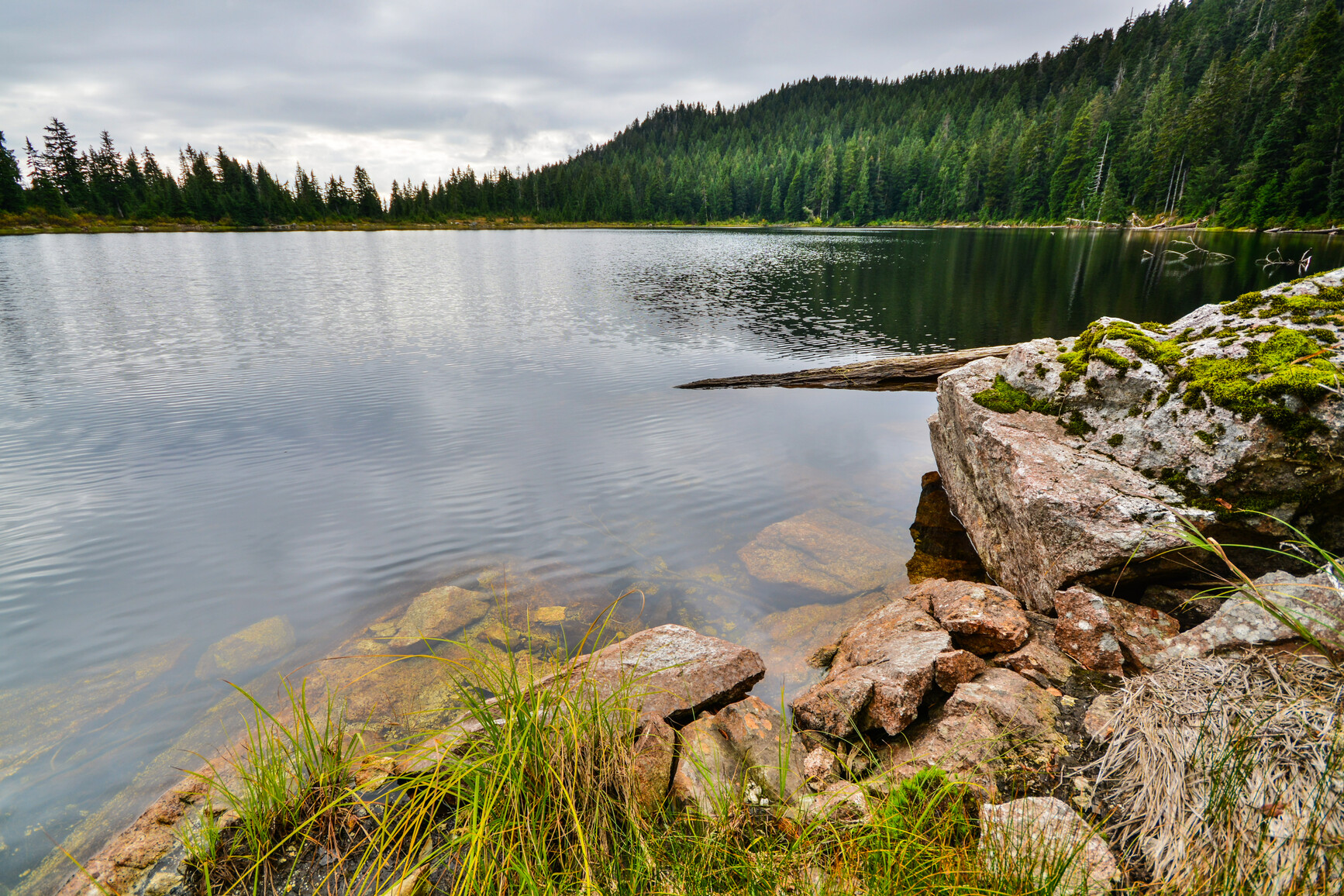
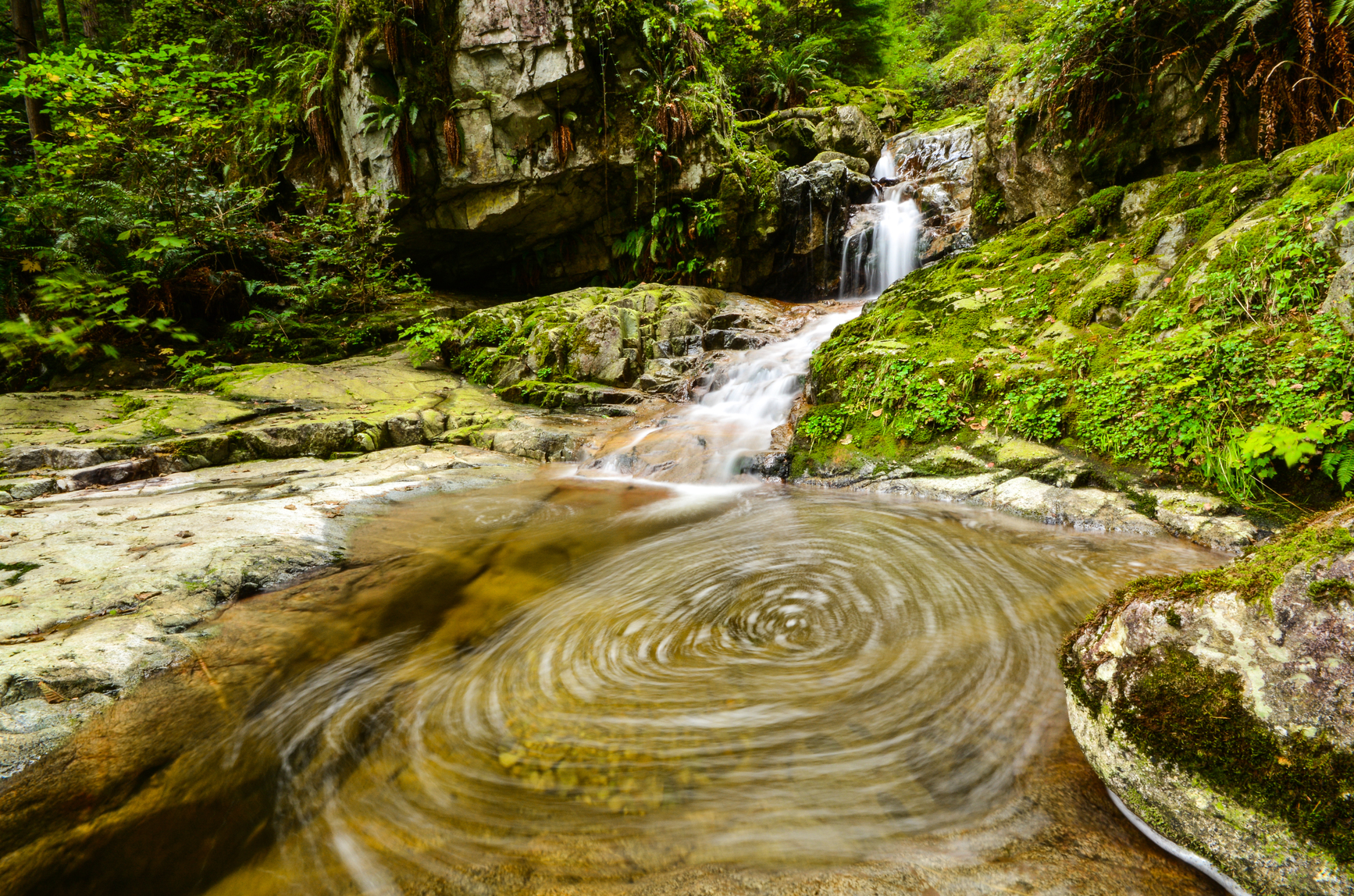
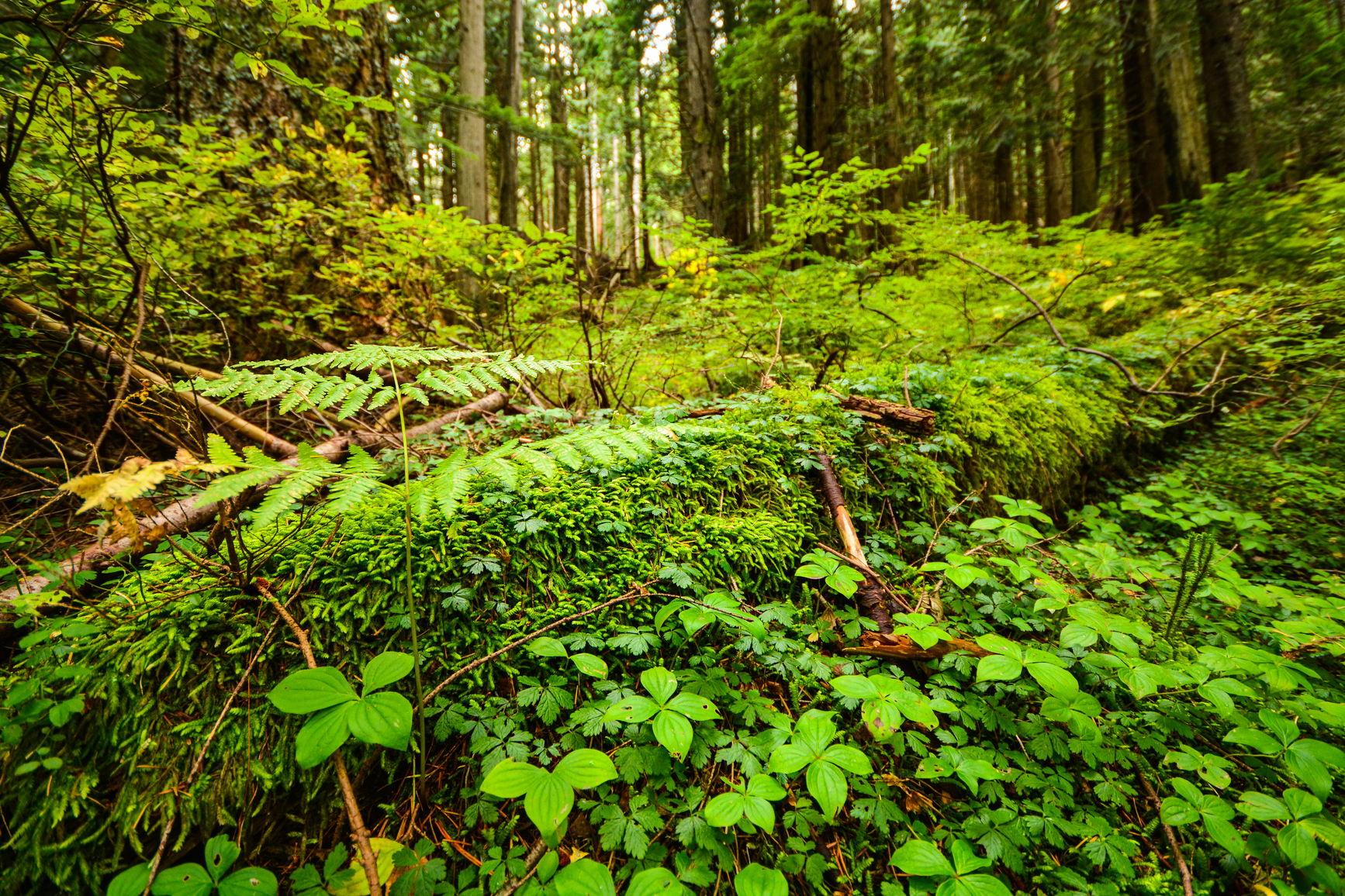
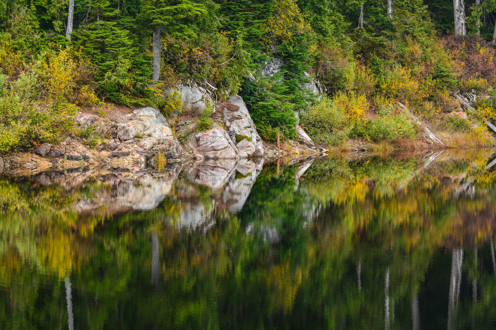
Pinecone Burke Park protects the western shore of Pitt Lake, the largest fresh water tidal lake in North America. It is a wilderness area protecting old-growth forests, numerous alpine lakes, rugged terrain, and remnant icefields. Widgeon Slough is the largest freshwater marsh in southwestern B.C. and Widgeon Lake is largest hanging lake in Greater Vancouver’s north shore mountains.
All five species of Pacific salmon, cutthroat trout, steelhead trout, and migratory dolly varden char can be found in the park. Pinecone Burke Park provides habitat for black-tailed deer, mountain goats, black bears, and grizzly bears.
Six sensitive or vulnerable species occur in the park: tailed frog, great blue heron, Vaux’s swift, Huttons’ vireo, shrew mole, and the Pacific jumping mouse.
The park also contains nationally recognized wetlands in the Widgeon Valley.
Reconciliation with Indigenous Peoples
BC Parks honours Indigenous Peoples’ connection to the land and respects the importance of their diverse teachings, traditions, and practices within these territories. This park webpage may not adequately represent the full history of this park and the connection of Indigenous Peoples to this land. We are working in partnership with Indigenous Peoples to update our websites so that they better reflect the history and cultures of these special places.