Park overview
Syringa Park is located in south central B.C. near the southeast end of the Lower Arrow Lake. The lake is a part of the Columbia River that was widened and deepened with the construction of the Hugh Keenleyside Dam at Castlegar.
Recreation opportunities on the Arrow Lake Reservoir have made the park a long time popular destination. This park offers a comfortable base camp for visitors to pursue a variety of activities including fishing, boating and swimming. Explore local history and visit the Doukhbour Village Museum and Zukerberg Island located in nearby Castlegar.
The park protects not only provincially significant interior Douglas fir forests but also preserves one of the few remaining examples of grassland ecosystems in the Kootenays. A variety of wildlife are at home in the park including, elk, deer and a herd of rocky mountain bighorn sheep that can often be observed grazing on the many rock bluffs. Opportunities for nature appreciation occur all year making this park a destination in every season.
Advisories
Dates of operation
The park gate is open May 1, 2024 to September 30, 2024
- Facility type
- Frontcountry camping
- Number of campsites
- Reservable frontcountry sites: 9
- Vehicle-accessible sites: 9
- RV-accessible sites: 9
- Main operating season
- 2024: May 3 to September 30
- Winter season
- Not known
- Booking required
- 2024: May 3 to September 29
- Winter season note
- Gate is closed during the off-season.
- Facility type
- Frontcountry camping
- Number of campsites
- Reservable frontcountry sites: 25
- Vehicle-accessible sites: 25
- Main operating season
- 2024: May 3 to September 30
- Winter season
- Not known
- Booking required
- 2024: May 3 to September 29
- Winter season note
- Gate is closed during the off-season.
- Facility type
- Day-use area
- Main operating season
- 2024: May 3 to September 30
- 2025: May 1 to September 30
- Winter season
- Not known
- Winter season note
- Gate is closed during the off-season.
- Facility type
- Frontcountry camping
- Number of campsites
- Reservable frontcountry sites: 30
- Vehicle-accessible sites: 61
- Main operating season
- 2024: May 3 to September 30
- Winter season
- Not known
- Booking required
- 2024: May 3 to September 29
- Winter season note
- Gate is closed during the off-season.
- Facility type
- Boat launch
- Main operating season
- 2024: May 3 to September 30
- Winter season
- Not known
- Service note
- The gate for this area is typically left open year round, general operating dates vary from April to October.
- Facility type
- Day-use area
- Main operating season
- 2024: May 3 to September 30
- 2025: May 1 to September 30
- Winter season
- Not known
- Service note
- The gate for this area is typically left open year round, general operating dates vary from April to October.
- Facility type
- Group camping
- Number of campsites
- Reservable frontcountry sites: 1
- Groupsites: 1
- Main operating season
- 2024: May 3 to September 23
- 2025: May 1 to September 30
- Winter season
- Not known
- Booking required
- 2024: May 3 to September 22
- 2025: May 1 to September 29
- Winter season note
- Gate is closed during the off-season.
Safety info
- Lake weather can change rapidly. Be prepared. Visitors should be aware that high winds could come quickly.
Camping
- Total number of campsites
- Total reservable frontcountry sites: 55
- Total vehicle-accessible sites: 86
- Total groupsites: 1
- Total RV-accessible sites: 9
Campsite reservations are accepted and first come, first served sites are also available. Group campsite reservations are also accepted at this park.
All campsite and group site reservations must be made the BC Parks reservations system. When reservations are not available all campsites function as first come, first served.
The park has two campgrounds with vehicle-accessible sites. All the sites are gravel and the road in the Main campground is paved, while the road in Big Horn is packed gravel.
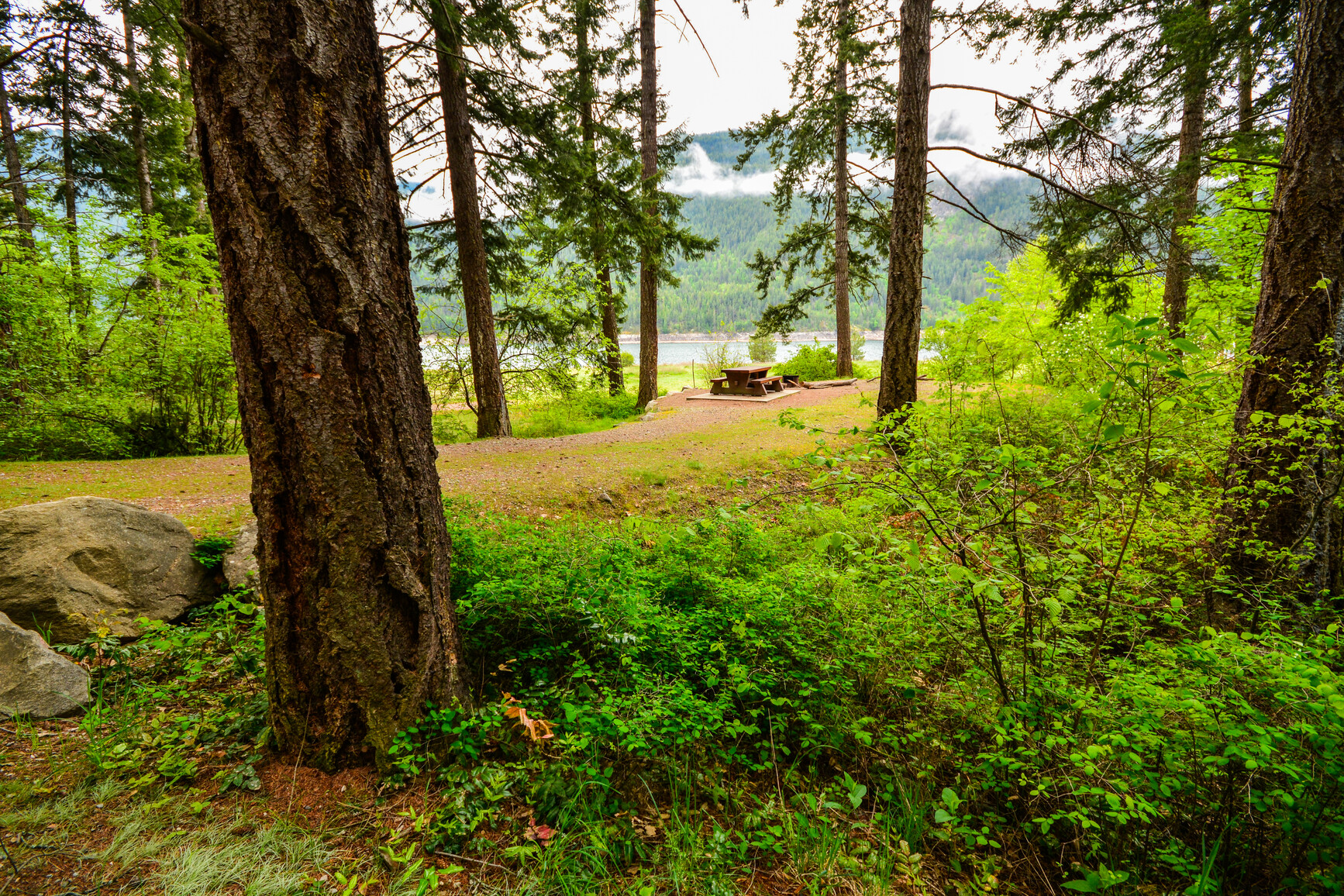
There are no pull through campsites, however, all the sites in Main campground are considered large and will accommodate bigger rigs. The Big Horn RV sites are generous, back in, gravel pads with electrical service. The Big Horn Loop sites are on the smaller size, more suitable for tents, campers and smaller RVs. All sites provide limited parking for extra vehicles. The Main Campground is one large loop with one cross road at its center. The Big Horn is adjacent to the day-use area with most sites overlooking the lake. The majority of the sites are shaded in a mixed forest of fir and pine.
The park offers services during the peak season of May to September. Campsite reservations are accepted and first come, first served sites are also available. Visitors can select any non-reserved site and staff will come to collect fees. A gatehouse with a pay phone is located about 2 km from the park entrance sign. The closest store is Scottie’s Marina 1.5 km from the park.
| Vehicle-accessible camping fee | $26 per party per night |
| Electrified sites | Additional $7 per night |
| BC seniors’ rate (day after Labour Day to June 14 only) | $13 per senior party per night |
For information on the BC seniors’ rate, see the camping fees page.
Are you planning a family reunion, church outing, youth trip or a gathering of friends? The Sturgeon Point group site is available to book up to 12 months in advance. The group campsite is open during the main camping season.
| Youth group camping fee | $1 per person (6+), with a $50 minimum and $150 maximum. Children under 6 are free! |
| Regular group camping fee | $120 per group site per night, plus $5 per adult (16+, minimum charge for 15 adults), plus $1 per child (6-15). Children under 6 are free! |
For information on the youth group policy see the group camping page.
Facilities
Accessibility information is available for this park.
There is a boil water advisory in place at this park until further notice while the water system is upgraded.
Cold well water is available for cooking and drinking. Four water taps are located throughout the campground, with two each at both the day-use area and boat launch. Taps are shut off during the off-season.
A doublewide, concrete boat launch at the southeast end of the park has a large, gravel vehicle and boat trailer parking area. It has a capacity for 85 cars. Boat trailers can be parked overnight and boats are sometimes left in the water or beached, but the shoreline offers no protection against weather changes. Visitors do enjoy waterskiing and windsurfing.
A sani-station and dump is available during the collecting season and is located just past the gatehouse.
The Big Horn RV sites 62 to 70 have been electrified. Sites 62 to 68 have 50amp. Sites 69 and 70 have 30amp service. All are good sized and have fire pits. All sites may be reserved. An additional service charge of $7 per night applies to these sites regardless of whether electrical service is used.
Campfires are allowed and campfire rings are provided at each campsite. We encourage visitors to conserve wood and protect the environment by minimizing the use of fire and using campstoves instead.
Firewood can be purchased in the park or you may bring your own wood. Fees for firewood are set locally and may vary from park to park.
To preserve vegetation and ground cover, please don’t gather firewood from the area around your campsite or elsewhere in the park (this is a ticketable offence under the Park Act). Dead wood is an important habitat element for many plants and animals and it adds organic matter to the soil.
Campfire bans may be in place. Before lighting a fire, check for bans or restrictions on BC Wildfire Service and on local or Indigenous government websites.
This park has three day-use and picnic areas. As Syringa Park is on a reservoir, the water does fluctuate from spring through fall. The water level is low in May, rises in June and is at full pond for July, August and September. The upper portion of the beach is sand with the lower portion rocky, which is mostly exposed at low water. Barbeque stands and fire rings are not available.
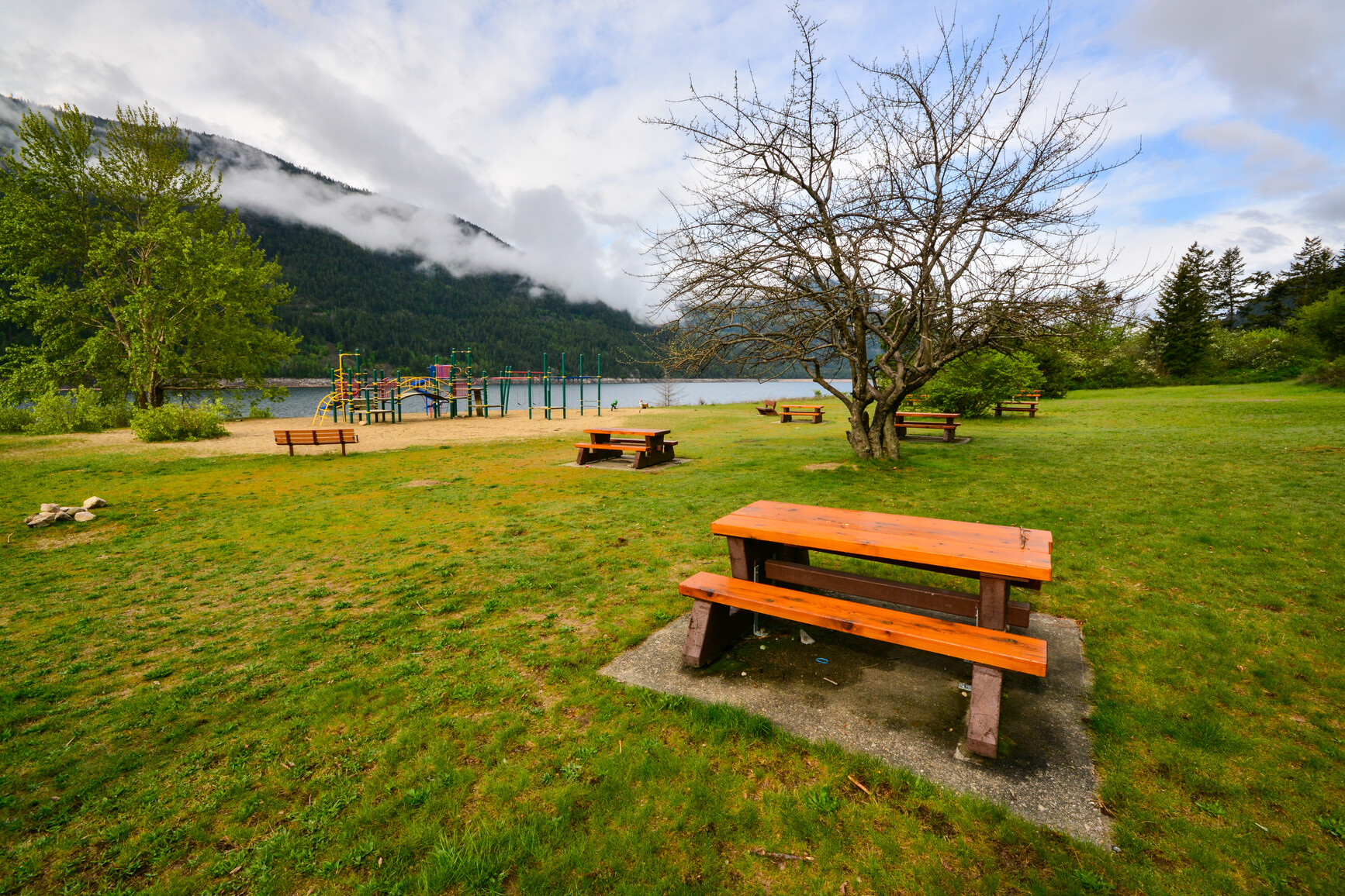
The main picnic area is located northwest of the campground along the lake. The beach is 250 metres long with 30 picnic tables located on a raised partially shaded grassy terrace in front of the beach. A toilet and change house, two pit toilets and water taps are available for day users. This day-use area is the largest in the park, with a paved parking lot that can accommodate 220 vehicles.
As indicated by its name, Boat Launch day-use area with its 150-metre beach, six picnic tables and four pit toilets can be found at the boat launch in the south end of the park just past the park entrance.
Camping day-use area is located in front of the campground and is primarily used by campers. The beach is 50 metres long and has seven tables. The campground washrooms and water taps are nearby. This day-use area hosts the only adventure playground in the park. The playground is set in sand with a swing set, monkey bars, slide and spring horse.
Two sets of pit toilets and two toilet buildings are conveniently located throughout the campground. Main beach day-use area has two pit toilets and one toilet building. Boat Launch day-use area has four pit toilets.
Activities
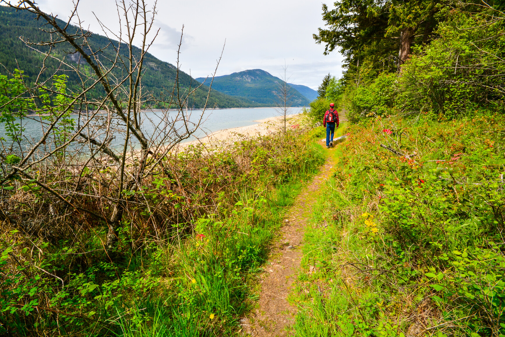
The Yellow Pine Nature Trail is a year-round trail, approximately 4 km long and takes 45 minutes to an hour to reach the top look out. It has three access points:
- From the south end of the park.
- On the topside of the main access road.
- On Deer Park road, directly above the gate house and from the edge of the day-use area parking lot, continuing across Deer Park road.
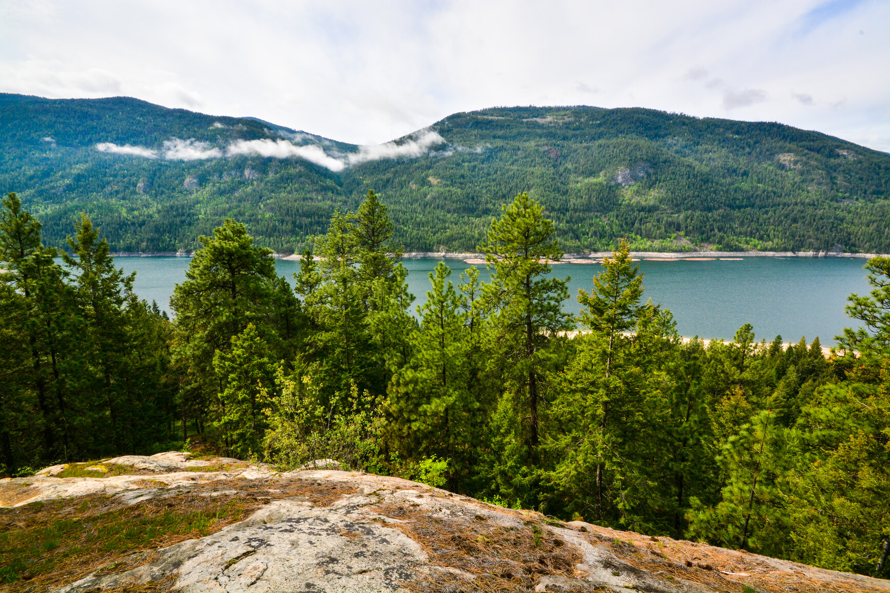
The trail climbs the hillside behind the park, is fairly steep and considered a moderate hike. Yellow Pine Trail takes you through mature yellow pine, past several granite rock outcroppings and offers intermittent views of Arrow Lake from a terraced hillside. Rest and enjoy the view from the first lookout or go all the way to the summit. Both lookouts have benches. An additional 2km of trail links the picnic area with the campground.
For your own safety and the preservation of the park, obey posted signs and keep to designated trails. Shortcutting trails destroy plant life and soil structure.
As Syringa Park is on a reservoir, the water does fluctuate from spring through fall. The water level is low in May, rises in June and is at full pond for July, August and September.
There are three beaches:
- Camper’s Beach adjacent to the campground
- Boater’s Beach at the boat launch
- Main Beach at the primary day-use area
The upper portion of the beaches is sand with the lower portion rocky, which is mostly exposed at low water. For six weeks in the summer during high water, Main Beach has a roped off swimming area with a maximum depth of six feet. The water temperature is described as refreshing to cool, however, with three choices and a combined 450 metres of sandy beach, the park provides an abundance of sunbathing and swimming opportunities.
There are no lifeguards on duty in BC Parks.
The peak months for canoeing and kayaking are July and August when the water is high. Shoreline canoeing and kayaking is recommended as lake weather can change rapidly. Easy access is provided at both the boat launch and day-use area.
The peak months for canoeing and kayaking are July and August when the water is high. Shoreline canoeing and kayaking is recommended as lake weather can change rapidly. Easy access is provided at both the boat launch and day-use area.
Lower Arrow Lake can provide excellent fishing for rainbow or bull trout, and kokanee salmon. Check the BC Fishing Regulations Synopsis for quotas and restrictions.
Anyone fishing in British Columbia must have an appropriate licence. To learn more, see the fishing and hunting guide.
The Freshwater Fisheries Society of BC has a fun, hands on, Learn to Fish Program that teaches basic angling skills to youth under 16 years old. Check back to this page or ask the park operator for more information.
This park has a designated off-leash area. In all other areas of the park, pets and domestic animals must be on a leash at all times and are not allowed in park buildings or beach areas. You are responsible for their behaviour and must dispose of their excrement. Backcountry areas are not suitable for dogs or other pets due to the potential for problems with bears and other wildlife.
Bicycles must keep to roadways. Bicycle helmets are mandatory in British Columbia.
Please note that bicycles with electric assist motors (e-bikes) are not allowed on the trails within Syringa Park. E-bikes are restricted to park roads and areas where motorized use is permitted. The only exception to this policy will be for authorized and identified trail maintenance bikes conducting work on behalf of BC Parks.
Waterskiing opportunities are available on Lower Arrow Lake.
Hunting is allowed in this park. Please check the BC Hunting & Trapping Regulations Synopsis for more information.
This park is located in south central B.C., 19 km northwest of Castlegar on Hwy 3A. Depending on your direction of travel look for the Robson exit just before or after you cross the bridge over the Kootenay River. The park is a 25 minute drive from Castlegar.
Park and activity maps
Learn more about this park
Park details
- Date established: November 19, 1968
- Size: 4,538 hectares
Park contact
This park proudly operated by:
RAP Park Contracting Ltd.
arpigeon@telus.net
Gatehouse: 250-365-6945
Alternate: 250-825-0117
Nature and culture
History
The park was named for Syringa Creek, which flows into the Lower Arrow Lake near the park’s eastern or southeastern boundary. The “Syringa” or Mock Orange is a shrub which is indigenous to the area. It blooms in early spring showing clusters of white flowers with bright yellow stamens that emit a powerful, pleasing fragrance. First established in 1968 to provide recreational opportunities, the park was increased to its present size in 1995 to protect a provincially significant ecosystem.
Cultural Heritage
This area is significant to the Okanagan, Shuswap, Sinixt, and Ktunaxa/Kinbasket First Nations. It encompasses areas of cultural and spiritual values.
Conservation
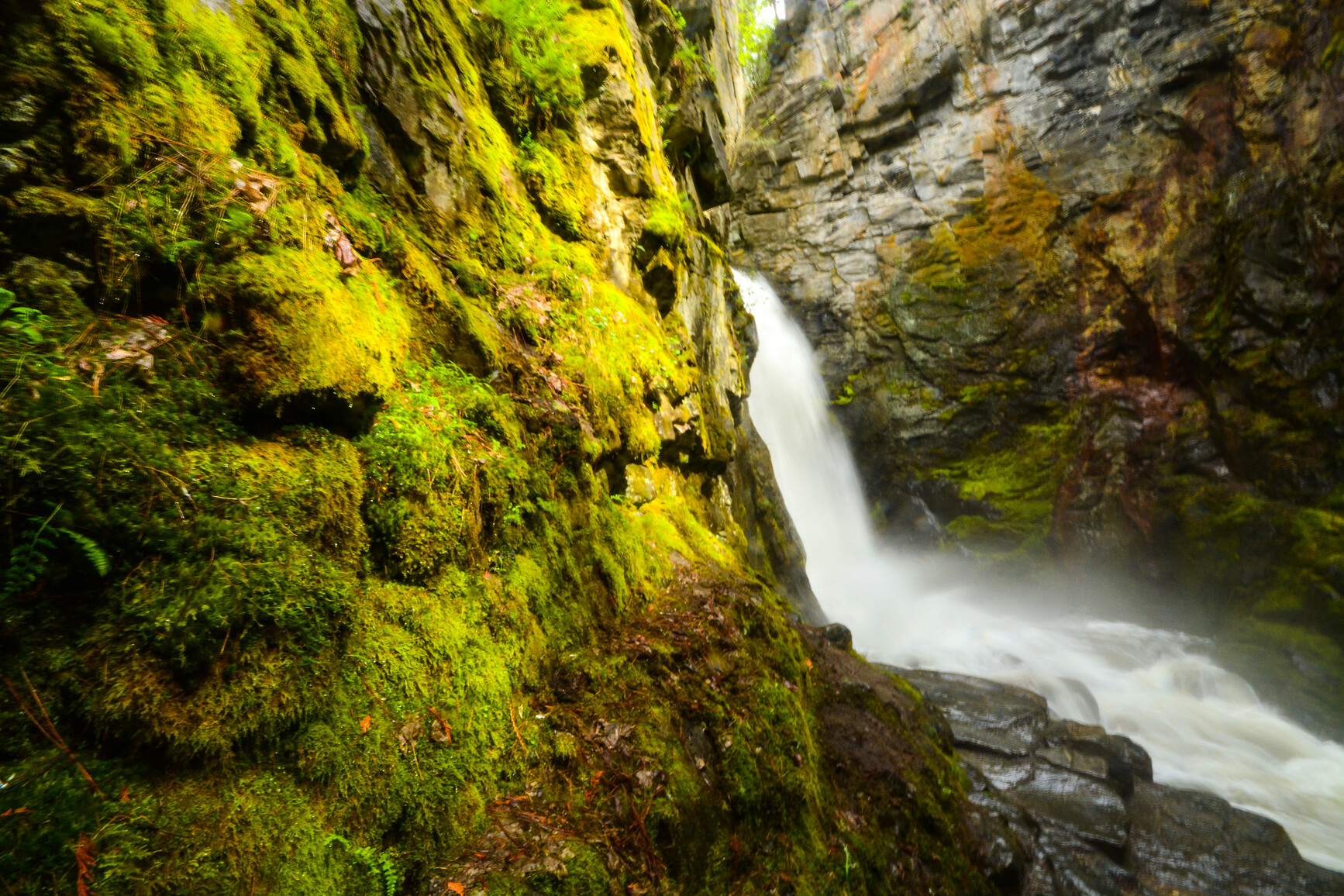
The moderately dry and warm climate of this part of the West Kootenay is conducive to the growth of plants and trees like bunchgrass and ponderosa pine that are not normally found in the region. It contains beaches, grasslands, open and closed pine forest, rock outcroppings and canyons. It is important seasonal range for rocky mountain bighorn sheep, elk, deer and cougar. Many bird species inhabit the parks’ forest and grasslands including white-throated swifts, canyon wrens nesting in the rock bands and great blue heron at the waters edge.
Wildlife
Park users should always be aware of bears and other wildlife in our park environment. Never feed or approach bears or other wildlife. Please view all wildlife from a distance.
Reconciliation with Indigenous Peoples
BC Parks honours Indigenous Peoples’ connection to the land and respects the importance of their diverse teachings, traditions, and practices within these territories. This park webpage may not adequately represent the full history of this park and the connection of Indigenous Peoples to this land. We are working in partnership with Indigenous Peoples to update our websites so that they better reflect the history and cultures of these special places.