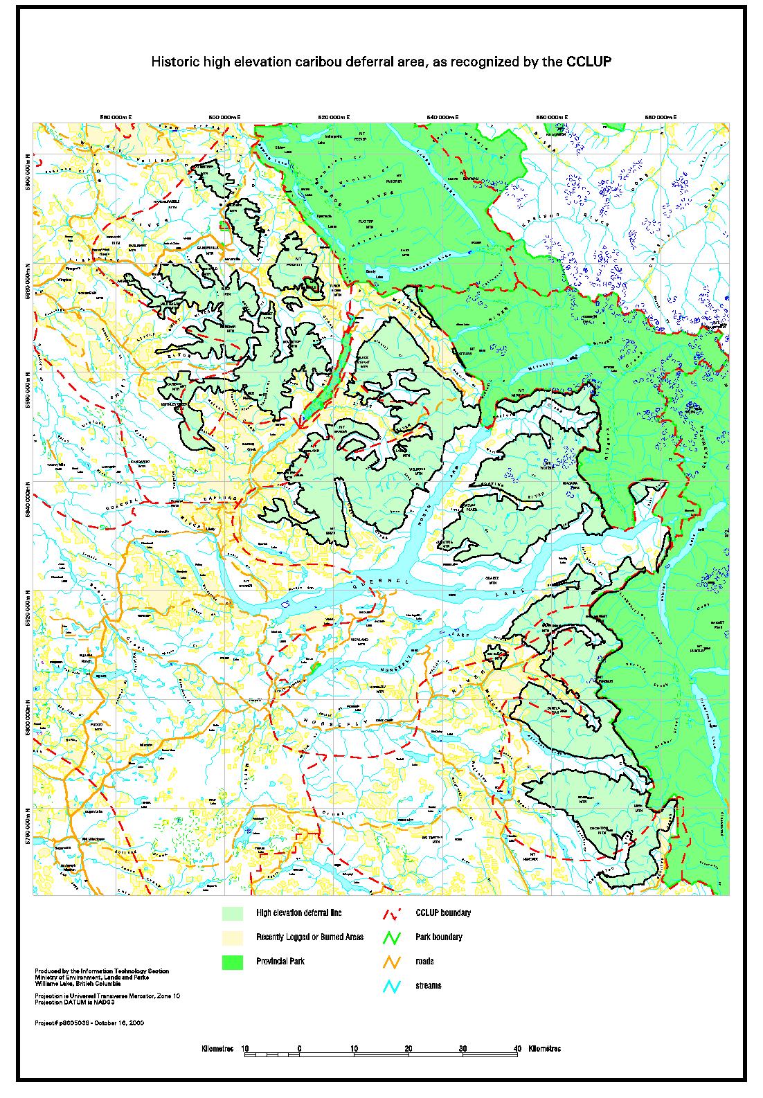
| Map1
- Historic high elevation caribou deferral area, as recommended
by CCLUP |
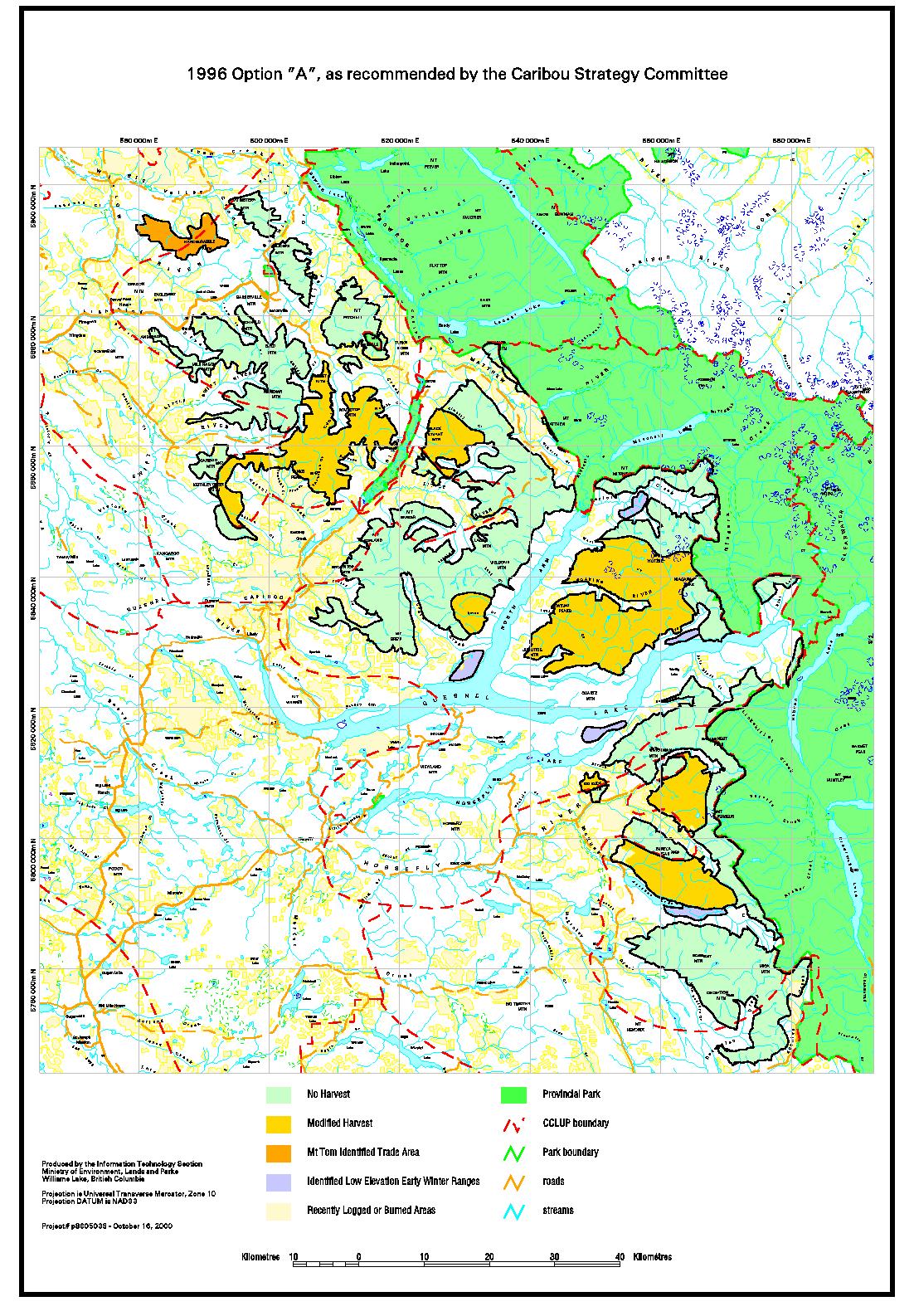
| Map
2 - 1996 Option "A", as recommended by the Caribou
Strategy Committee |
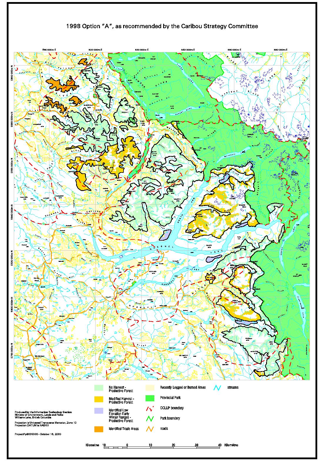
| Map
3 - 1998, Option "A", as recommended by the
Caribou Strategy Committee |
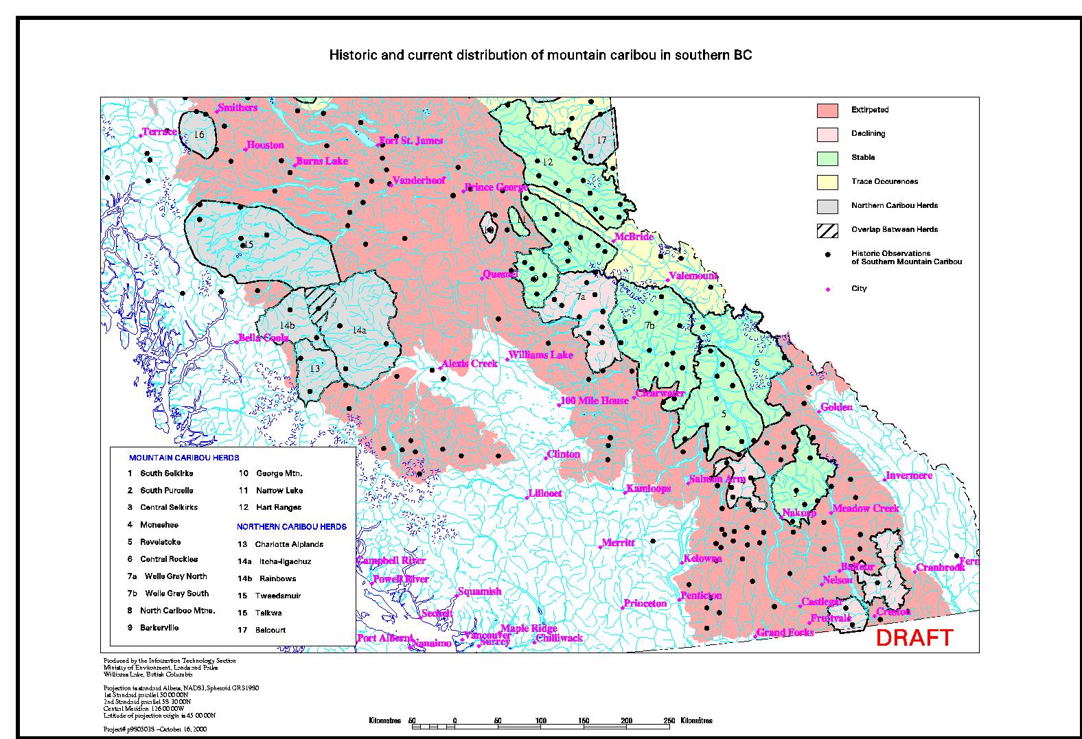
| Map
4 - Historic and current distribution of mountain caribou
in southern BC |
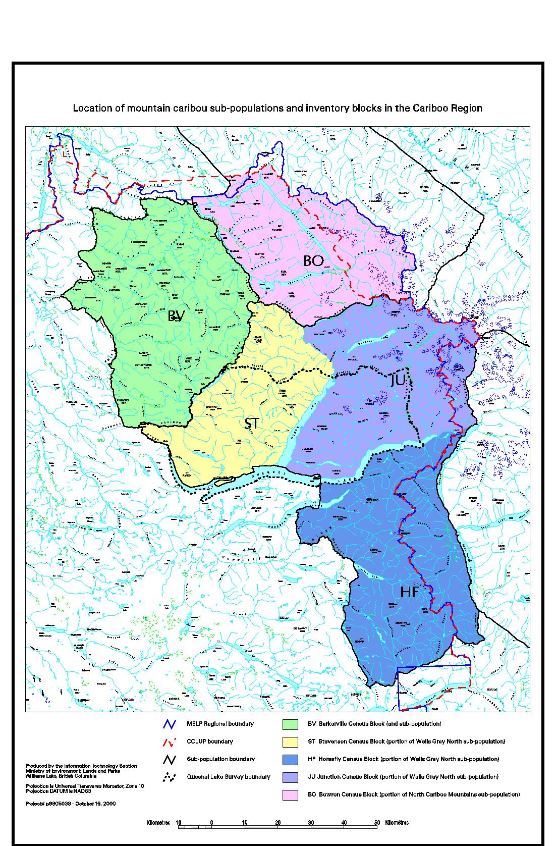
| Map
5 - Location of mountain caribou sub-populations and inventory
blocks in the Cariboo Region |
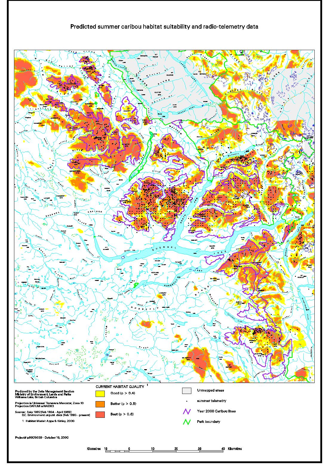
| Map
6 - Predicted summer caribou habitat suitability and radio-telemetry
data |
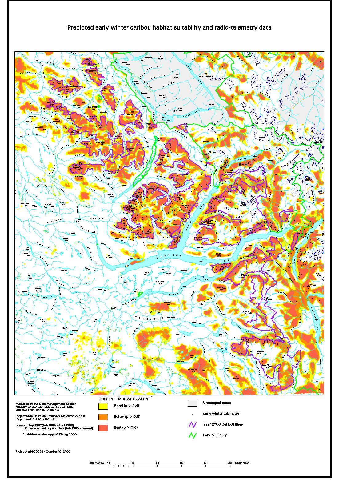
| Map
7 - Predicted early winter caribou habitat suitability
and radio-telemetry data |
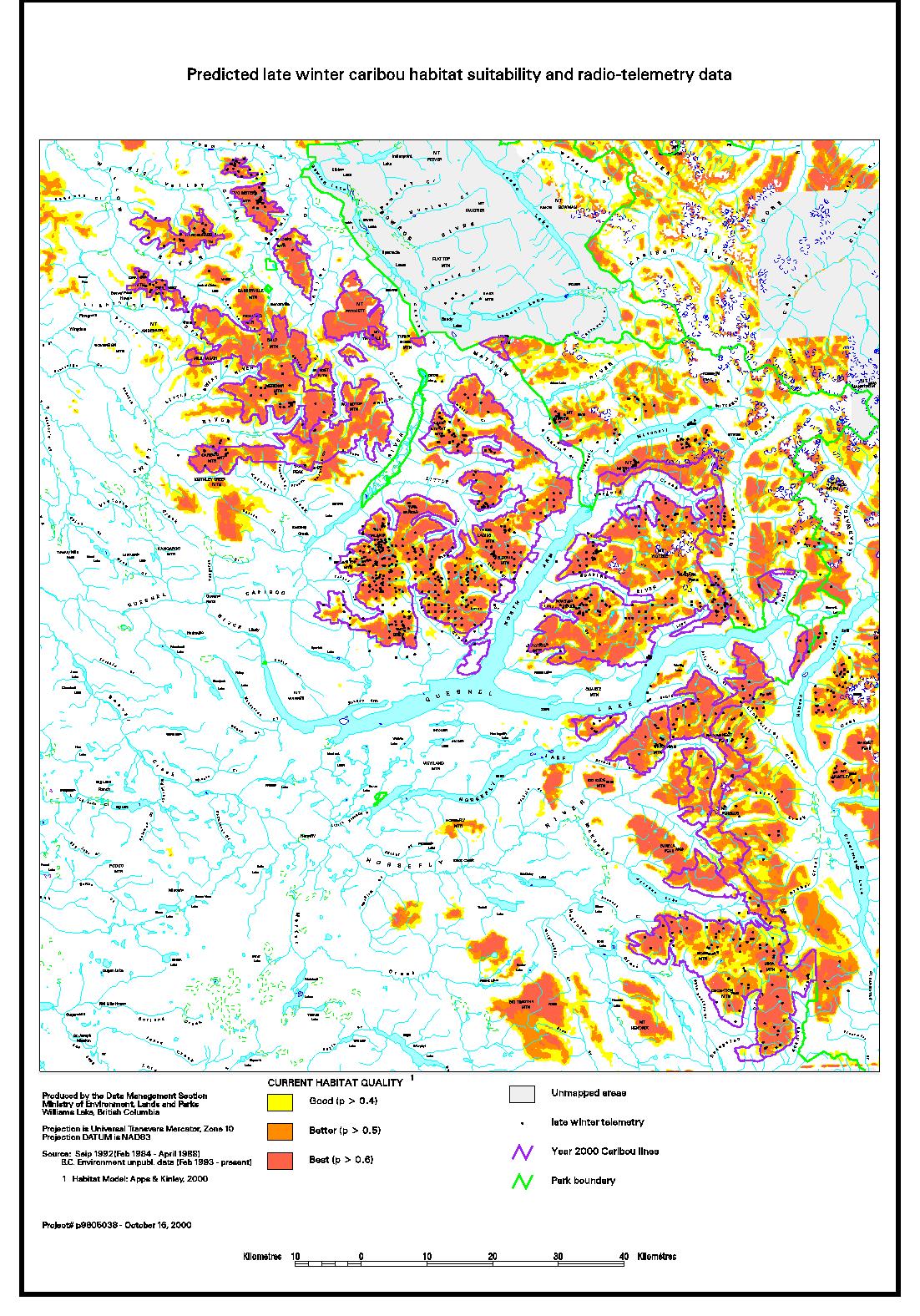
| Map
8 - Predicted late winter caribou habitat suitability
and radio-telemetry data |
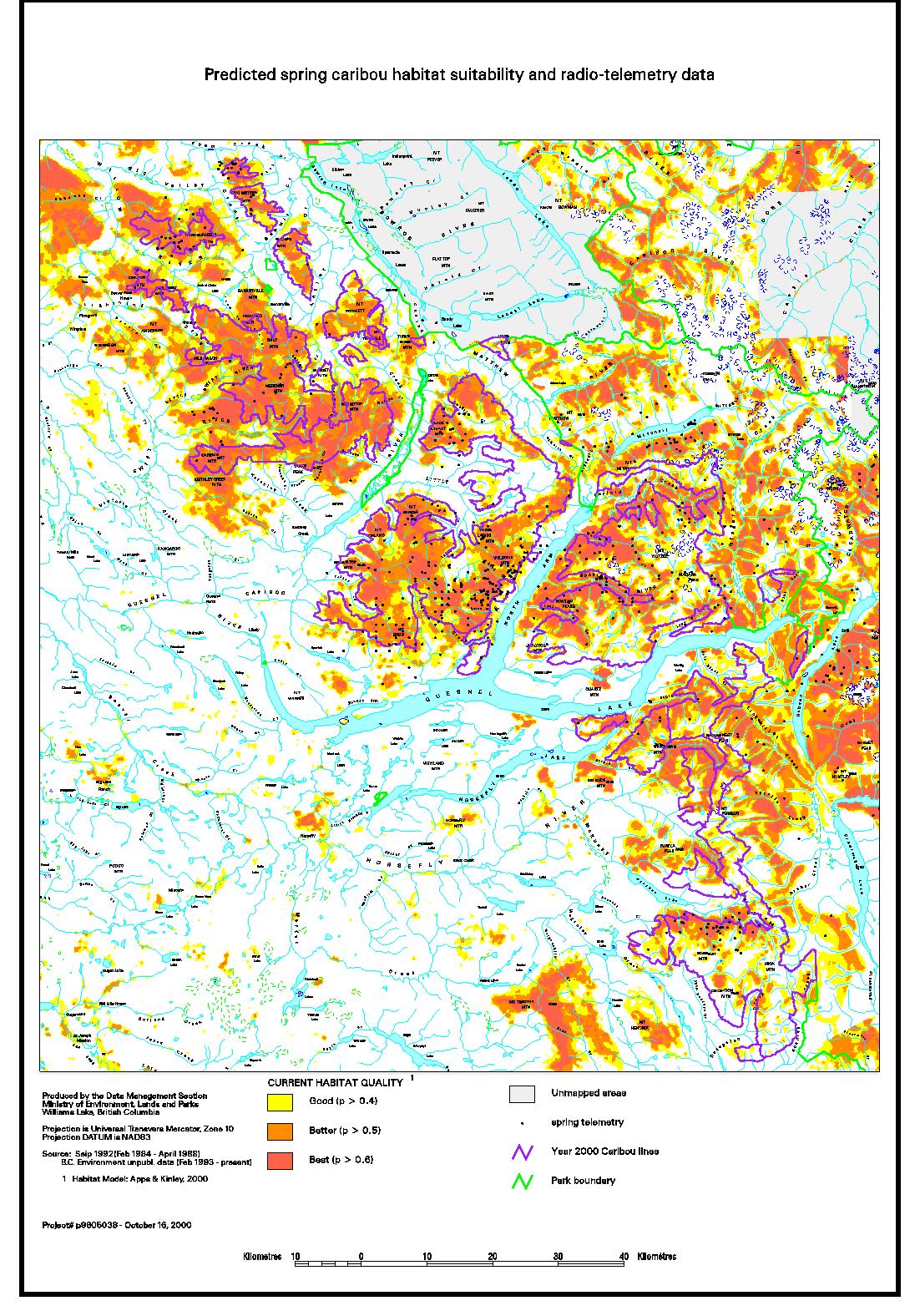
| Map
9 - Predicted spring caribou habitat suitability and radio-telemetry
data |
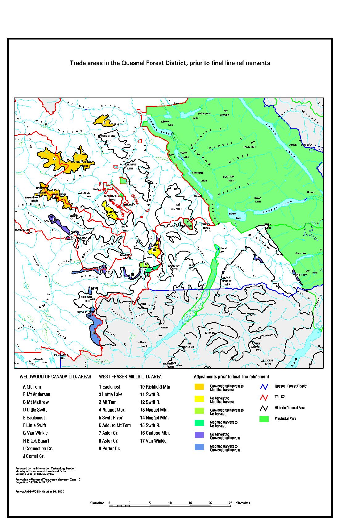
| Map
10 - Trade areas in the Quesnel Forest District, prior
to final line refinements |
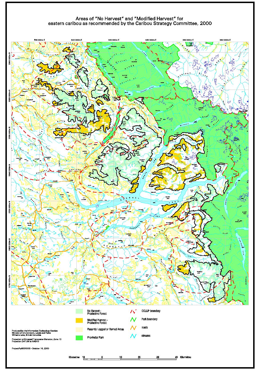
| Map
11 - Areas of "No Harvest" and "Modified
Harvest" for eastern caribou as recommended by the Caribou
Strategy Committee |
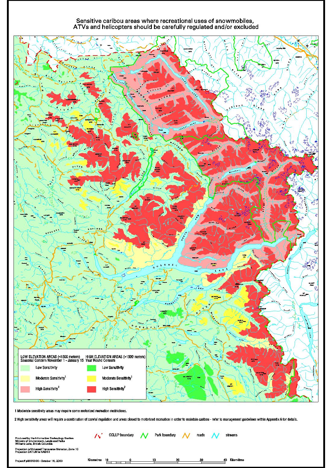
| Map
12 - Sensitive caribou areas where recreational uses of
snowmobiles, ATVs and helicopters should be carefully regulated
and/or excluded |
| Map
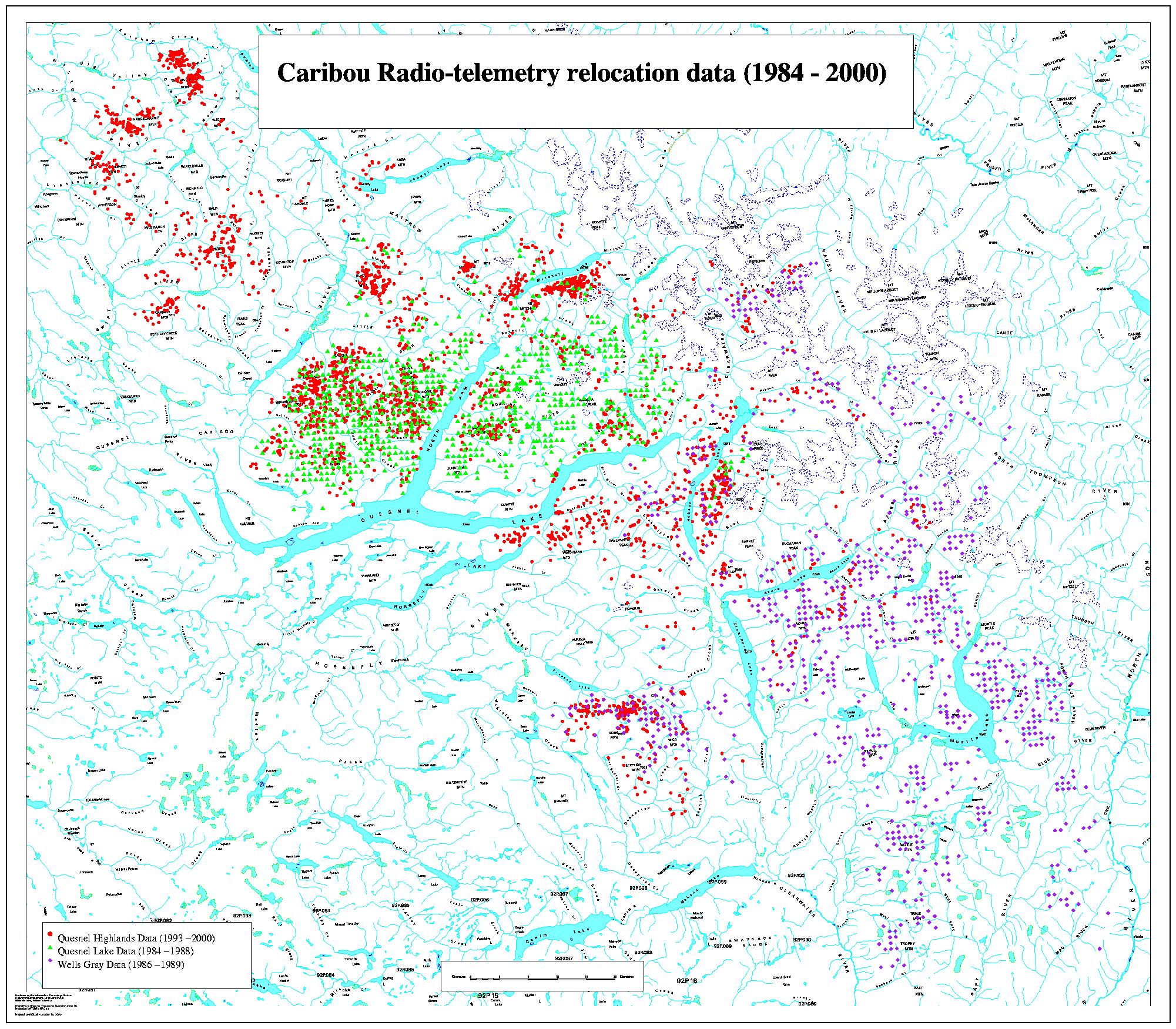
13 - Caribou radio-telemetry relocation data (1984 - 2000) |

