 |
||||||
|
Cottonwood River Fish Access Restoration
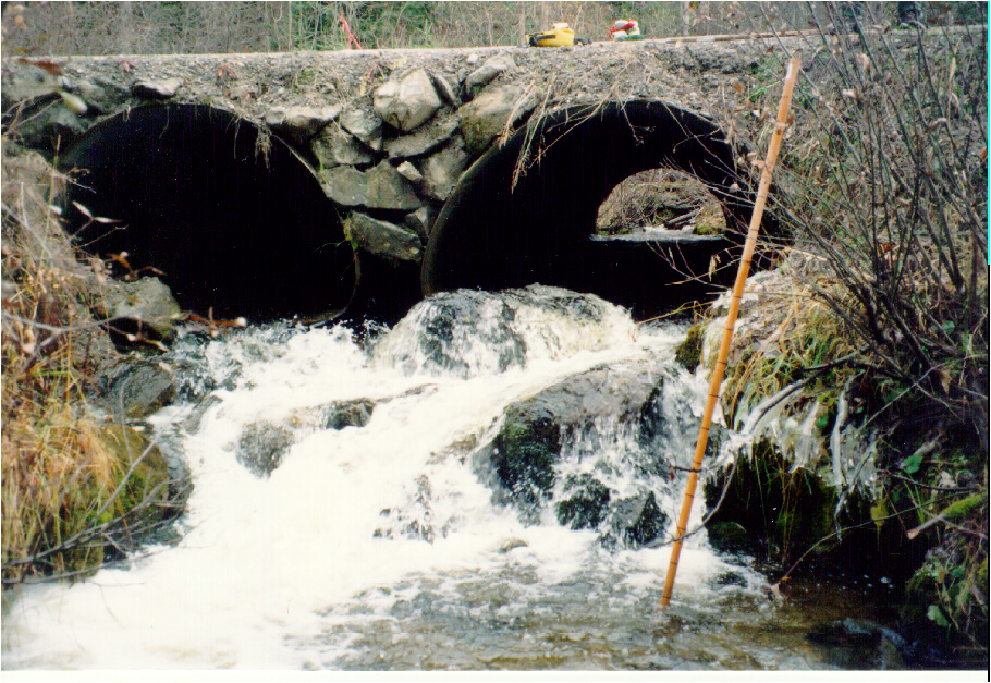
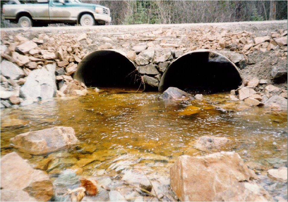
Objectives To restore fish passage at identified high priority sites along the 1300 Rd of the Cottonwood Watershed. FRBC Region/ MELP Region/ MoF Region Cariboo/Cariboo/Cariboo Author Michael Parker Proponent West Fraser Timber Ltd., Quesnel Division Watershed Cottonwood River Location The Cottonwood River is located in the Quesnel Forest District. This system flows Northwest for 151km before entering the Fraser River just north of the City of Quesnel. Introduction As part of a Level 1 FHAP completed in 1998 by Carmanah Research Ltd., a Fish Passage Culvert Inspection was conducted on a portion of the watershed. Twenty seven sites were assessed with 20 being rated as high priority, and representing more than 34 km of habitat that was inaccessible above these sites. Four sites were identified for installation of a downstream weir to backflood the culvert, and another two were identified for replacement by bridge. All sites were along tributaries feeding the Sovereign Creek system that flows into the Cottonwood River Assessments and Prescriptions Overview and Level 1 Fish Habitat and Assessments were completed in early 1998, and G3 Consulting completed Level 2 prescriptions for some project areas during 1998. Two sites were earlier identified in a Fish Habitat Inventory of the Swift River Watershed (Imhof and Sutherland, 1996). Rehabilitation Work The four culverts that were backflooded a total of 17km of stream was made accessible for a cost of $12,000. Three of these sites were flooded by creating a rock riffle downstream of the culvert, thus eliminating outfall drops of 25-60 cm, and in culvert velocities up to 1.06 m/s. One site was used to test an alternative approach, by rebuilding the riffle directly from the downstream lip of the culvert by filling in the existing plunge pool. Pool habitat was not limited in the reach, and this type of approach allowed us to place substrate within the culvert itself to further slow velocities. Large "key" angular boulders were placed at the culvert outlet lip such that they extended 15cm above the culvert lip. It is anticipated that these key stones will help hold substrate in the culvert. All rock weirs were constructed with clean angular of assorted sizes up to 1m3. Two bridges were installed at sights where existing culverts were undersized, and had created outfall drop barriers. One was on a tributary to Little Swift Creek, and installation gained access to over 2.5 km of high value Bull Trout spawning habitat. The other was on Horan Creek and provided access to 1.7km of habitat on a first order rearing stream. Cost Summary
Restoration Results In total more than 21.5 km of stream habitat is once again accessible to fish in six different Cottonwood tributary systems. This is a combination of spawning and rearing habitat for target species of Rainbow trout and Bull trout. In addition materials have been stockpiled at a project site on a tributary to Sovereign Creek in anticipation of in stream works during 1999. Proposed Work Level 2 Prescriptions were completed by G3 Consulting Ltd. for in stream works on Sovereign Creek, Horan Creek and Fontaine Creek of the Cottonwood River Watershed. These LWD/boulder complexing type projects are scheduled to take place in 1999. Additional crossings will be examined for works based on FRBC eligibility criteria that are yet to be confirmed. For Further Information contact:
Material Referenced: Imhof, D. and D. Sutherland. 1996. Fish Habitat Inventory of the Swift river Watershed 1995. British Columbia Ministry of Environment Lands and Parks. Regional Fisheries Report No. CA.964
|
|||||||||||||||||