 |
||||||
|
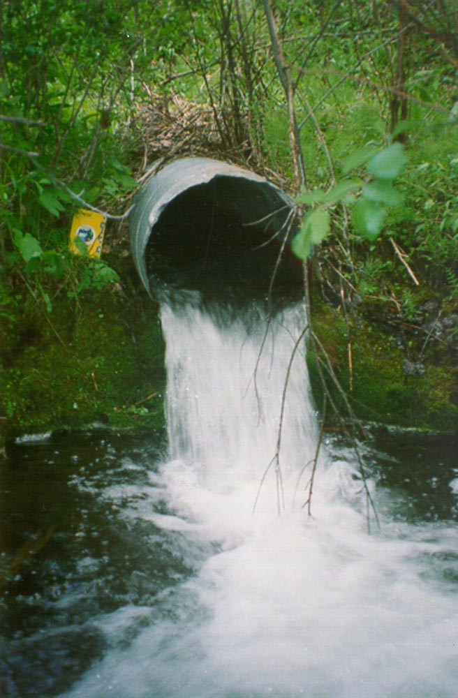
Lorin Lake Bridge 8200 Road Objectives The primary objective of this project was to remove man-made barriers to fish passage allowing migrating fish access to increased habitat. A second objective was to reduce the risk of sediment delivery into the stream. FRBC Region/ MELP Region/ MoF Region Cariboo-Chilcotin/Cariboo/Cariboo Author Ken MacKenzie Proponent Weldwood of Canada Ltd. 100 Mile House Operations Location: The crossing is located at 14.5 km on the Bowers Lake Forest Service Road (8200 Road) at an unnamed stream which flows from Lorin Lake into Cougar Creek. Introduction Both Lorin Lake and Cougar Lake are popular fishing lakes and receive moderate to high fishing pressure throughout the fishing season. Rainbow trout are the only game fish found in this system. Assessments and Prescriptions The Jim-Windy Watershed fish passage – culvert inspection report identified this site as the top priority for restoration in this watershed for a number of reasons. The culvert at the crossing was a complete barrier to fish passage by increasing water velocity (velocity on June 6, 1998 was 1.81 m/s) and because of an outfall drop of 25 cm. The stream has good potential spawning substrate and is the main upstream tributary for Cougar Lake. The culvert was undersized and had the potential to become plugged which may have resulted in a serious road washout and considerable sediment delivery into the stream. Because of the relatively steep slope of the stream at the crossing site (6.5%), the best option to restore fish passage was deemed to be a clear-span structure. A permanent, concrete decked bridge was prescribed because the Bowers Lake FSR is a well used main haul road. Rehabilitation Work To minimize environmental impacts during the culvert replacement work, the following steps were taken:
Structure Details
Cost Summary Design, supply and install bridge $47,500 Rip rap supply $2,500 Supervision $2,000 TOTAL $52,000 Environmental Benefits Rainbow trout from Cougar Lake now have unrestricted access to an additional 1.5 km of spawning stream to Lorin Lake in addition to Lorin Lake itself and the small streams that drain into it . This more than doubles the available upstream habitat from Cougar Lake. The trout population in Lorin Lake is no longer isolated from the remainder of the watershed. For Further Information Contact: Ken MacKenzie Figure 1-1. Channel is constructed to route stream prior to pulling culvert on unnamed creek.
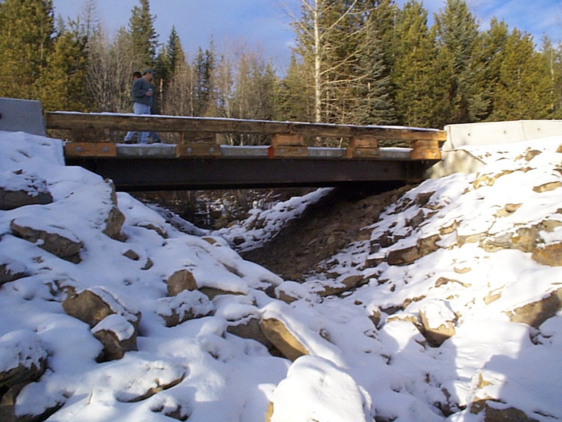
Figure 1-2. Completed 8200 road bridge installation.
|
|||||