 |
||||||
|
Talchako River Groundwater Channel Objectives To restore access to existing offchannel habitat and restore groundwater off channel habitat in the Talchako River for overwinter and high flow refuge for Coho and Cutthroat. FRBC Region/ MELP Region/ MoF Region Vancouver Island/Cariboo/Vancouver Island Author Michael Parker , MELP Proponent International Forest Products, Mid Coast Division, Hagensborg, BC Watershed Talchako River Location Talchako River partially defines Tweedsmuir Provincial Parks’ South West boundary. It is located approximately 380 km West of the City of Williams Lake and 60 km East of the community of Bella Coola. Along with the Atnarko River it forms the Bella Coola River. Introduction All significant tributaries to the Talchako are glacial fed and limited to fish access by gradient within less than 1 km. The Talchako itself is highly glacial with very little offchannel habitat. Several offchannel ponds and groundwater channels exist between 72-84 km. As most of these run parallel to the mainstem on the valley floor, they were areas that were logged over. Beaver activity has also prevented access to several of these high value clear water areas. Assessments and Prescriptions In 1996 a Overview and Level 1 Assessment was completed for the Bella Coola River including the Talchako and some of its major tributaries. In 1998, further Level 1 Assessments were completed on several of the small groundwater channels and off channel habitat in the upper regions of the watershed.. Ministry of Environment completed prescriptions for SOD removal through old cutblocks, access structures around beaver dams and groundwater channel excavation to reopen and enhance areas within cutblocks. Rehabilitation Work On the ground activities can be divided into three:
Cost Summary
Restoration Results Within two hours of completing the beaver dam by pass channel one juvenile Coho and one Cutthroat were into the second step pool. By the next day fish were found throughout the steps. Minnow traps will be set in the pond and channel above in 1999 to examine distribution and species. Removal of SOD created a visible increase in localized stream velocities and scour of fine in some areas was revealing buried cobble and gravel substrate. Groundwater channel excavation was not completed at the time of writing this report. Proposed Work Further groundwater channel excavation and complexing is anticipated at three locations for 1999. Access problems at two long abandoned beaver dams will also be evaluated and prescriptions written. For Further Information contact:
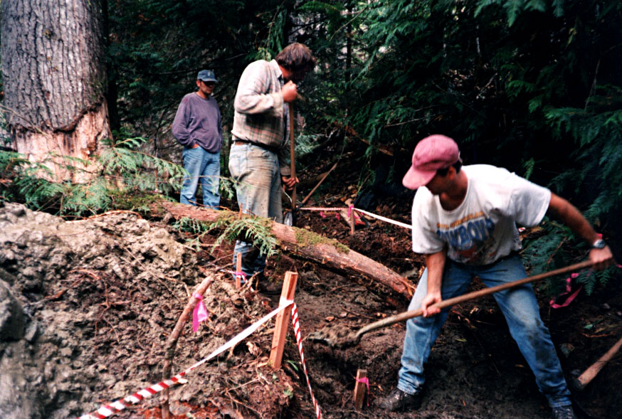
Initial hand excavation of beaver dam by pass channel, Talchako River, 77km.
Same section of by pass channel with flow and vegetated banks, Talchako River 77km. Portion of excavated groundwater channel at 77km, Talchako River prior to LWD complexing.
|
||||||||||||||||||