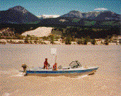
Water Survey Data
 The Water Surveys Program has provided surveys and technical assistance by conducting field surveys, producing maps and plans and maintaining a database of survey activities. The Water Surveys Program has provided surveys and technical assistance by conducting field surveys, producing maps and plans and maintaining a database of survey activities.
Water Surveys Data Queries
Find these reports and surveys by searching our web library, EcoCat.
History
The oldest Annual Report in Water Management Division Library of the Province of British Columbia, Department of Lands and Forests - Lands, Surveys, and Water Rights Branches is from 1946; original field survey note books however,date back to 1904. The following excerpt is from the report of the Comptroller of Water Rights in 1946, Water - Resources Surveys:
These cover a wide field and embrace not only where and in what quantity water resources exist, but how and to what extent they can be put to economic use for developing power for irrigation and for domestic supply, with the complementary problems of storage and flood-control.
Already then, and in all likelihood even earlier, water surveyors were working in co-existence with their colleagues in the Lands and Surveys Branches.
The 1960 Annual Report of the Water Rights Branch states:
The third dominant function of the Water Rights Branch is to carry out water resource surveys. Basic data are gathered to encourage and guide the future use and conservation of our water resources, and engineering investigations are carried out pertaining to irrigation and domestic-water supply, stream erosion, flooding, and other water problems.
During the mid 1960s, to satisfy the water storage requirements for the ARDSA Program, surveys of lakes and potential reservoir sites became one of the most important functions of the Surveys Section. This activity was concentrated in the Okanagan and Thompson River Valleys and expanded quickly into the rest of the Province.
The demand for management of floodplains, following several disastrous floods in the interior of British Columbia, in the early 1970s, required a third field survey crew to meet the demands for river cross-sections and airphoto field control for photogrammetric mapping.
In the 80s regionalization took place and a restraint program was introduced by the government. These factors effected the delivery of the survey program by including survey requests from the Regions into the operations and by reducing the field staff to two crews.
The surveyors have always tried to respond in a professional, efficient and timely manner and to adapt quickly to the changes in the directives of the water management program. These directives are influenced by technology, urban developments, floods, droughts and political mandates.
|