Water Protection & Sustainability Branch
|
|
|
 |
|
Aquifers in British Columbia
Ground water provides 23 percent of the province's population with drinking water, comprises 9 percent of total water consumption in the province and represents 25 percent of the ground water use in the nation (Hess, 1986). It has been recognized for a number of years that a greater understanding of the existence and characteristics of aquifers in British Columbia is essential. The 1993 discussion paper Stewardship of the Water of British Columbia proposed that a program for classifying and mapping aquifers in ground water management areas be initiated.
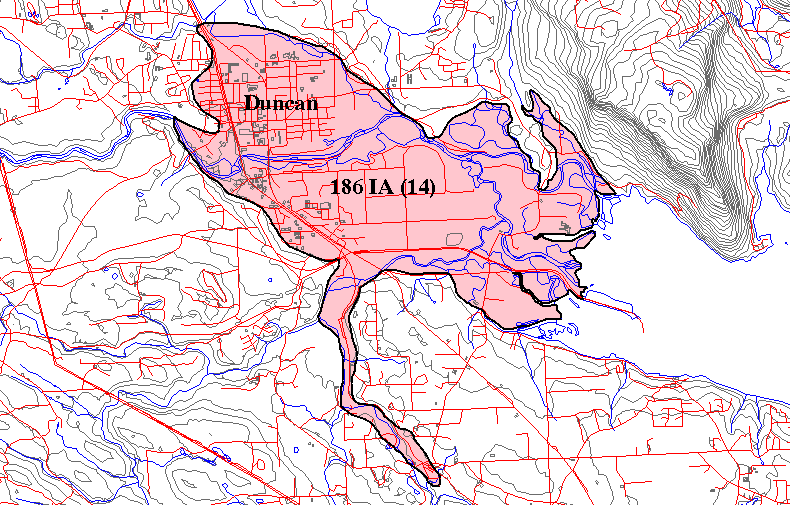
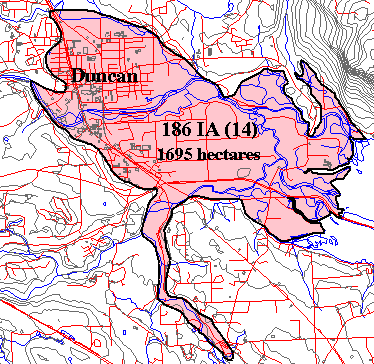
In 1994, a map based Aquifer Classification System was developed for the Ministry of Environment, Lands and Parks (now Ministry of Environment) "Water Management Program" to identify, map and categorize aquifers using data from the provincial water well database. The objective of this aquifer classification system is to inventory and prioritize aquifers for planning, management and protection of the Province's ground water resource. To date, over 800 aquifers have been delineated. Individual aquifers in the format as shown by the example of the Duncan Aquifer to the lower left are displayed at the Aquifers and Water Wells of British Columbia site.
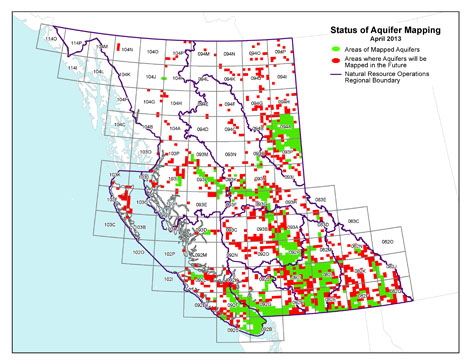
Status of Aquifer Classification Mapping
(Click map for larger view)
Visit the DataBC Catalogue to download digitized aquifer polygons (GIS/geospatial data).
Classifying aquifers in our province is of vital importance. In some areas ground water is the only viable and economic source of water supply for individual and community water supply systems as well as augmenting agricultural and industrial uses. Ground water often maintains base flows in rivers and streams during periods of drought and is critical to fisheries habitat and spawning areas. With increasing demand and reliance on ground water from a growing population comes the need to increase efforts to protect and manage the resource.
Example of an Aquifer at Duncan, B.C.
(Click map for larger view)
 |
Aquifer classification mapping provides an appropriate tool for optimizing water resources decisions affecting use and resource protection. There is more information on the B.C. Aquifer Classification System by Berardinucci and Ronneseth (2002), and Kreye et al, (1994) in the Reports section of this home page. |
|
|