Assessments under the Environmental Assessment Act
The B.C. Environmental Assessment Act (BCEAA) is the legal
framework for the province's EA process for proposed major projects. The BCEAA is supported by several regulations, including the
Reviewable Projects Regulation, as well as a variety of policy, procedure and technical guidelines. Once a project is reviewed and approved, the proponent is granted an EA certificate by two provincial Ministers (one of whom is the Minister of Environment). This approval is required before any decisions can be made on permits and other approvals that are required to
construct and operate a large-scale project in B.C.
The Environmental Assessment Office (EAO) is an independent provincial agency responsible for conducting EA reviews, and administering the BCEAA. The EAO leads major project reviews and prepares an assessment report detailing the findings of its review,
which may also contain recommendations. The report, along with the project application, is referred to two government Ministers, who decide on
project approval. Once approved, an EA certificate is issued.
In order for a major project to proceed, an Environmental Assessment review must be completed successfully and the proposed project must be approved by two provincial government Ministers. The EA process addresses a broad range of environmental, economic, social, health and heritage issues
through a single, integrated process. It ensures that the issues and concerns of all interested parties and First Nations are considered together,
and that a project, if it is to proceed, will do so in a sustainable manner. B.C.’s EA process is important to ensure that major
projects meet the goals of environmental, economic and social sustainability. The assessment process is also needed to ensure that the issues and
concerns of the public, First Nations, stakeholders, and government agencies are considered.
Over 70 per cent of the major projects undergoing a provincial EA will also require a federal assessment under the
Canadian Environmental Assessment Act (CEAA). When a project falls under both provincial and federal EA responsibility, there is an agreement in place which ensures that the two governments will carry out a single, cooperative EA while retaining
their respective decision-making powers. This harmonized approach creates greater efficiency and effectiveness for both the private and public sectors.
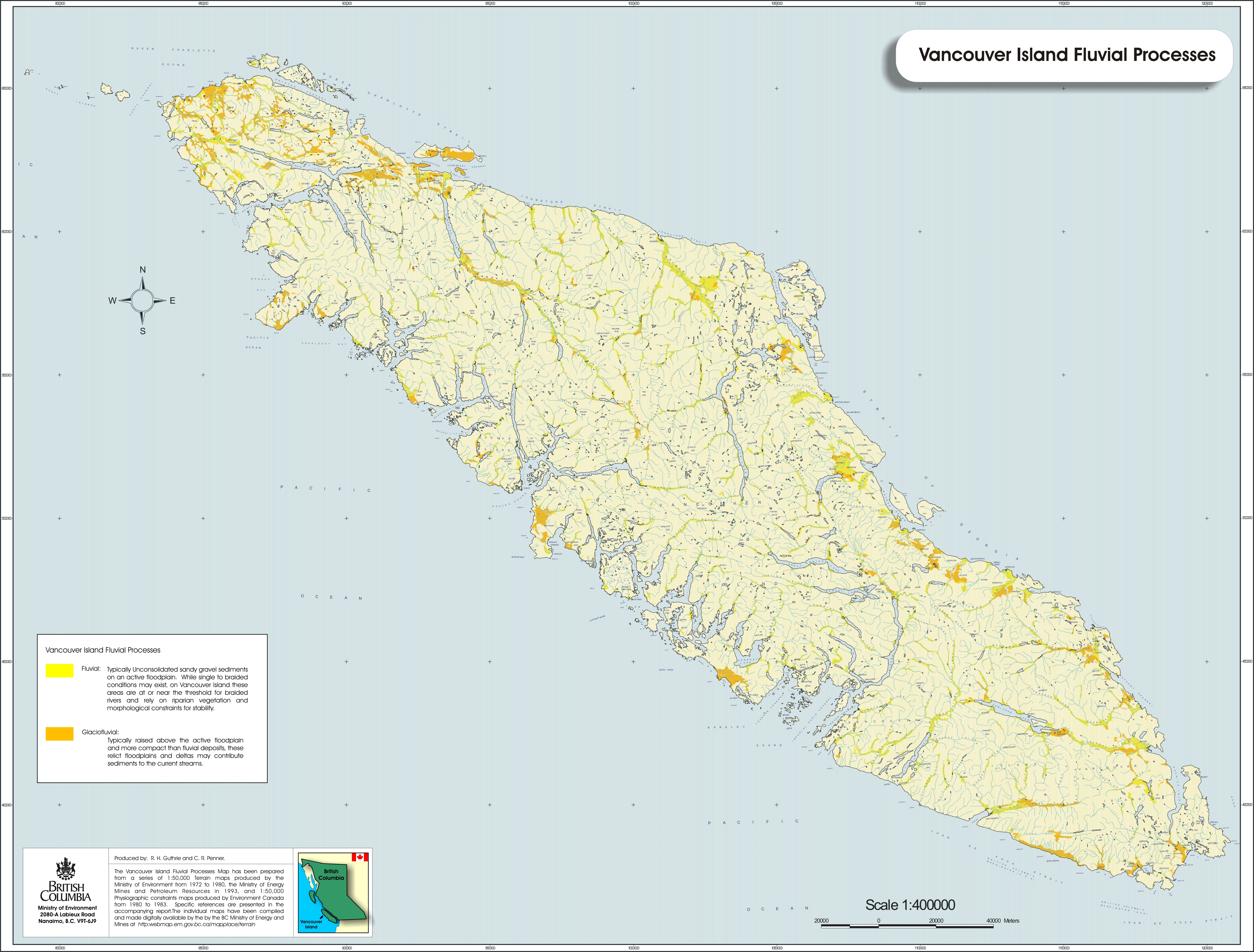
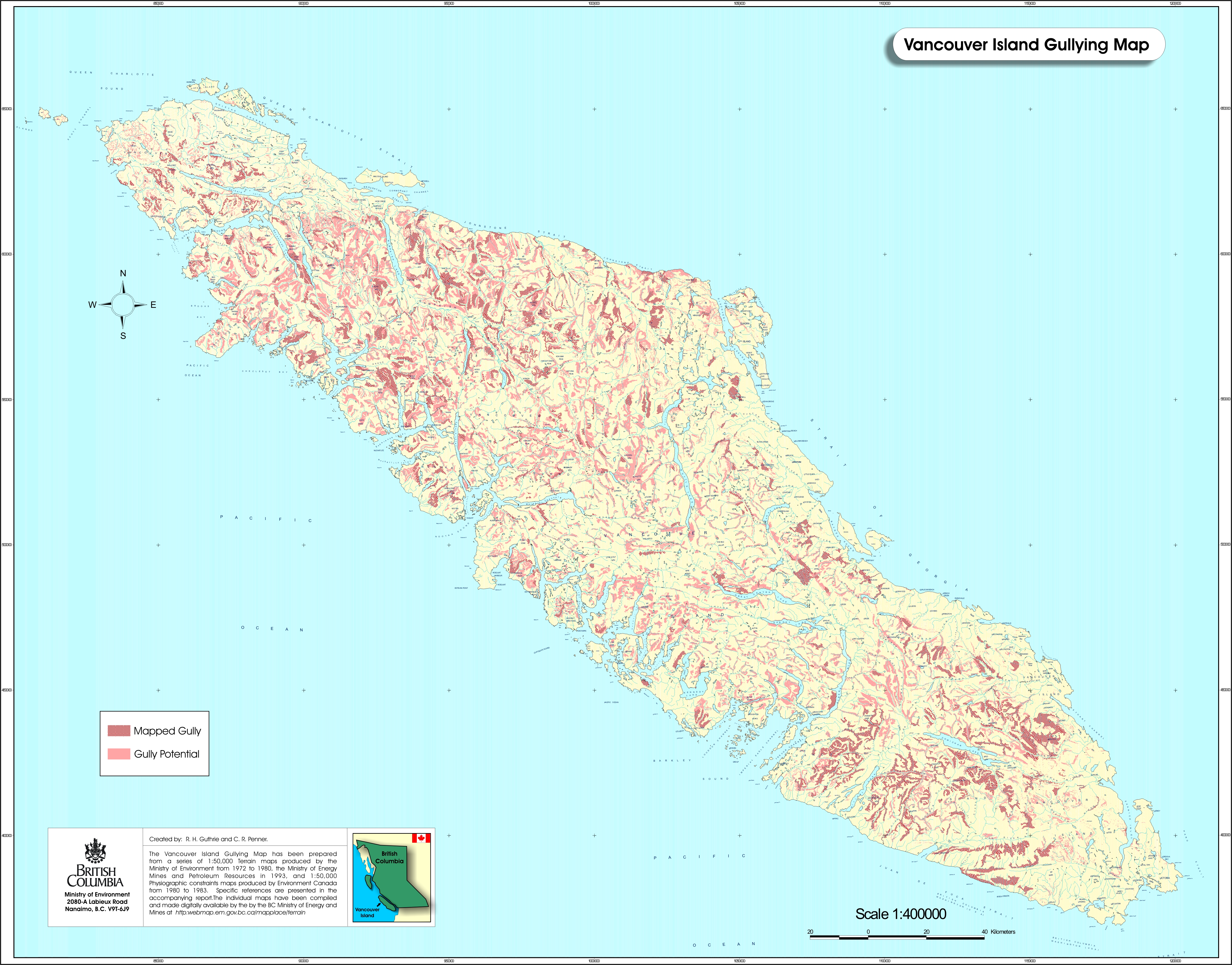
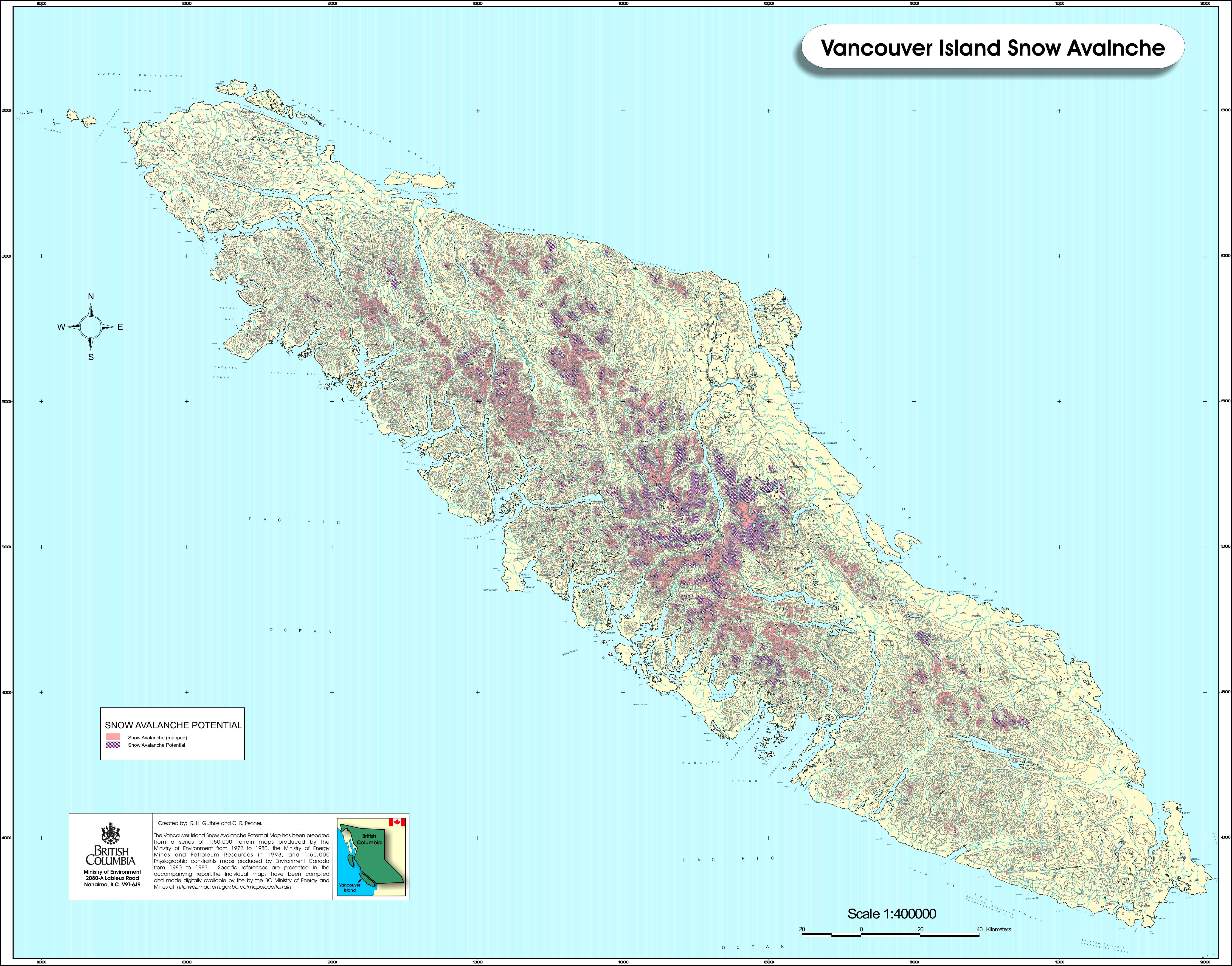
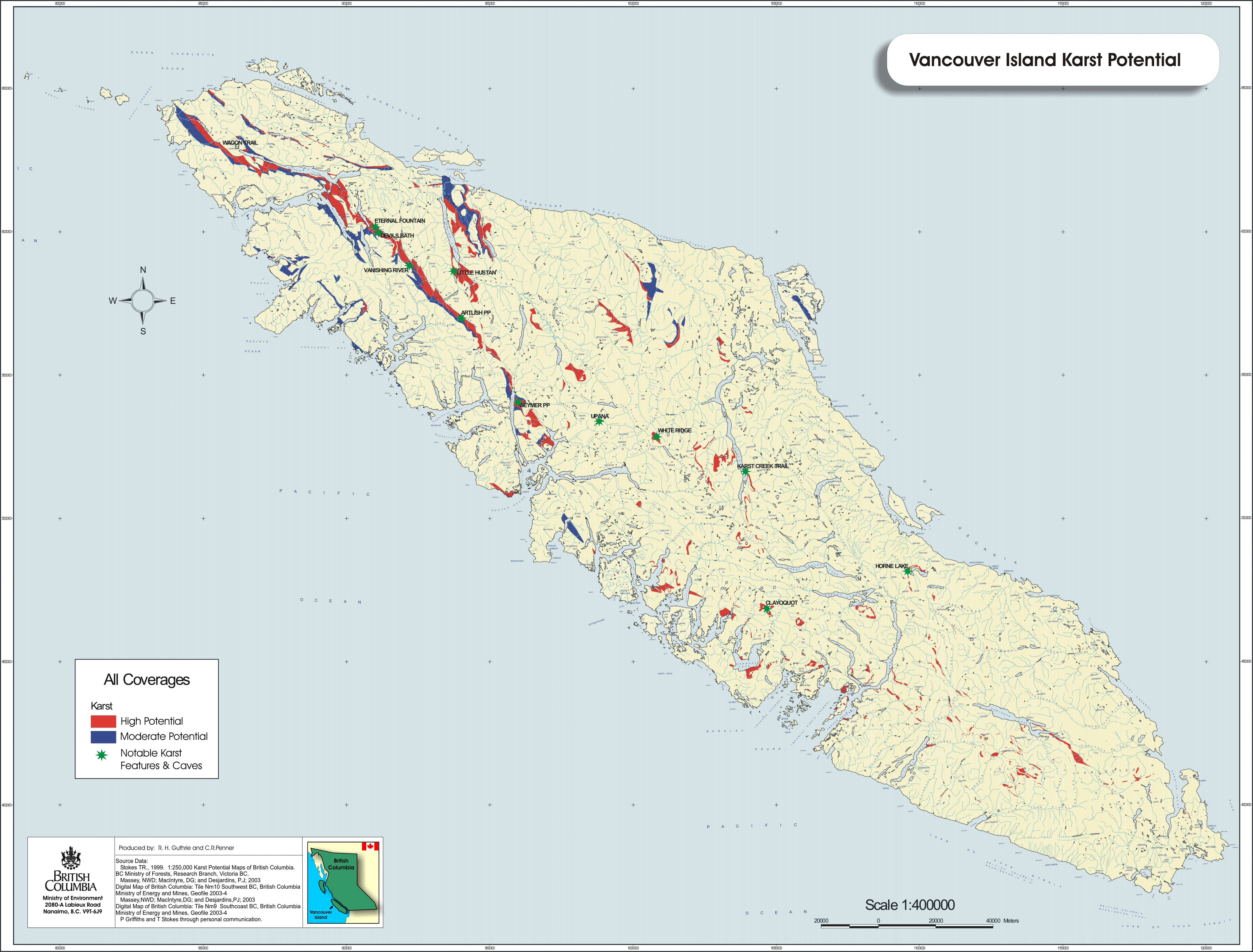
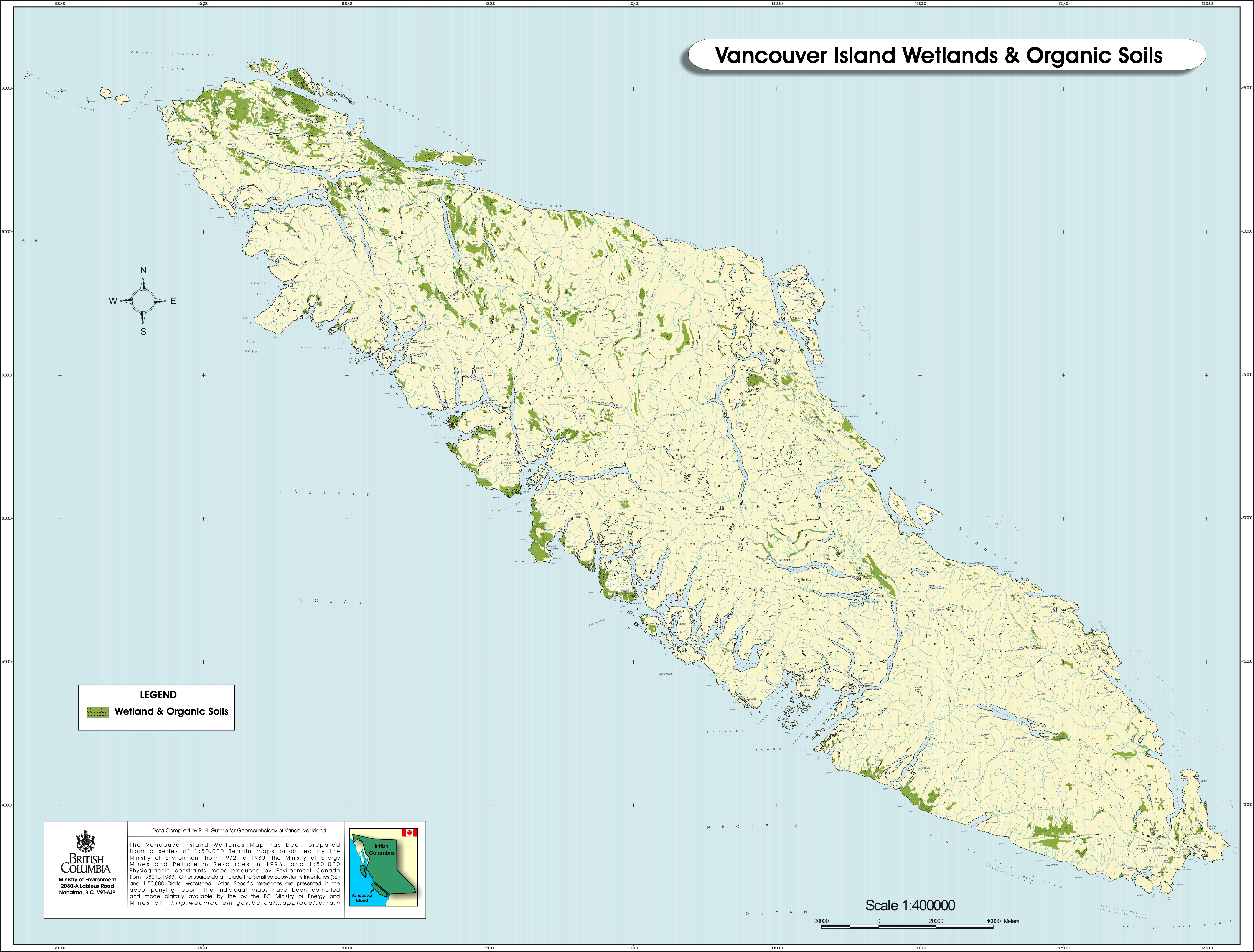
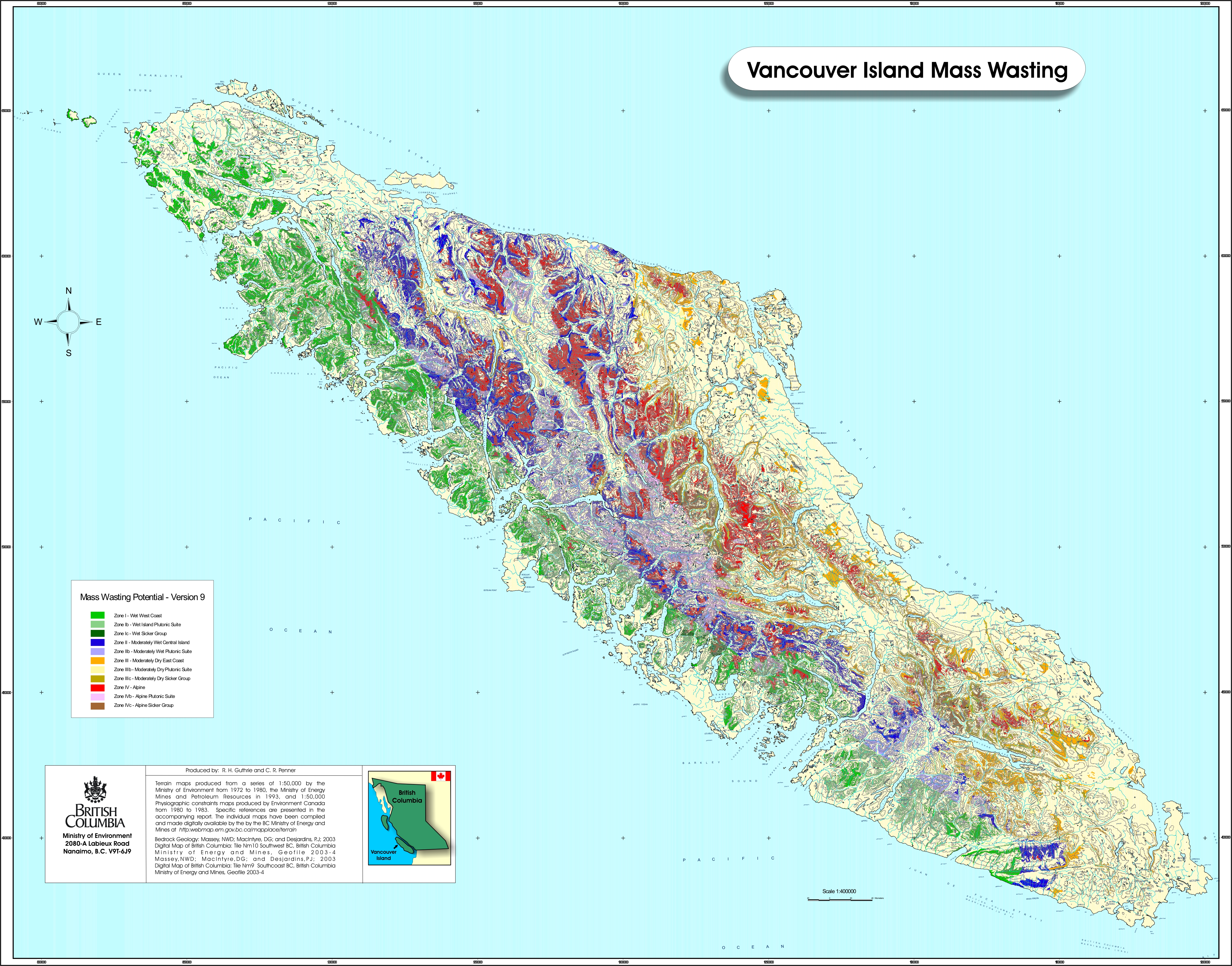
Geomorphology
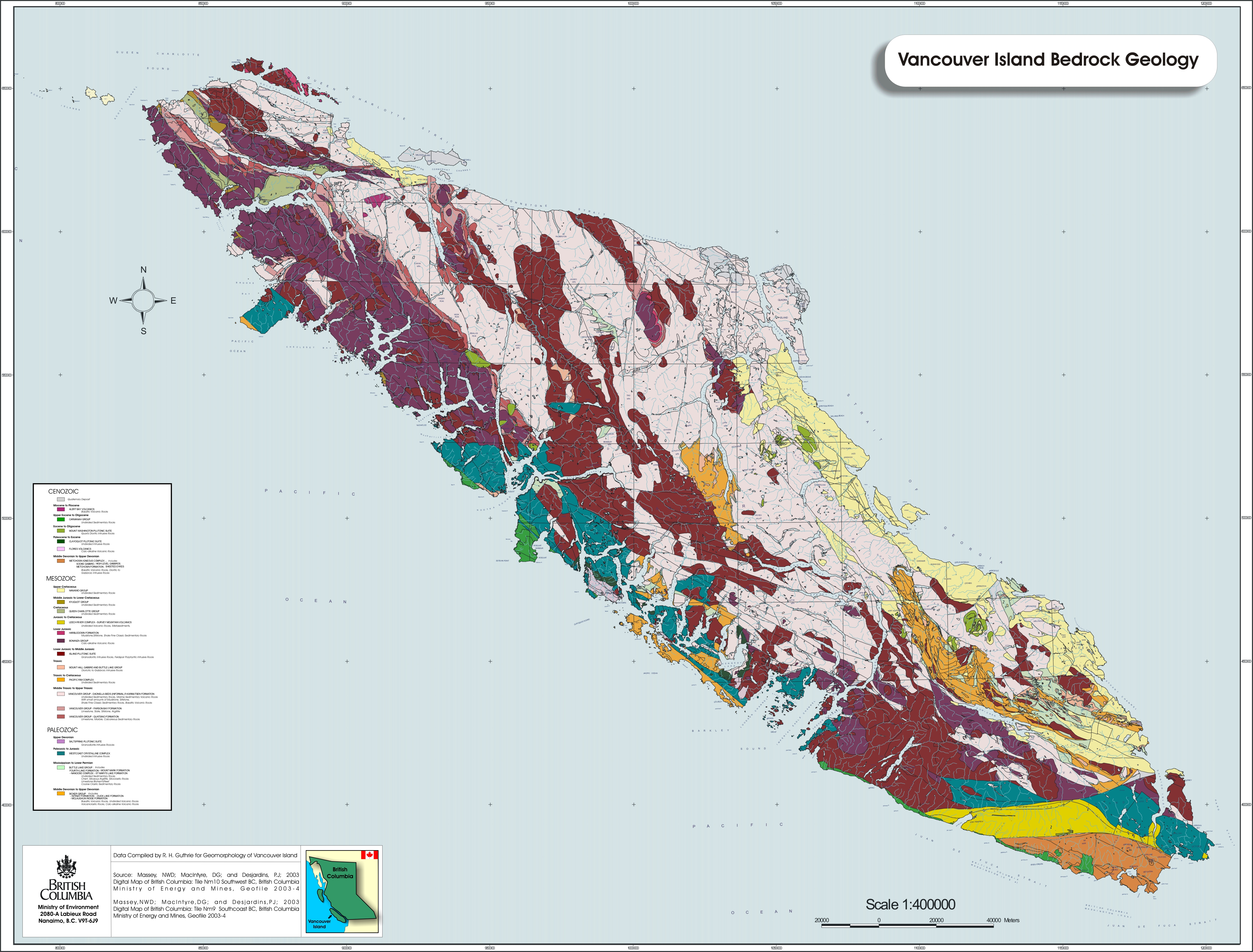
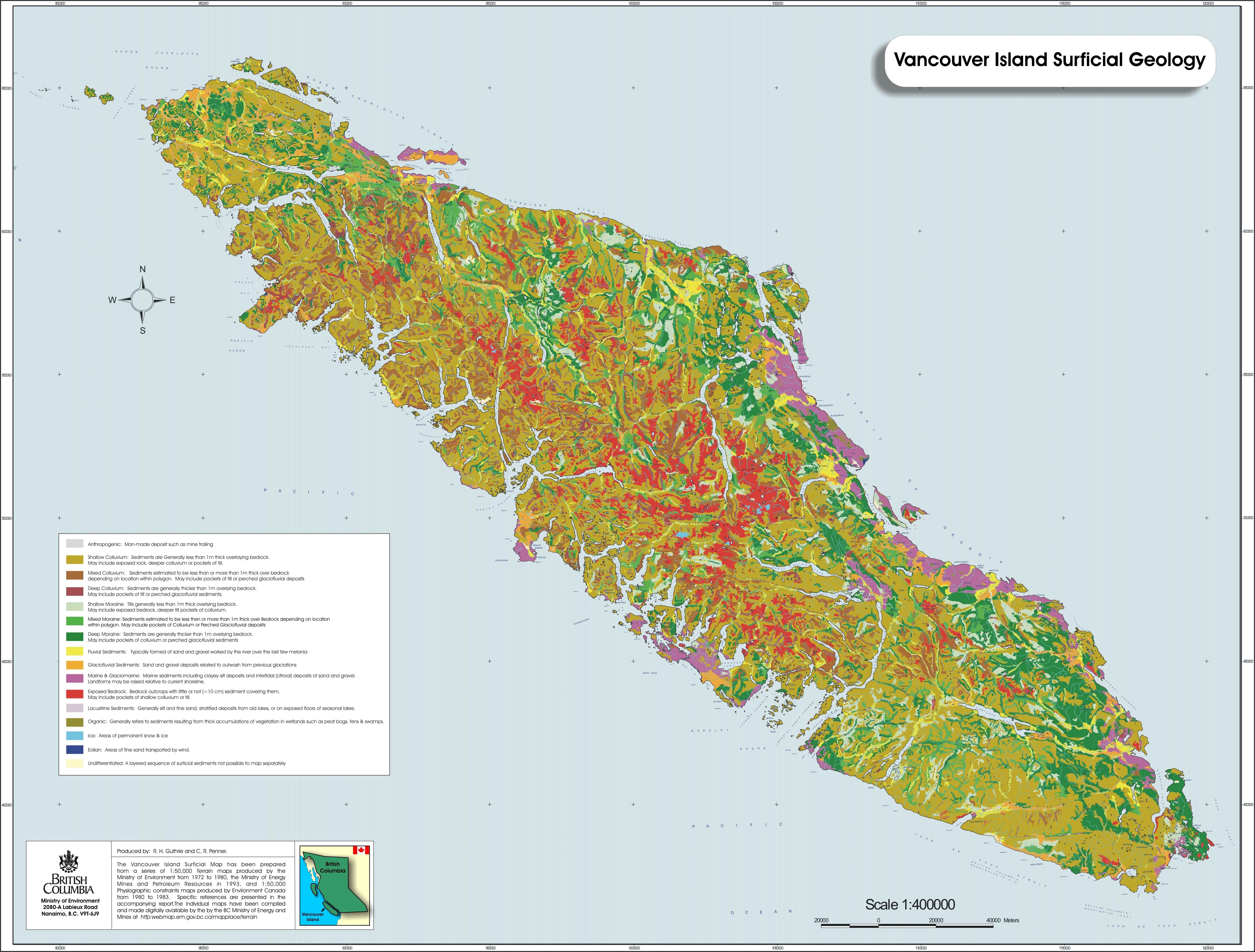
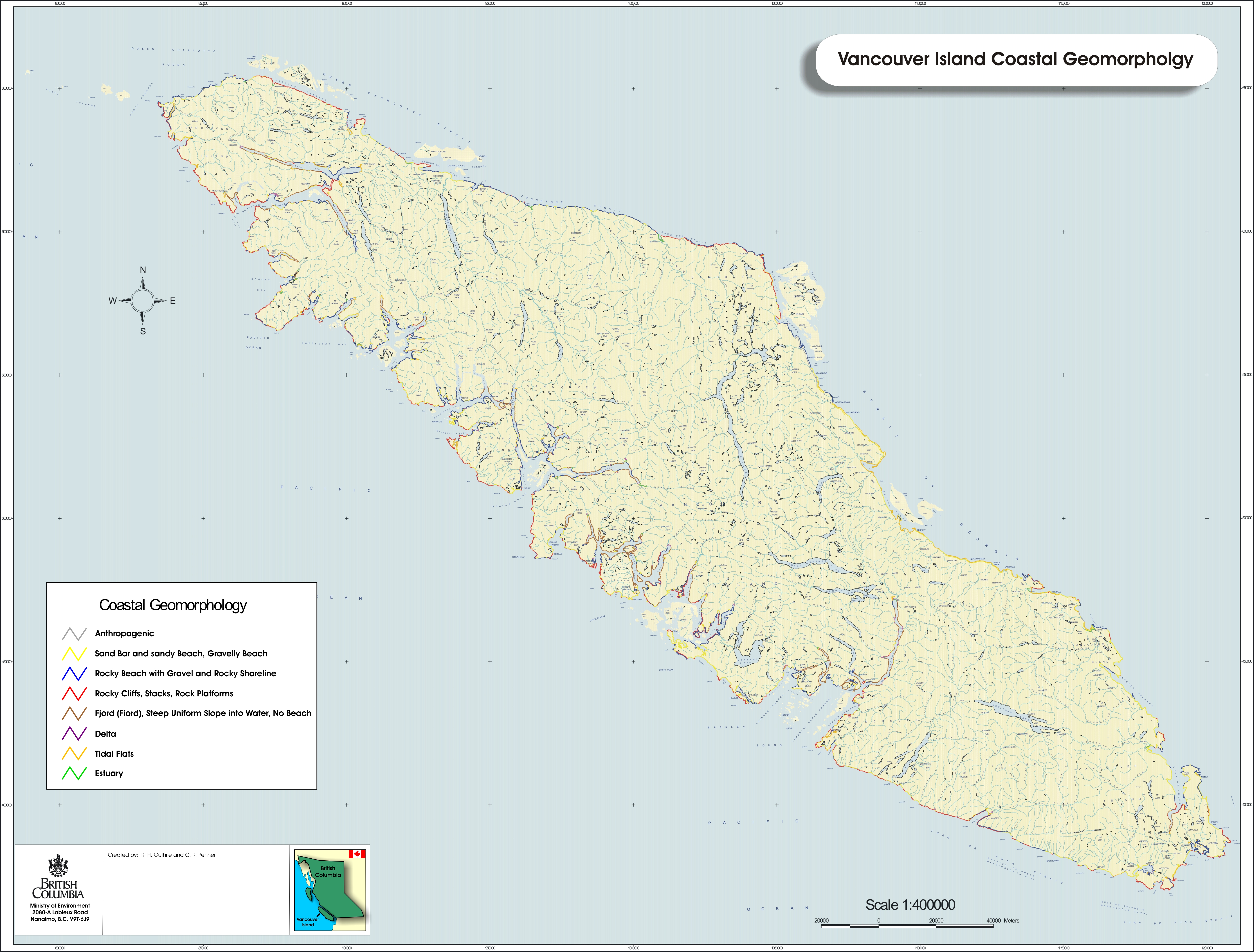
Geomorphology is the study of the physical features of the Earth’s surface, specifically landforms and landform processes, their origins
and composition. Applied geomorphology uses the same knowledge and techniques to provide or assist in finding solutions to planning, resource, engineering, conservation, or environmental problems.
Ecosystems and species are closely linked to the geological and geomorphological framework in which they thrive. From salmon
streams to tidal flats, rugged mountains to deeply incised valleys, limestone caves to coastal stacks, the environments found in coastal British
Columbia were thousands and even millions of years in the making. Yet the systems are dynamic and changing – sometimes gradually and sometimes
suddenly.
A comprehensive understanding of geomorphology is not only necessary to manage for the current processes at work, but also to be
able to predict future events. For example: how often will this site flood? What is the likelihood of a landslide occurring after this activity? How long would
this beach take to recover from a particular use? How long before sand dunes take over this portion of the island? Where is it safe to build? As global warming and human development force changes in the landscape, geomorphology is the science that helps us prepare for whatever those changes may
be.
Impervious Surfaces in French Creek (PDF 880KB)
References and Journal Papers
Hydrology
Timing and quantity of runoff have significant potential to affect stream morphology, riparian stability and in-stream flows, important to
maintaining healthy functioning aquatic ecosystems and downstream values. Flood frequency and drought are increasing concerns related to climate change, requiring ongoing analysis. The Vancouver Island regional hydrologist provides analytical support and advice to regional Environmental
Stewardship staff on hydrologic and fluvial geomorphic impacts and risks associated with proposed development, or from natural disturbance, in Parks
and Protected Areas, urban and forest environments. The hydrologist may provide advice and analysis in support of instream flows that affect fisheries values.
As part of a regional team, the hydrologist participates in watershed-level, state-of-environment reporting. These reports include
assessments of
the Artlish River, Nahwitti River, Mactush Creek and French Creek watersheds.
The hydrologist is involved in monitoring where, under the Water Act Section 9 Notification system, the habitat officer has authority
(See Water
Regulation). For example, fish
passage-at-stream crossings have been a ministry-focus of monitoring over the last several years, given historical concerns about cumulative
loss of accessible fish habitat, attributable to culverts. This has been supported by follow-up outreach to improve practices and increase awareness.
The regional hydrologist provides science-based input to the Forest and Range Practices Act requirements for Fisheries Sensitive
Watershed designation and objectives provided for by the Government Actions
Regulation (GAR)
Together with the regional geomorphologist, the regional hydrologist participates in the Environmental Stewardship Climate Change Adaptation
initiative, under the provincial Climate Action Plan (Climate Action Plan - LiveSmart BC). Seeking to reduce impacts and future costs, the provincial Climate Action Plan looks at how to respond pro-actively to forecast climate change, affecting ecosystems. This
involves assessment of hydrologic risks and linkages with ecosystem health at both the landscape and regional scales.
Mining
The Ecosystem Section reviews information and provides feedback to the Ministry of Energy, Mines and Petroleum Resources. This information, is in turn, used with mineral and aggregate exploration
and mine development applications. Further information on the process is available at
http://www.empr.gov.bc.ca/Mining/Pages/default.aspx.
Protection of Private Forest Land
The Private Managed Forest Land Council is the agency responsible for the oversight of forest practices on Private Managed Forest Land.
Water Act – Instream Works and Notifications
In the Vancouver Island Region, notifications made under the Water Act are overseen by the Ecosystems Section of Environmental Stewardship. Section 9 of
the Water Act requires "that a person may only make Changes in and About a Stream under an Approval; in accordance with Part 7 of the Water Regulation
(unofficial consolidation), including Notification where required; or under a Water Licence or Order."
Notifications are used for works that don't involve diversion of water; that may be completed within a short period of time; and have minimal impact
on the environment, or third parties. A person must not make a change in and about a stream unless that person notifies a habitat officer of the Ministry of Environment. The application for "working in and about a stream" is available at the following website for the complete application package.
Applicants
on Vancouver Island should review the terms and conditions of the habitat officer.
Urban and Rural Development
The Vancouver Island Ecosystems Section develops guidelines and outreach intended to minimize ecosystem losses that are typically associated with urban
and rural development.
The majority of the island's urban and rural growth is concentrated along the south-eastern coast, within the ecosystems of the Coastal Douglas Fir
(moist maritime) and Coastal Western Hemlock (very dry maritime, very wet hypermaritime and submontane very wet maritime) biogeoclimatic zones. As a
consequence, undisturbed examples of these ecosystems are now considered rare and many of the species which depend on these ecosystems are threatened by
human activities. The Vancouver Island Regional Ecosystems Section strives to increase public awareness of rare ecosystems and species by providing
economically viable alternatives, scientifically defensible guidelines and outreach that is targeted to decision makers, the development community and
the public, during urban and rural land development.
Riparian Areas Regulation
In the Vancouver Island Region, implementation of the Riparian Areas Regulation is administered by the Ecosystems Section of Environmental
Stewardship. Within the Vancouver Island Region, the RAR applies only to the following regional districts, including their incorporated
municipalities: Capital, Comox-Valley, Strathcona, Cowichan Valley, Nanaimo and the trust area under the Islands Trust Act.
Riparian areas are the areas bordering streams, lakes and wetlands that link water to land. The blend of stream-bed, water, trees,
shrubs and grasses directly influences and provides fish habitat. Protecting riparian fish habitat, while facilitating urban development that exhibits
high standards of environmental stewardship, is a priority for the Government of British Columbia. Good quality streamside habitat is essential for
ensuring healthy fish populations. The purpose of the Regulation is to protect the features, functions and conditions that are vital in the
natural maintenance of stream health and productivity.
The Riparian Areas Regulation (RAR), enacted under Section 12 of the Fish Protection Act in July 2004, calls on local
governments to protect riparian areas during residential, commercial, and industrial development by ensuring that proposed activities are subject to a science-based assessment, conducted by a Qualified Environmental Professional (QEP). The RAR model uses Qualified Environmental Professionals (QEPs),
hired by land developers to:
- Assess habitat and the potential impacts to the habitat
- Develop mitigation measures
- Ensure impacts from development to fish and fish habitat, particularly riparian habitat are avoided
Protecting Species and Ecosystems at Risk
The Vancouver Island Region is under several conflicting pressures from resource extraction, urban development, tourism and recreation. Consequently, several species and ecosystems that inhabit this area are designated at risk, provincially, by the
BC Conservation Data Centre and/or federally by the
Committee on the Status of Endangered Wildlife in Canada. Threatened and Endangered
species, and ecosystems, are afforded protection under the federal Species at Risk Act,
Fisheries Act and
Migratory Birds Convention Act. Provincially, the
Forest and Range Practices Act and
Wildlife Act are used to protect species and ecosystems at risk. Some tools are available for protecting species and ecosystems at
risk under the Forest and Range Practices Act, including the designation of
Wildlife Habitat Areas and Ungulate Winter Ranges.
To ensure British Columbia is a spectacular place with healthy, natural and diverse ecosystems that sustain and enrich the
lives of all, the Ministry of Environment staff, in collaboration with others, has developed the
Conservation Framework. The Framework provides a set of
science-based tools and actions for conserving species and ecosystems in B.C. Ecosystems section staff participate on
Recovery Teams, undertake inventory projects and help develop and implement habitat protection guidelines for these species and ecosystems. Standardized inventory methodologies for species continue to be refined by the
Resource Inventory Standards Committee and sensitive and rare ecosystems have been mapped
using the Sensitive Ecosystem Inventory.
An important part of protecting Vancouver Island’s
biodiversity includes documenting, tracking and eliminating invasive species. Ecosystems staff are working with the
Coastal Invasive Species Committee to help protect rare species and ecosystems on Vancouver
Island. An important regional initiative is work being done on non-native species, including research on population sizes and range expansion of the introduced Eastern Grey Squirrel. For more info and to report a sighting... |